Category:Sawtooth National Recreation Area
Jump to navigation
Jump to search
national recreation area in Idaho, United States  | |||||
| Upload media | |||||
| Instance of | |||||
|---|---|---|---|---|---|
| Named after | |||||
| Location |
| ||||
| IUCN protected areas category | |||||
| Inception |
| ||||
| official website | |||||
 | |||||
English: Media related to Sawtooth National Recreation Area, a protected area in Idaho, United States.
Subcategories
This category has the following 3 subcategories, out of 3 total.
Media in category "Sawtooth National Recreation Area"
The following 17 files are in this category, out of 17 total.
-
 Beautiful country outside of Ketchum, Idaho.jpg 3,504 × 2,336; 1.06 MB
-
 Falls Creek Valley.JPG 1,600 × 1,200; 374 KB
-
 Fisher Creek Trail.JPG 2,816 × 2,112; 4.62 MB
-
 Grand Mogul.JPG 2,816 × 2,112; 1.71 MB
-
 Parks Peak.JPG 2,816 × 2,112; 2.14 MB
-
 Railroad Saddle Sawtooth NF Kelly Martin (51798002720).jpg 2,988 × 1,972; 6.38 MB
-
 S Sawtooth Valley.JPG 1,600 × 1,200; 379 KB
-
 Sawtooth mtns.JPG 2,816 × 2,112; 3.3 MB
-
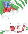
 Sawtooth National Forest Map with roads.jpg 1,241 × 1,521; 249 KB
-
 Sawtooth National Forest Map.jpg 1,079 × 1,307; 166 KB
-
 Sawtooth Valley ID1.jpg 3,778 × 2,241; 7.44 MB
-
 Sawtooth Valley.JPG 2,816 × 2,112; 1.37 MB
-
 Sawtooths 4.jpg 4,871 × 1,605; 1.75 MB
-
 Scoop Lake, Custer County, Idaho.JPG 2,816 × 2,112; 2.33 MB
-
 Smith Falls.JPG 1,200 × 1,600; 349 KB
-
 Warm Springs Meadow.JPG 2,816 × 2,112; 2.18 MB
-
 Washington Lake.jpg 2,816 × 2,112; 4.33 MB


.jpg)


Categories:
- National recreation areas of the United States
- Protected areas of Blaine County, Idaho
- Protected areas of Boise County, Idaho
- Protected areas of Custer County, Idaho
- Protected areas of Elmore County, Idaho
- Locations along Idaho State Highway 21
- Locations along Idaho State Highway 75
- South Central Rockies Forests Ecoregion (One Earth)