Category:Saul Road, County Down
Jump to navigation
Jump to search
| Object location | | View all coordinates using: OpenStreetMap |
|---|
Subcategories
This category has the following 3 subcategories, out of 3 total.
A
S
- Saul Church (27 F)
- Spar, Saul Road, Downpatrick (3 F)
Media in category "Saul Road, County Down"
The following 45 files are in this category, out of 45 total.
-
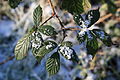 Bramble and snow, County Down, January 2010.JPG 4,272 × 2,848; 3.91 MB
-
 Down (003), October 2009.JPG 2,848 × 4,272; 3.89 MB
-
 Down (004), October 2009.JPG 4,272 × 2,848; 3.06 MB
-
 Down (005), October 2009.JPG 4,272 × 2,848; 4.13 MB
-
 Down (007), October 2009.JPG 4,272 × 2,848; 3.9 MB
-
 Down (008), October 2009.JPG 4,272 × 2,848; 6.11 MB
-
 Down (009), October 2009.JPG 4,272 × 2,848; 6.07 MB
-
 Down (010), October 2009.JPG 4,272 × 2,848; 3.28 MB
-
 Down (017), October 2009.JPG 2,848 × 4,272; 6.58 MB
-
 Farm track, County Down, January 2010.JPG 4,272 × 2,848; 6.67 MB
-
 Fire engine, Downpatrick, August 2010 (01).JPG 4,272 × 2,848; 3.51 MB
-
 Fire engine, Downpatrick, August 2010 (02).JPG 4,272 × 2,848; 3.42 MB
-
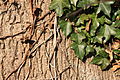
 Ivy and snow, County Down (01), January 2010.JPG 4,272 × 2,848; 3.95 MB
-
 Ivy and snow, County Down (02), January 2010.JPG 4,272 × 2,848; 3.99 MB
-
 Ivy and tree, County Down (01), January 2010.JPG 4,272 × 2,848; 6.92 MB
-
 Ivy and tree, County Down (02), January 2010.JPG 4,272 × 2,848; 6.26 MB
-
 Road drainage, Saul Road (01), January 2010.JPG 4,272 × 2,848; 6.49 MB
-
 Road drainage, Saul Road (02), January 2010.JPG 2,848 × 4,272; 6.67 MB
-
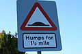 Road signs, Downpatrick (01), January 2010.JPG 4,272 × 2,848; 3.38 MB
-
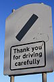
 Road signs, Downpatrick (02), January 2010.JPG 2,848 × 4,272; 3.25 MB
-
 Road signs, Downpatrick (03), January 2010.JPG 2,848 × 4,272; 4.46 MB
-
 Road signs, Downpatrick (04), January 2010.JPG 2,848 × 4,272; 3.38 MB
-
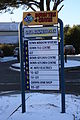 Saul Business Park, Downpatrick, January 2010.JPG 2,848 × 4,272; 4.73 MB
-
 Saul Road, County Down (01), January 2010.JPG 4,272 × 2,848; 5.3 MB
-
 Saul Road, County Down (02), January 2010.JPG 4,272 × 2,848; 6.15 MB
-
 Saul Road, County Down (03), January 2010.JPG 4,272 × 2,848; 7.04 MB
-
 Saul Road, County Down (04), January 2010.JPG 4,272 × 2,848; 6.56 MB
-
 Snow tracks, Saul Road (01), January 2010.JPG 4,272 × 2,848; 6.03 MB
-
 Snow tracks, Saul Road (02), January 2010.JPG 2,848 × 4,272; 6.19 MB
-
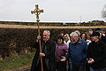
 St Patricks Day Inter Church Procession, Downpatrick, March 2010 (01).JPG 4,272 × 2,848; 4.8 MB
-
 St Patricks Day Inter Church Procession, Downpatrick, March 2010 (02).JPG 4,272 × 2,848; 5.06 MB
-
 St Patricks Day Inter Church Procession, Downpatrick, March 2010 (03).JPG 4,272 × 2,848; 3.52 MB
-
 St Patricks Day Inter Church Procession, Downpatrick, March 2010 (04).JPG 4,272 × 2,848; 5.08 MB
-
 St Patricks Day Inter Church Procession, Downpatrick, March 2010 (05).JPG 2,848 × 4,272; 3.68 MB
-
 St Patricks Day Inter Church Procession, Downpatrick, March 2010 (06).JPG 2,848 × 4,272; 4.2 MB
-
 St Patricks Day Inter Church Procession, Downpatrick, March 2010 (07).JPG 4,272 × 2,848; 4.32 MB
-
 Traffic mirror, Saul Road, January 2010.JPG 2,848 × 4,272; 4.68 MB
-
 Trees, Downpatrick (02), January 2010.JPG 4,272 × 2,848; 7.85 MB
-
 Trees, Downpatrick (03), January 2010.JPG 2,848 × 4,272; 5.15 MB
-
 Trees, Downpatrick (04), January 2010.JPG 2,848 × 4,272; 5.76 MB
-
 Trees, Downpatrick, January 2010.JPG 4,272 × 2,848; 8.75 MB
-
 Ulsterbus bus stop, January 2010.JPG 4,272 × 2,848; 3.85 MB
-
 Ulsterbus, Downpatrick, January 2010.JPG 4,272 × 2,848; 3.76 MB
-
 Utility pole, Saul Road, January 2010.JPG 2,848 × 4,272; 3.54 MB
-
 Utility poles, Saul Road, January 2010.JPG 2,848 × 4,272; 4.26 MB

,_October_2009.JPG)
,_October_2009.JPG)
,_October_2009.JPG)
,_October_2009.JPG)
,_October_2009.JPG)
,_October_2009.JPG)
,_October_2009.JPG)
,_October_2009.JPG)

.JPG)
.JPG)
,_January_2010.JPG)
,_January_2010.JPG)
,_January_2010.JPG)
,_January_2010.JPG)
,_January_2010.JPG)
,_January_2010.JPG)
,_January_2010.JPG)
,_January_2010.JPG)
,_January_2010.JPG)
,_January_2010.JPG)

,_January_2010.JPG)
,_January_2010.JPG)
,_January_2010.JPG)
,_January_2010.JPG)
,_January_2010.JPG)
,_January_2010.JPG)
.JPG)
.JPG)
.JPG)
.JPG)
.JPG)
.JPG)
.JPG)

,_January_2010.JPG)
,_January_2010.JPG)
,_January_2010.JPG)


