Category:Satilla River
Jump to navigation
Jump to search
English: The Satilla River rises in Ben Hill County, near the town of Fitzgerald, and flows in a mostly easterly direction to the Atlantic Ocean. Along its approximately 235 mile course are the cities of Waycross, Waynesville, and Woodbine. The Satilla drains almost 4,000 square miles of land, all of it in the coastal plain of southeastern Georgia. It has white sandbars and is the largest blackwater river situated entirely within Georgia.
Français : Le fleuve Satilla ( Satilla River) est un fleuve des États-Unis long de 418 kilomètres qui se jette dans l'océan Atlantique.
river in the United States of America | |||||
| Upload media | |||||
| Instance of | |||||
|---|---|---|---|---|---|
| Location | Georgia | ||||
| Length |
| ||||
| Mouth of the watercourse | |||||
| Different from | |||||
 | |||||
Subcategories
This category has the following 2 subcategories, out of 2 total.
Media in category "Satilla River"
The following 19 files are in this category, out of 19 total.
-
 Georgia Coast Rail-Trail, end of fishing pier.JPG 4,608 × 3,456; 5.36 MB
-
 Georgia Coast Rail-Trail, looking back at boardwalk b.JPG 4,608 × 3,456; 5.29 MB
-
 Georgia Coast Rail-Trail, looking back at boardwalk.JPG 4,608 × 3,456; 5.32 MB
-
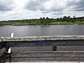
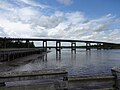
 Georgia Coast Rail-Trail, Satilla River Bridge.JPG 4,608 × 3,456; 4.97 MB
-
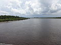 Georgia Coast Rail-Trail, Satilla River.JPG 4,608 × 3,456; 4.63 MB
-
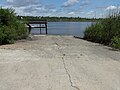
 Satilla River boat ramp, Atkinson County.JPG 5,152 × 3,864; 7.86 MB
-
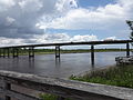
 Satilla River bridge, US82WB, Brantley County.JPG 4,608 × 3,456; 3.89 MB
-
 Satilla River near GA64 bridge.JPG 5,152 × 3,864; 7.74 MB
-
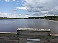
 Satilla River Waterfront Park, boardwalk bench.JPG 4,608 × 3,456; 4.77 MB
-
 Satilla River Waterfront Park, boat ramp.JPG 4,608 × 3,456; 6.19 MB
-
 Satilla River Waterfront Park, pier left.JPG 4,608 × 3,456; 5.02 MB
-
 Satilla River Waterfront Park, pier looking down.JPG 4,608 × 3,456; 5.12 MB
-
 Satilla River Waterfront Park, pier right.JPG 4,608 × 3,456; 4.8 MB
-
 Satilla River Waterfront Park, pier west face.JPG 4,608 × 3,456; 4.99 MB
-
 Satilla River Waterfront Park, Satilla River bridge a.JPG 4,608 × 3,456; 4.72 MB
-
 Satilla River Waterfront Park, Satilla River Bridge b.JPG 4,608 × 3,456; 4.79 MB
-
 Satilla River Waterfront Park, Satilla River from end of pier.JPG 4,608 × 3,456; 4.7 MB
-
 Satilla River, south of Douglas, GA, US.jpg 6,000 × 4,000; 5.09 MB
-
 SatillaWoodbineGA.JPG 3,872 × 2,592; 3.83 MB


