Category:Satellite pictures of volcanoes in Alaska
Jump to navigation
Jump to search
Subcategories
This category has the following 3 subcategories, out of 3 total.
A
P
- 2013 Mount Pavlof eruption (10 F)
Media in category "Satellite pictures of volcanoes in Alaska"
The following 13 files are in this category, out of 13 total.
-
 Aleuten-Great-Sitkin-Island.jpg 2,978 × 1,978; 1.92 MB
-
 Aleuten-Seguam.JPG 2,396 × 1,456; 544 KB
-
 Aleutian Islands amo 2014135 lrg.jpg 5,200 × 4,000; 3.8 MB
-
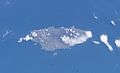
 Augustine island satellite.jpg 581 × 843; 22 KB
-
 Cleveland, United States (2023-11-10-20-59-57 UMBRA-04).tiff 23,134 × 34,831, 8 pages; 1.04 GB
-
 Denali, Alaska, Image of the Day DVIDS850638.jpg 4,000 × 4,000; 4.43 MB
-
 ISS-38 Islands of the Four Mountains.jpg 4,256 × 2,832; 2.21 MB
-
 Mount Shishaldin Volcano, Alaska, USA - March 22nd, 2020 (49691541171).jpg 9,930 × 5,040; 19.26 MB
-

-
 Pavlof2014iss.jpg 1,440 × 960; 460 KB
-
 Springtime in the Gulf of Alaska (15656993711).jpg 17,300 × 12,000; 13.07 MB
-
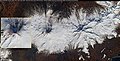
 Takawangha Volcano, Alaska (ASTER).jpg 2,985 × 2,730; 396 KB
-
 Umnak oli 2014123 lrg.jpg 10,977 × 7,200; 9.83 MB


.jpg)


.jpg)
.jpg)
