Category:Satellite pictures of the Zambezi
Jump to navigation
Jump to search
Media in category "Satellite pictures of the Zambezi"
The following 23 files are in this category, out of 23 total.
-
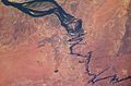
 Angzam tmo 2010117 lrg 01.jpg 6,144 × 6,372; 7.52 MB
-
 Angzam tmo 2010117 lrg 02.jpg 720 × 480; 235 KB
-
 Biomass Burning, Southern Africa.JPG 4,256 × 2,832; 4.84 MB
-
 ISS-52 Victoria Falls.jpg 3,276 × 2,180; 2.32 MB
-
 ISS009-E-7622- Zambezi river near Mongu.jpg 3,032 × 1,998; 4.71 MB
-
 ISS018-E-40000 - View of Mozambique.jpg 3,072 × 2,040; 660 KB
-
 ISS018-E-6013 - View of Mozambique.jpg 3,072 × 2,040; 1.01 MB
-
 ISS018-E-6014 - View of Mozambique.jpg 3,072 × 2,040; 1,022 KB
-
 NASA Barotse Floodplain compressed.JPG 538 × 867; 111 KB
-
 NASA Image of Barotse Floodplain.PNG 538 × 867; 1.13 MB
-
 Satellite view of Victoria Falls.jpg 3,032 × 2,008; 1.46 MB
-
 The Zambezi River (NESDIS 2015-06-16).png 1,920 × 1,080; 4.19 MB
-
 Zambezi ali 2010128.jpg 719 × 480; 177 KB
-
 Zambezi Barotse floodplain.jpg 396 × 700; 61 KB
-
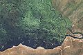
 Zambezi Delta diversity ESA394392.jpg 6,459 × 4,560; 6.96 MB
-
 Zambezi Delta diversity ESA394392.tiff 6,459 × 4,560; 168.56 MB
-
 Zambezi delta.jpg 5,253 × 5,294; 15.03 MB
-
 Zambezi Flood Plain, Namibia (EO-1).jpg 4,200 × 2,800; 4.01 MB
-
 Zambezi Flood Plain, Namibia (MODIS).jpg 4,552 × 3,640; 3.02 MB
-
 Zambezi River Delta.jpg 720 × 480; 148 KB
-
 Zambezi River Zambia.jpg 3,512 × 2,487; 7.06 MB
-
 Zambezi River, Zambia ESA302993.tiff 3,512 × 2,487; 25.02 MB
-
 Zambia.A2004112.0845.721.250m.jpg 2,871 × 3,131; 4.58 MB


.png)


.jpg)
.jpg)


