Category:Satellite pictures of the San Francisco Bay Area
Jump to navigation
Jump to search
Subcategories
This category has only the following subcategory.
S
Media in category "Satellite pictures of the San Francisco Bay Area"
The following 66 files are in this category, out of 66 total.
-
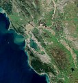
 Bay Area by Sentinel-2, 2019-03-11 (big version).jpg 20,389 × 21,539; 487.33 MB
-
 Bay Area by Sentinel-2, 2019-03-11 (small version).jpg 10,200 × 10,776; 123.14 MB
-
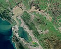
 BayareaUSGS.jpg 769 × 798; 613 KB
-
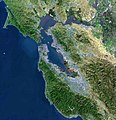
 View of the Bay Area and the Californian Delta.jpg 6,034 × 4,838; 39.04 MB
-
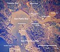 Wpdms nasa photo san pablo bay.jpg 534 × 467; 91 KB
-
 Aerial image of the Military Ocean Terminal Concord piers.jpg 6,800 × 4,000; 2.55 MB
-
 B1-sed-msk-clr-sed (ASTER).jpg 4,000 × 4,800; 1.9 MB
-
 Bay Area by Sentinel-2 (Original 10m Res).jpg 18,541 × 19,634; 343.16 MB
-
 Bay Area by Sentinel-2.jpg 9,190 × 9,751; 100.18 MB
-
 Bayarea.jpg 277 × 283; 26 KB
-
 Brewer Island, USGS, current.png 1,500 × 1,500; 4.15 MB
-
 Concord ca aerial map.jpg 1,368 × 758; 123 KB
-
 Concord Flower Bed cropped.jpg 350 × 227; 47 KB
-
 Concord Flower Bed.jpg 787 × 500; 130 KB
-
 ER-2 Silicon Valley image.jpg 620 × 512; 102 KB
-
 FremontCA.jpg 646 × 464; 140 KB
-
 Hamilton Air Force Base - USGS Topo.jpg 768 × 768; 202 KB
-
 Hamiltonafb-10jul1993.jpg 635 × 589; 124 KB
-
 Hayward fault california.tif 2,135 × 2,386; 10.56 MB
-
 ISS-53 San Francisco Bay Area, California.jpg 4,096 × 2,726; 1.51 MB
-
 ISS-65 San Francisco Bay Salt Ponds, California.jpg 5,568 × 3,712; 2.25 MB
-
 ISS048-E-6387 - View of California.jpg 4,928 × 3,280; 2.05 MB
-
 Iss071e003216.jpg 4,928 × 2,768; 1.73 MB
-
 Iss071e133353.jpg 8,256 × 5,504; 8.95 MB
-
 Map East Bay.jpg 887 × 689; 382 KB
-
 Map Whole East Bay.jpg 818 × 614; 269 KB
-
 May East Bay colored.jpg 865 × 666; 357 KB
-
 Mccafee Oakland Raid satellite view.png 1,024 × 722; 1.3 MB
-
 Napa County Airport - California.jpg 580 × 639; 127 KB
-
 NASA Satellite Captures Super Bowl Cities - Santa Clara, CA (24766659591).jpg 6,148 × 5,933; 21.57 MB
-
 NASA Worldwind, USGS imagery map, Bird Island, California.png 1,200 × 1,200; 1.39 MB
-
 NASA Worldwind, USGS imagery map, Jakes Island, California.png 500 × 500; 219 KB
-
 NASA Worldwind, USGS imagery map, Little Holland Tract, California.png 2,001 × 2,000; 3.82 MB
-
 NASA Worldwind, USGS imagery map, Moore Tract, California.png 2,090 × 2,090; 4.93 MB
-
 NASA Worldwind, USGS imagery map, Ogilvie Island, California.png 1,900 × 1,900; 2.48 MB
-

-
 NASA Worldwind, USGS imagery map, Richardson Island, California.png 602 × 601; 588 KB
-
 NASA Worldwind, USGS imagery map, Simms Island, California.png 900 × 900; 1.37 MB
-
 Oakland Arena satellite view.png 992 × 653; 1,004 KB
-
 San fran bay.jpg 639 × 634; 138 KB
-
 San Francisco (SF).jpg 1,367 × 1,800; 881 KB
-
 San Francisco at night.jpeg 1,020 × 676; 281 KB
-
 San Francisco Bay (52242693610).png 13,000 × 8,139; 134.35 MB
-
 San Francisco Bay 751 pan crop 15 (33553414412).jpg 5,821 × 7,655; 36.9 MB
-
 San Francisco Bay Agriculture (52242205086).png 13,000 × 8,519; 166.65 MB
-
 San Francisco Bay ESA22014515.jpeg 10,980 × 14,367; 37.66 MB
-
 San Francisco Bay ESA22014515.tiff 10,980 × 14,367; 451.36 MB
-
 San Francisco Bay NASA World Wind Globe.jpg 1,600 × 1,050; 1.31 MB
-
 San Francisco Bay Salt ponds 2002.jpg 540 × 334; 52 KB
-
 San Francisco Bay SPOT 1258.jpg 6,000 × 6,000; 42.93 MB
-
 San Francisco Peninsula JPLLandsat.jpg 1,152 × 870; 161 KB
-
 San Francisco web.jpg 584 × 860; 85 KB
-
 San Francisco. satelit. C.had.jpeg 1,020 × 676; 373 KB
-
 San Fransisco Bay satellite.jpg 10,600 × 4,800; 40.12 MB
-
 San Jose by Sentinel-2, 2019-03-11.jpg 5,546 × 7,563; 56.8 MB
-
 Santa Clara Valley in California - red border.jpg 1,254 × 1,146; 573 KB
-
 Santa Cruz Mountains.jpg 586 × 859; 321 KB
-
 Satellite Image of Alcatraz.jpg 1,059 × 540; 142 KB
-
 Satellite Image of The Bay Area from Sentinel-2 2021-08-02.jpg 1,313 × 779; 487 KB
-
 Satellite view of fog over the Golden Gate.jpg 2,721 × 4,081; 10.21 MB
-
 Sf-t-color-sml (ASTER).jpg 2,000 × 2,440; 558 KB
-
 STS001-012-0305.jpg 4,120 × 4,152; 7.22 MB
-
 STS135-E-6460 - View of Earth.jpg 4,256 × 2,832; 1.35 MB
-
 Wfm yerba buena treasure islands usgs.jpg 861 × 1,152; 532 KB
-
 West Marin highlighted in Bay Area.jpg 769 × 798; 527 KB
-
 Wpdms usgs photo san francisco full bay.jpg 300 × 300; 46 KB
.jpg)
.jpg)


.jpg)
.jpg)


.jpg)


.png)


.jpg)

.png)
.jpg)
.png)


.jpg)


