Category:Satellite pictures of the Peloponnese
Jump to navigation
Jump to search
Subcategories
This category has only the following subcategory.
Media in category "Satellite pictures of the Peloponnese"
The following 16 files are in this category, out of 16 total.
-
 Blue Marble map peloponnes section.jpg 641 × 547; 102 KB
-
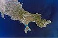 Cape Malea and Elafonissos island in the Bay of Vatika.ISS015-E-9024.JPG 3,032 × 2,009; 1.24 MB
-
 Elafonissos island in the Bay of Vatika. ISS016-E-19087.JPG 3,032 × 2,000; 689 KB
-
 Golful Corintului.JPG 508 × 599; 95 KB
-
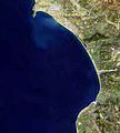 Gulf of Kyparissia satellite picture.jpg 240 × 266; 17 KB
-
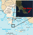 Kap Malea.png 366 × 392; 61 KB
-
 Laconic Gulf satellite picture.jpg 299 × 246; 22 KB
-
 Messenian Gulf satellite picture.jpg 296 × 320; 21 KB
-
 Navarino Bay in Peloponnese.jpg 657 × 600; 225 KB
-
 Olympia ast 2007247 lrg.jpg 3,228 × 4,279; 5.01 MB
-
 Patras NASA WorldWind.jpg 1,024 × 658; 139 KB
-
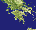 Peloponnes--w.jpg 641 × 547; 88 KB
-
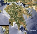
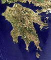 Peloponnese modis.jpg 900 × 1,062; 284 KB
-
 Peloponnese-Map satview BlueMarbleProject.jpg 1,200 × 1,095; 1.23 MB
-
 Satellite image of Ionian Islands in March 2003.jpg 1,398 × 1,866; 640 KB
-
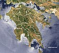
 The Peloponnese from ISS.jpg 720 × 720; 188 KB


