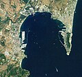
Category:Satellite pictures of the Bay of Gibraltar
Jump to navigation
Jump to search
Media in category "Satellite pictures of the Bay of Gibraltar"
The following 11 files are in this category, out of 11 total.
-
Algeciras and Gibraltar.jpg 3,508 × 2,540; 1.9 MB
-
Bahía de Algeciras - ic Landsat.jpg 1,060 × 989; 440 KB
-
Bay of Gibraltar, Mediterranean Sea by Planet Labs.jpg 4,840 × 3,630; 6.4 MB
-
Bay of Gibraltar.jpg 540 × 405; 89 KB
-
Gibraltar (satellite view).jpg 2,048 × 1,280; 611 KB
-
Gibraltar-NLT Landsat7.jpg 1,018 × 694; 489 KB
-
ISS015-E-5271 - View of Spain.jpg 3,032 × 2,008; 1,005 KB
-
ISS063-E-70342 - View of Earth.jpg 3,712 × 5,568; 3.89 MB
-
ISS063-E-70343 - View of Earth.jpg 3,712 × 5,568; 3.47 MB
-
ISS063-E-70346 - View of Earth.jpg 5,568 × 3,712; 3.43 MB
-
ISS063-E-70349 - View of Earth.jpg 5,568 × 3,712; 3.48 MB


