Category:Satellite pictures of lakes
Jump to navigation
Jump to search
Subcategories
This category has the following 7 subcategories, out of 7 total.
A
Media in category "Satellite pictures of lakes"
The following 104 files are in this category, out of 104 total.
-
17.93804E 5.01000N Lake Boali.png 1,678 × 933; 2.06 MB
-
2002年8月28日,洪峰通过武汉流向九江市的实时卫星照片.jpg 4,400 × 4,400; 3.91 MB
-
2011年鄱阳湖、洞庭湖5月份和6月份水量对比之5月.jpg 720 × 360; 120 KB
-
2011年鄱阳湖、洞庭湖5月份和6月份水量对比之6月.jpg 720 × 360; 142 KB
-
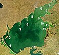
AzovseaNASA3.jpg 342 × 316; 50 KB
-
Becharof Lake NASA.jpg 1,024 × 702; 203 KB
-
Becharof Lake with Ugashik Lakes by Sentinel-2.jpg 8,348 × 8,348; 69.4 MB
-
Castaic-reservoir Planet Labs satellit image.jpg 3,748 × 2,811; 3.25 MB
-
Chao Lake NASA.png 1,364 × 690; 1.47 MB
-
Diamond Peak ASTER 2011-06-20.jpg 4,288 × 3,464; 3.52 MB
-
Dozois 77.07W 47.46N.jpg 1,016 × 823; 265 KB
-
Drought in Morocco (Copernicus).jpg 3,525 × 2,548; 3.16 MB
-
Extreme cold weather freezes Issyk-Kul lake.jpg 4,794 × 2,543; 7.9 MB
-
Fuente de Piedra Lagoon dry (cropped1).jpg 1,279 × 1,479; 1.09 MB
-
Glacial Lakes of Patagonia.jpg 3,535 × 2,540; 3.1 MB
-
Glacial lakes, Bhutan.jpg 3,000 × 1,665; 1.98 MB
-
Gouin Reservoir 74.72W 48.61.jpg 1,280 × 986; 728 KB
-
Harmful Bloom in Lake Atitlán, Guatemala.jpg 1,800 × 1,200; 2.28 MB
-
Harveys Lake Enviromapper image.png 400 × 300; 99 KB
-
Hyatt Reservoir.png 442 × 575; 344 KB
-
ISS-56 Salt lakes in the Crimea.jpg 3,712 × 5,568; 2.24 MB
-
ISS-57 Iraq, Lake Dukan.jpg 5,568 × 3,712; 1.91 MB
-
ISS-61 Mattmarksee reservoir, Swiss Alps.jpg 5,568 × 3,712; 3.18 MB
-
ISS034-E-33960 - View of Rwanda.jpg 4,256 × 2,832; 812 KB
-
ISS034-E-33961 - View of Rwanda.jpg 4,256 × 2,832; 789 KB
-
ISS047E108766 (Neuseenland).jpg 720 × 480; 570 KB
-
ISS047E108766 lrg (Neuseenland).jpg 4,928 × 3,280; 3.48 MB
-
ISS069-E-023100 lrg twin volcanoes in the Andes Mountains.jpg 2,916 × 1,944; 3.94 MB
-
Krasne Lake, Crimea by Planet Labs.jpg 7,228 × 5,422; 8.52 MB
-
Lac de Korienze Mali - Landsat8.jpg 950 × 878; 620 KB
-
Laguna Cáceres Bolivia Satelital map 57.75960W 18.png 1,150 × 799; 2.08 MB
-
Laguna de Bay 2020 (cropped).jpg 2,310 × 1,680; 1.47 MB
-
Laguna de Bay zoom.jpg 600 × 400; 81 KB
-
Laguna de Rocha.JPG 617 × 356; 30 KB
-
Laguna de Sayula.jpg 639 × 435; 82 KB
-
Lake chapala.png 1,024 × 692; 1.21 MB
-
Lake Cildir NASA.jpg 1,024 × 702; 239 KB
-
Lake debo mali - Landsat8 December 2013.jpg 1,375 × 1,106; 1.18 MB
-
Lake debo Mali - Landsat8.jpg 1,491 × 1,100; 946 KB
-
Lake Kinkony NASA.jpg 1,024 × 702; 229 KB
-
Lake Lämmi, LandSat-8, 2016-10-20.jpg 1,600 × 1,200; 658 KB
-
Lake Manchar (2003).jpg 500 × 320; 63 KB
-
Lake Mead, Hoover Dam, and the Nevada-Arizona Border, December 12, 2018.jpg 2,560 × 1,440; 849 KB
-
Lake Nokoue NASA.jpg 1,024 × 702; 244 KB
-
Lake Peipsi Landsat2000-Peipsi.jpeg 500 × 600; 104 KB
-
Lake Peipsi Landsat2000.jpeg 528 × 862; 165 KB
-
Lake Peipus, LandSat-8, 2016-10-20 (cropped).jpg 2,400 × 3,000; 2.04 MB
-
Lake Peipus, LandSat-8, 2016-10-20.jpg 2,716 × 4,629; 4.07 MB
-
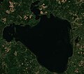
Lake Pihkva, LandSat-8, 2016-10-20.jpg 1,500 × 1,500; 720 KB
-
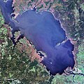
Lake Poyang Satellite Map during January of 2014.jpg 634 × 714; 60 KB
-
Lake Poyang Satellite Map during May of 2012.jpg 634 × 714; 68 KB
-
Lake razna sentinel-2.jpg 1,354 × 1,201; 241 KB
-
Lake sakakawea.jpg 3,904 × 3,856; 6.91 MB
-
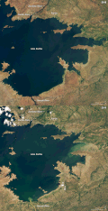
Lakekariba oli 2018345 lrg.jpg 7,421 × 5,829; 5.2 MB
-
Lakekariba oli 2019357 lrg.jpg 7,421 × 5,829; 6.26 MB
-
Lakekariba oli 2019357.gif 720 × 700; 713 KB
-
Lakekariba2 oli 2018344 lrg 01.jpg 1,066 × 1,036; 766 KB
-
Lakekariba2 oli 2019332 lrg.jpg 1,066 × 1,036; 859 KB
-
Lakekariba2 oli 2019332.jpg 720 × 700; 479 KB
-
Lakekariba3 oli 2018344 lrg.jpg 1,793 × 1,195; 1.48 MB
-
Lakekariba3 oli 2019332 lrg.jpg 1,793 × 1,195; 1.6 MB
-
Lakekariba3 oli 2019332.gif 720 × 480; 487 KB
-
Lakes in Syria and Turkiye (iss071e462180).jpg 4,928 × 2,768; 1.66 MB
-
Lakes of Central Asia ESA239381.jpg 2,143 × 2,143; 1.96 MB
-
Lakes of Central Asia ESA239381.tiff 2,143 × 2,143; 13.29 MB
-
Landsat 8 - Lake Gossi Mali.jpg 891 × 943; 61 KB
-
Landsat Kakhivka Water Reservoir1.JPG 338 × 282; 30 KB
-
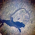
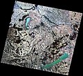
Landsat-5 felvétele az Észak-Dunántúlról.jpg 1,199 × 1,102; 335 KB
-
Larissa (Greece) with lake Karla.jpg 540 × 815; 232 KB
-
Manchar SPOT 1299.jpg 500 × 500; 103 KB
-
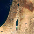
Modis near east.jpg 540 × 540; 80 KB
-
Moundou.Logone Occidental.Lac Ouei.png 1,023 × 660; 1.16 MB
-
Newberry Lakes.png 888 × 525; 549 KB
-
Pipmuacan Reservoir ISS011-E-7610.JPG 3,032 × 2,008; 1.03 MB
-
Pipmuacan Reservoir ISS015-E-6926.JPG 3,032 × 2,008; 1.26 MB
-
RanchoSecoRecParkWorldWindMap.jpg 990 × 609; 642 KB
-
Robert-Bourassa Reservoir.jpg 1,280 × 986; 463 KB
-
Satelites image of Lake Poyang.png 640 × 780; 975 KB
-
Satellite Image of Lake Baidang.png 1,278 × 798; 2.4 MB
-
Satellite Image of Lake Nanche.png 1,278 × 798; 1.66 MB
-
Satellite image of Lake Scutari (2020).jpg 5,011 × 3,341; 4.6 MB
-
Satellite view of Ashokan Reservoir after Hurricane Irene.jpg 652 × 324; 212 KB
-
Siwaoasiszm oli2 2023023.jpg 720 × 480; 418 KB
-
Sobradinho CBERS4 MUX falsacor.pdf 2,512 × 2,218; 14.11 MB
-
Surface area of Myanmar’s Inle Lake reduced by floating farms (Copernicus).jpg 5,551 × 3,522; 12.94 MB
-
Suvasvesi-WorldWind.jpg 1,003 × 820; 222 KB
-
São José da Barra, Minas Gerais Brazil - Planet Labs satellite image.jpg 1,200 × 900; 244 KB
-
Teshekpuk.ASTER.2000-08-15.jpg 1,956 × 2,996; 996 KB
-
The water levels of Puente Nuevo Reservoir, at worrisome levels (Copernicus).jpg 4,410 × 2,540; 3.25 MB
-
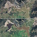
Theewaterskloof oli 2017203 lrg.jpg 1,826 × 986; 623 KB
-
Theewaterskloof oli 2018190 lrg.jpg 1,826 × 986; 675 KB
-
Theewaterskloof oli 2018190.jpg 720 × 720; 754 KB
-
Thief Valley Reservoir.png 438 × 475; 268 KB
-
TontoNatlMnmt L7 15jun00.jpg 540 × 540; 115 KB
-
Três Marias Reservoir, Minas Gerais - Planet Labs Satellite image.jpg 3,616 × 2,711; 1.48 MB
-
Usoi Sarez.png 759 × 552; 1,009 KB
-
Warm Springs Reservoir.png 475 × 818; 565 KB
-
Wfm clearlake indian valley landsat.jpg 1,280 × 948; 300 KB
-
Wfm lake casitas landsat.jpg 1,280 × 948; 227 KB
-
Wfm lake isabella landsat.jpg 1,280 × 948; 221 KB
-
Wfm san luis reservoir landsat.jpg 1,280 × 948; 266 KB
-
鄱阳湖四月份与五月份水量对比1.jpg 720 × 480; 141 KB
-
鄱阳湖四月份与五月份水量对比2.jpg 720 × 480; 163 KB


