Category:Satellite pictures of Thomas Fire
Jump to navigation
Jump to search
Media in category "Satellite pictures of Thomas Fire"
The following 21 files are in this category, out of 21 total.
-
 09December2017ThomasFire.tif 1,916 × 1,023; 7.48 MB
-
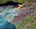
 23December2017ThomasFire.tif 1,916 × 1,023; 7.48 MB
-
 City of Montecito, California, 10 January 2018, Landsat 8, band 758.tif 1,916 × 1,023; 7.48 MB
-
 First Light Image from NOAA-20 VIIRS Captures Thomas Fire (NESDIS 2017-12-14).jpg 1,920 × 1,080; 606 KB
-
 ISS-53 Southern California Wildfires (1).jpg 5,568 × 3,712; 3.41 MB
-
 ISS-53 Southern California Wildfires (2).jpg 3,712 × 5,568; 3.66 MB
-
 ISS-53 Southern California Wildfires (3).jpg 5,568 × 3,712; 3.99 MB
-
 ISS-53 Southern California Wildfires (4).jpg 3,712 × 5,568; 4 MB
-
 ISS-53 Southern California Wildfires (5).jpg 3,712 × 5,568; 1.84 MB
-

-

-

-
 Montecito, January 12, 2018 ESA Sentinel-2 satellite image.tif 1,916 × 1,023; 7.48 MB
-
 NOAA’s Newest Polar-Orbiting Satellite Celebrates a Milestone (NESDIS 2020-05-29).png 1,920 × 1,080; 1.12 MB
-
 Satellite image of Thomas Fire.jpg 3,456 × 3,781; 1.88 MB
-
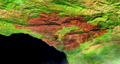
 Thomas Fire burn scar on Dec 7.jpg 1,640 × 1,310; 602 KB
-
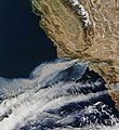
 Thomas Fire Erupts in Southern California (NESDIS 2017-12-05).jpg 1,920 × 1,080; 170 KB
-
 Thomas Fire Now Third-largest in California History (NESDIS 2017-12-18).jpg 1,920 × 1,080; 395 KB
-
 Thomas fire satfoto 12-18-2017.jpg 720 × 480; 494 KB
-
 Thomas Fire, California, 2-3 February 2018, Sentinel-2 True Color Satellite Image.tif 1,916 × 1,023; 7.48 MB
-
 ThomasFirePlumeISS-2017-12-06.jpg 4,095 × 2,612; 1.39 MB
.jpg)
.jpg)
.jpg)
.jpg)
.jpg)
.jpg)
.png)


.jpg)
.jpg)

