Category:Satellite pictures of New Britain
Jump to navigation
Jump to search
Subcategories
This category has the following 2 subcategories, out of 2 total.
S
Media in category "Satellite pictures of New Britain"
The following 19 files are in this category, out of 19 total.
-
 Dampier Strait NASA.jpg 1,024 × 702; 125 KB
-
 ISS018-E-38628 - View of Papua New Guinea.jpg 3,072 × 2,040; 290 KB
-
 ISS018-E-38629 - View of Papua New Guinea.jpg 3,072 × 2,040; 266 KB
-
 ISS018-E-38630 - View of Papua New Guinea.jpg 3,072 × 2,040; 255 KB
-
 ISS034-E-5482 - View of Papua New Guinea.jpg 4,256 × 2,832; 646 KB
-
 ISS034-E-5483 - View of Papua New Guinea.jpg 4,256 × 2,832; 663 KB
-
 ISS034-E-5484 - View of Papua New Guinea.jpg 4,256 × 2,832; 667 KB
-
 ISS034-E-5485 - View of Papua New Guinea.jpg 4,256 × 2,832; 702 KB
-
 ISS034-E-5486 - View of Papua New Guinea.jpg 4,256 × 2,832; 685 KB
-
 ISS034-E-5494 - View of Papua New Guinea.jpg 4,288 × 2,848; 759 KB
-
 ISS034-E-5502 - View of Papua New Guinea.jpg 4,288 × 2,848; 1,016 KB
-
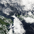
 ISS055-E-23186 - View of New Britain, Papua New Guinea.jpg 3,712 × 5,568; 2.14 MB
-
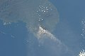
 Langila ash.jpg 540 × 540; 78 KB
-
 Lolobau Island (Landsat).JPG 504 × 370; 65 KB
-
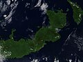
 Newbritain lrg.jpg 2,964 × 1,800; 1.31 MB
-
 Plume from Ulawun, New Britain, Papua New Guinea (MODIS 2018-01-18).jpg 1,600 × 1,200; 223 KB
-
 SuluRangeNASA.jpg 640 × 422; 57 KB
-
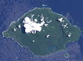
 Tavui caldera.jpg 640 × 432; 31 KB
-
 Ulawun steam plume.jpg 759 × 663; 143 KB


.JPG)

.jpg)


