Category:Satellite pictures of Hyogo prefecture
Jump to navigation
Jump to search
| Prefectures of Japan | |||
|---|---|---|---|
| Hokkaido | Aomori · Iwate · Miyagi · Akita · Yamagata · Fukushima · Ibaraki · Tochigi · Gunma · Saitama · Chiba · Tokyo · Kanagawa · Niigata · Toyama · Ishikawa · Fukui · Yamanashi · Nagano · Gifu · Shizuoka · Aichi · Mie · Shiga · Kyoto · Osaka · Hyogo · Nara · Wakayama · Tottori · Shimane · Okayama · Hiroshima · Yamaguchi | Tokushima · Kagawa · Ehime · Kōchi | Fukuoka · Saga · Nagasaki · Kumamoto · Ōita · Miyazaki · Kagoshima | Okinawa | 
| ||
Media in category "Satellite pictures of Hyogo prefecture"
The following 12 files are in this category, out of 12 total.
-
Akashi-Strait 1.png 1,194 × 900; 690 KB
-
Awaji, Japan.jpg 2,048 × 1,280; 948 KB
-
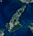
Awaji-island 1.png 903 × 995; 372 KB
-
Awajishima satellite map.jpg 548 × 783; 35 KB
-
Harima-Nada 1.png 1,203 × 921; 755 KB
-
Kitan-Strait 1.png 1,274 × 936; 682 KB
-
Kobe Portisland-Aerial photography 1976.jpg 2,500 × 2,500; 4.6 MB
-
Naruto Strait NASA WorldWind Outflow.jpg 1,024 × 658; 89 KB
-
Naruto-Strait 1.png 1,156 × 873; 557 KB
-
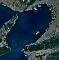
Osaka-Bay 1.png 938 × 949; 502 KB
-
PortIslandCloseup 2003262.jpg 489 × 501; 106 KB
-
Wfm kansai overview.jpg 3,703 × 3,235; 2.42 MB


