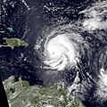
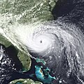
Category:Satellite pictures of Hurricane Hugo
Jump to navigation
Jump to search
Media in category "Satellite pictures of Hurricane Hugo"
The following 24 files are in this category, out of 24 total.
-
GOES imagery of Hurricane Hugo passing over U S Virgin Islands (2268-435).jpg 1,893 × 1,695; 581 KB
-
Hugo 1989-09-15 1105Z.png 599 × 600; 535 KB
-
Hugo 1989-09-15 1231Z.png 1,080 × 1,080; 1.42 MB
-
Hugo 1989-09-15 1545Z.jpg 1,024 × 1,024; 708 KB
-
Hugo 1989-09-15 1631Z.png 1,062 × 1,062; 1.3 MB
-
Hugo 1989-09-15 2000Z.png 1,725 × 2,300; 5.76 MB
-
Hugo 1989-09-17 1744Z.jpg 601 × 601; 379 KB
-
Hugo 1989-09-21 1844Z.jpg 2,064 × 1,720; 819 KB
-
Hugo 1989-09-21 1847Z.jpg 601 × 601; 380 KB
-
Hugo 1989-09-21 1900Z.png 1,500 × 2,000; 4.83 MB
-
Hugo sept 21 1989.jpg 1,920 × 1,920; 1.32 MB
-
Hugo-Sept2189.jpg 720 × 720; 274 KB
-
Hugo160mph918mb.gif 400 × 531; 163 KB
-
HugoPersp hg.jpg 1,264 × 984; 192 KB
-
Huracán Hugo.jpg 576 × 1,315; 431 KB
-
Hurricane Hugo 21 September IR image.jpg 1,600 × 900; 158 KB
-
Hurricane Hugo approaching the South Carolina coast (2268-399).jpg 2,000 × 1,192; 394 KB
-
Hurricane Hugo approaching the South Carolina coast as seen from GOES-7 (2268-518).jpg 3,528 × 2,020; 1.25 MB
-
Hurricane Hugo September 17 1989.jpg 1,920 × 1,080; 213 KB
-
Hurricane Hugo, 1989 (50700002638).jpg 750 × 563; 107 KB
-
HurricaneHugolandfall.gif 1,080 × 781; 214 KB
-
Hurricanhugo.jpg 654 × 541; 95 KB
-
Img-1989-09-19-18-GOE-7-IR.jpg 1,200 × 1,200; 235 KB
-
Wea00456.jpg 700 × 476; 82 KB


