Category:Satellite pictures of Fogo (Cape Verde)
Jump to navigation
Jump to search
Subcategories
This category has only the following subcategory.
S
Media in category "Satellite pictures of Fogo (Cape Verde)"
The following 9 files are in this category, out of 9 total.
-
 AS09-22-3426 (21846626990).jpg 4,400 × 4,600; 1.22 MB
-
 Dust particles over Sao Filipe ESA22123200.jpeg 10,980 × 10,980; 15.24 MB
-
 Fogo Island (53302913944).jpg 5,568 × 3,712; 2.69 MB
-
 Fogo island satellite.png 271 × 280; 147 KB
-
 Fogo, 2009.jpg 720 × 480; 388 KB
-
 Fogo, Cabo Verde ESA411784.jpg 3,840 × 2,160; 464 KB
-
 Fogo, Cape Verde Islands.jpg 2,800 × 2,800; 3.49 MB
-
 Fogo-island-perspective.jpg 1,154 × 796; 119 KB
-
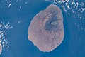 ISS062-E-227 - View of Fogo, Cape Verde.jpg 5,568 × 3,712; 2.44 MB
.jpg)

.jpg)


