Category:Satellite pictures of Flevoland
Appearance
Provinces of the Netherlands: Drenthe · Flevoland · Friesland · Gelderland · Groningen · North Holland · Zeeland
Media in category "Satellite pictures of Flevoland"
The following 10 files are in this category, out of 10 total.
-
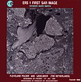
ERS-1 first image ESA19336572 (cropped).jpeg 1,591 × 1,602; 1.06 MB
-
ERS-1 first image ESA19336572.jpeg 1,951 × 1,991; 895 KB
-
Flevoland by Sentinel-2, 2018-06-30.jpg 7,477 × 7,477; 62.48 MB
-
Flevoland, the Netherlands (49502353748).jpg 3,527 × 2,633; 13.17 MB
-
Flevopolder by Sentinel-2, 2018-06-30.jpg 6,208 × 4,265; 29.67 MB
-
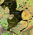
IJsselmeer satellite.jpg 893 × 947; 268 KB
-
Noordoostpolder by Sentinel-2, 2018-06-30.jpg 3,820 × 3,068; 13 MB
-
Satellite image of Flevopolder, Netherlands (5.48E 52.43N).png 1,024 × 702; 1.49 MB
-
Satellite image of IJsseloog, Netherlands.png 384 × 127; 104 KB
-
Satellite image of Noordoostpolder, Netherlands (5.78E 52.71N).png 1,024 × 702; 1.39 MB


