Category:Satellite pictures of Distrito Federal (Brazil)
Jump to navigation
Jump to search
States of Brazil: Acre · Alagoas · Amapá · Amazonas · Bahia · Ceará · Espírito Santo · Goiás · Maranhão · Mato Grosso · Mato Grosso do Sul · Minas Gerais · Pará · Paraíba · Paraná · Pernambuco · Piauí · Rio de Janeiro · Rio Grande do Norte · Rio Grande do Sul · Rondônia · Roraima · Santa Catarina · São Paulo · Sergipe · Tocantins · Distrito Federal (Brasil)
Subcategories
This category has only the following subcategory.
B
- Satellite pictures of Brasília (26 F)
Media in category "Satellite pictures of Distrito Federal (Brazil)"
The following 11 files are in this category, out of 11 total.
-
 Brasília yesterday, seen by brazilian CBERS4 satellite.jpg 2,017 × 1,127; 1.48 MB
-
 Federal District, Brazil, from space.jpg 1,600 × 1,062; 1.37 MB
-
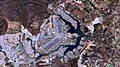
 Partial view of the Federal District, Brazil seen from space in 2001 (2).jpg 4,000 × 3,000; 4.25 MB
-
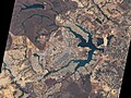
 Partial view of the Federal District, Brazil seen from space in 2001 (3).jpg 3,169 × 2,998; 2.77 MB
-
 Partial view of the Federal District, Brazil seen from space in 2001.jpg 720 × 480; 254 KB
-
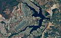
 Partial view of the Federal District, Brazil seen from space in 2015 (2).jpg 2,066 × 1,788; 785 KB
-
 Partial view of the Federal District, Brazil seen from space in 2015.jpg 2,048 × 1,280; 581 KB
-
 Vista noturna do Distrito Federal, Brasil (2).jpg 720 × 540; 190 KB
-
 Vista noturna do Distrito Federal, Brasil.jpg 4,256 × 2,832; 1.73 MB
-
 Vista parcial do Distrito Federal, Brasil (2).jpg 4,288 × 2,840; 6.23 MB
-
 Vista parcial do Distrito Federal, Brasil.jpg 640 × 636; 214 KB


.jpg)
.jpg)

.jpg)

.jpg)

.jpg)
