Category:Satellite pictures and aerial views of Bilbao
Jump to navigation
Jump to search
Media in category "Satellite pictures and aerial views of Bilbao"
The following 13 files are in this category, out of 13 total.
-
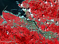 Aster bilbao lrg.jpg 1,400 × 1,050; 1.2 MB
-
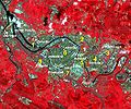
 Bilbao - Planet Imagery.jpg 2,000 × 1,234; 1.04 MB
-
 Bilbao satelite.png 1,400 × 1,004; 1.99 MB
-
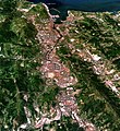
 Bilbao Spain 13Mar2018 SkySat.jpg 2,050 × 1,265; 1.21 MB
-
 Bilbao-districts.jpg 526 × 437; 271 KB
-
 Bilbo.jpg 797 × 873; 313 KB
-
 Bilboko portuaren bonbardaketa.jpg 1,500 × 996; 1.26 MB
-
 Nasa, Visible Earth Project.jpg 1,639 × 402; 856 KB
-
 Ortoargazkia-euskalduna ontziola-1983.png 954 × 644; 1.79 MB
-
 Ortofoto-zorrotzaurre penintsula-2012.png 954 × 644; 1.81 MB
-
 Ortofoto-Zorrotzaurre-1945.png 954 × 644; 889 KB
-
 Ortofoto-Zorrozaurre-1965.png 954 × 644; 959 KB
-
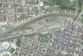
 Zorrozaurre2010.jpg 3,072 × 1,916; 5.23 MB


