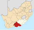
Category:Sarah Baartman District Municipality
Jump to navigation
Jump to search
district municipality in the Eastern Cape, South Africa | |||||
| Upload media | |||||
| Instance of |
| ||||
|---|---|---|---|---|---|
| Named after | |||||
| Location | Eastern Cape, RSA | ||||
| Capital | |||||
| Head of government |
| ||||
| Inception |
| ||||
| Population |
| ||||
| Area |
| ||||
| Elevation above sea level |
| ||||
 | |||||
Subcategories
This category has the following 14 subcategories, out of 14 total.
Media in category "Sarah Baartman District Municipality"
The following 16 files are in this category, out of 16 total.
-
Baviaans8-wiki.jpg 523 × 350; 164 KB
-
Close encounter with a buck - panoramio.jpg 4,128 × 3,096; 5.57 MB
-
Creek at Storms River Mouth - panoramio.jpg 1,704 × 2,272; 2.54 MB
-
DC10 locator.svg 1,000 × 565; 323 KB
-
ECDMA10 locator.svg 1,000 × 565; 323 KB
-
Map No. 7 of Schedule 2 to Notice 1998 of 2005.png 2,800 × 1,950; 3.92 MB
-
Map of South Africa with Cacadu highlighted (2011).svg 809 × 709; 498 KB
-
Map of South Africa with Sarah Baartman highlighted (2016).svg 809 × 709; 724 KB
-
Map of the Eastern Cape with Cacadu highlighted (2011).svg 928 × 620; 475 KB
-
Map of the Eastern Cape with Sarah Baartman highlighted (2016).svg 928 × 620; 669 KB
-
Map of the Eastern Cape with the Cacadu DMA highlighted (2006).svg 928 × 620; 574 KB
-
Next town Willowmore - 87km to go - Looking South - panoramio.jpg 1,600 × 901; 375 KB
-
Premier Logistics Scania 460 (28501171900).jpg 2,530 × 1,832; 557 KB
-
R61 Road-001.jpg 2,791 × 1,396; 1.01 MB
-
Sarah Baartman District Municipality .jpg 1,280 × 904; 44 KB
-
South Africa Districts showing Cacadu.png 1,141 × 828; 31 KB


