Category:Santa Maria de Boldú
Jump to navigation
Jump to search
| Object location | | View all coordinates using: OpenStreetMap |
|---|
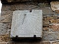
church building in La Fuliola, Spain  | |||||
| Upload media | |||||
| Instance of | |||||
|---|---|---|---|---|---|
| Part of | |||||
| Location | La Fuliola, Urgell, Ponent, Province of Lleida, Catalonia | ||||
| Street address |
| ||||
| Architectural style | |||||
| Heritage designation |
| ||||
| Inception |
| ||||
| Elevation above sea level |
| ||||
 | |||||
Català: Església de l'Assumpció de Boldú (la Fuliola)
This is a category about a building listed in the Catalan heritage register as Bé Cultural d'Interès Local (BCIL) under the reference IPA-29768. |
Media in category "Santa Maria de Boldú"
The following 6 files are in this category, out of 6 total.
-
 Antiga església de Boldú (La Fuliola).jpg 800 × 600; 138 KB
-
 SANTA MARIA DE BOLDÚ - IB-493.jpg 1,536 × 2,048; 1.04 MB
-
 SANTA MARIA DE BOLDÚ - IB-494.jpg 2,048 × 1,536; 937 KB
-
 SANTA MARIA DE BOLDÚ - IB-496.jpg 2,048 × 1,536; 1 MB
-
 SANTA MARIA DE BOLDÚ - IB-497.jpg 1,536 × 2,048; 1.01 MB
-
 SANTA MARIA DE BOLDÚ - IB-509.jpg 1,536 × 2,048; 909 KB
.jpg)


