Category:Santa Cruz Mountains
Appearance
mountain range in California, United States | |||||
| Upload media | |||||
| Instance of | |||||
|---|---|---|---|---|---|
| Location |
| ||||
| Has part(s) |
| ||||
| Mountain range | |||||
| Highest point |
| ||||
| Elevation above sea level |
| ||||
 | |||||
Subcategories
This category has the following 37 subcategories, out of 37 total.
A
- Arctostaphylos ohloneana (2 F)
B
C
E
- Edgewood County Park (32 F)
F
H
J
L
- La Honda Creek (7 F)
- Loma Prieta (14 F)
M
P
- Permanente Creek (25 F)
- Picchetti Brothers Winery (80 F)
S
- Skyline-to-the-Sea Trail (13 F)
- California State Route 35 (20 F)
T
- Mount Thayer (10 F)
U
- Uvas Canyon County Park (103 F)
~
- Arctostaphylos andersonii (11 F)
- Iris fernaldii (1 P, 8 F)
Media in category "Santa Cruz Mountains"
The following 142 files are in this category, out of 142 total.
-
Santa Cruz Mountains.jpg 586 × 859; 321 KB
-
Russian Ridge-Wildflowers.jpg 2,524 × 1,516; 2.32 MB
-
Aerial photo of Pacifica and east side of San Mateo County beyond the mountains.jpg 4,608 × 3,456; 10.06 MB
-
Aerial view of Devil's Slide on the California Coast.jpg 4,608 × 3,456; 9.85 MB
-
Aerial view of Pacifica and San Francisco looking northeast.jpg 3,456 × 4,608; 8.23 MB
-
Aerial view of Pacifica and San Francisco.jpg 3,456 × 4,608; 10.2 MB
-
Aerial view Santa Cruz Mountains April 2022.jpg 4,032 × 3,024; 2.13 MB
-
Aesculus californica flowers Los Trancos CA.jpg 3,872 × 2,592; 3.9 MB
-
Arctostaphylos glutinosa.jpg 2,048 × 1,536; 1.86 MB
-
Aubrey's Way path in Santa Cruz Mountains.JPG 2,071 × 1,418; 767 KB
-
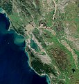
Bay Area by Sentinel-2, 2019-03-11 (big version).jpg 20,389 × 21,539; 487.33 MB
-
Bay Area by Sentinel-2, 2019-03-11 (small version).jpg 10,200 × 10,776; 123.14 MB
-
BayareaUSGS.jpg 769 × 798; 613 KB
-
Bayofsanfrancicsco1873.jpg 8,240 × 10,736; 14.19 MB
-
BigLittle.JPG 3,008 × 2,000; 1.57 MB
-
Black Mountain Summit Pano.jpg 7,089 × 700; 4.39 MB
-
BSA backpack.jpg 3,072 × 2,304; 2.35 MB
-
CA SR 35 at Purisima Creek Redwood, Aug 2019.jpg 3,456 × 2,304; 5.09 MB
-
CA-84 Woodside April 2023 001.jpg 5,464 × 3,640; 14.13 MB
-
CA-84 Woodside April 2023 002.jpg 5,464 × 3,640; 11.52 MB
-
CA-84 Woodside April 2023 003.jpg 5,464 × 3,640; 11.24 MB
-
CA-84 Woodside April 2023 HDR.jpg 5,464 × 3,640; 8.44 MB
-
Campbell and San Jose from El Sereno.jpg 2,592 × 1,944; 2.02 MB
-
Clark Canyon Ranch Clark.jpg 500 × 375; 116 KB
-
Deer (8843904333).jpg 2,573 × 1,709; 1.48 MB
-
Deer Creek east of Arastradero Road Aug. 29, 2010.jpg 1,536 × 2,048; 2.11 MB
-
Deer in Ben Lomond.jpg 1,527 × 2,281; 2.26 MB
-
El Granada and Pilar Pont Harbor.jpg 2,443 × 1,940; 1.43 MB
-
Fallen Redwood in Adobe Creek.jpg 1,280 × 960; 911 KB
-
Fish Ladder Los Trancos Creek 2011.jpg 1,936 × 2,592; 5.65 MB
-
Fog in the Santa Cruz Mountains.jpg 1,600 × 900; 116 KB
-
Foothills near I-1280 p1130165.jpg 2,560 × 1,920; 2.37 MB
-
GanapatiTempleMountMadona.jpg 4,000 × 3,000; 4.32 MB
-
Half Moon Bay airport and El Granada, California.jpg 4,096 × 1,940; 2.19 MB
-
Highway 84 between San Gregorio and La Honda - September 2013.png 2,592 × 1,742; 5.91 MB
-
View of horizon from Castle Rock State Park.jpg 1,288 × 625; 275 KB
-
Hills, Ocean, Fog and Mountains - La Honda, CA - February 2016.png 1,920 × 1,080; 3.09 MB
-
Horseshoe Lake, Skyline Ridge CA Aug 2019.jpg 3,456 × 2,304; 3.91 MB
-
Houses of Half-Moon-Bay California.jpg 1,271 × 629; 199 KB
-
La Honda and the Pacific from the Water District Trail - February 2016.png 1,920 × 1,080; 2.89 MB
-
La Honda Creek in Flood - January 2016.png 2,448 × 3,264; 9.86 MB
-
La Honda from the Water District Trail - March 2016.png 3,264 × 2,448; 5.25 MB
-
La Honda Road - panoramio.jpg 1,843 × 1,229; 926 KB
-
Lake Elsman.jpg 3,992 × 2,992; 5.46 MB
-
Lexington Reservoir from El Sereno Open Space Preserve.JPG 2,592 × 1,944; 1.96 MB
-
Long Ridge Openspace.JPG 1,067 × 1,600; 617 KB
-
Los Trancos Fence 2- San Andreas Fault.jpg 2,576 × 1,936; 5.15 MB
-
Los Trancos openspace.jpg 1,024 × 683; 264 KB
-
Marshall Creek, Ben Lomond, CA.jpg 2,304 × 3,072; 1.61 MB
-
Martin Ray Vineyards.jpg 4,272 × 2,848; 5.55 MB
-
USA-San Jose-Almaden Quicksilver Park-English Camp-3.jpg 3,264 × 2,448; 2.46 MB
-
Monte Bello Ridge from Ipiwa trail, Aug 2019.jpg 3,456 × 2,304; 4.59 MB
-
Monterey Bay from Santa Cruz Mountains 1875 post card.png 903 × 469; 912 KB
-
NASA Ames, Moffett Field, and US-101.jpg 3,264 × 2,448; 3.06 MB
-
Natural ground cover.JPG 3,008 × 2,000; 1.53 MB
-
Oxalis oregana 000.jpg 800 × 600; 117 KB
-
Oxalis oregana 001.jpg 800 × 600; 83 KB
-
Pacific Ocean and mountains near Half-Moon-Bay California.jpg 1,291 × 581; 182 KB
-
Palo Alto Baylands February 2013 015.jpg 4,928 × 3,264; 5.59 MB
-
Peters Creek California.jpg 1,600 × 1,200; 877 KB
-
Pilarcitos and Frenchmans Creeks.jpg 4,032 × 3,024; 1.19 MB
-
Pink Flowers (140428137).jpeg 2,048 × 1,365; 433 KB
-
Portola Redwoods State Park, ferns.jpg 2,602 × 1,735; 2.14 MB
-
PulgasRidgeTrailBridge.JPG 2,048 × 1,360; 2.21 MB
-
Purisima Creek Redwoods, Aug 2019 1.jpg 3,456 × 2,304; 4.87 MB
-
Purisima Creek Redwoods, Aug 2019 2.jpg 3,456 × 2,304; 4.87 MB
-
Purisima Creek Redwoods, Aug 2019 3.jpg 3,456 × 2,304; 5.24 MB
-
Purisima Creek vista.jpg 1,280 × 960; 103 KB
-
Radar Tower on the Summit of Mt. Umunhum, CA.jpg 3,024 × 4,032; 2.77 MB
-
View from Ridge Winery - Santa Cruz Mountain AVA.jpg 4,256 × 2,832; 10.05 MB
-
Road with trees along Santa Cruz Mountains.JPG 2,129 × 1,713; 674 KB
-
San Andreas Lake (1).jpg 750 × 562; 102 KB
-
San Andreas Lake from San Andreas Trail 1.JPG 2,272 × 1,704; 715 KB
-
San Francisco Bay Area Skyline Blvd.jpg 1,270 × 494; 142 KB
-
San Francisco Bay Area Skyline Blvd2.jpg 1,572 × 494; 137 KB
-
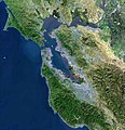
San Francisco Peninsula JPLLandsat.jpg 1,152 × 870; 161 KB
-
San Lorenzo River.jpg 1,280 × 845; 437 KB
-
SanAndreas.jpg 3,581 × 1,727; 425 KB
-
SankatMochanHanumanMountMadona.jpg 4,000 × 3,000; 3.1 MB
-
Santa Clara Valley in California - red border.jpg 1,254 × 1,146; 573 KB
-
Santa Cruz Mountains from Santana Row Day.jpg 5,040 × 1,040; 1.22 MB
-
Santa Cruz Mountains from Santana Row.jpg 3,536 × 1,040; 722 KB
-
Santa Cruz Mountains, Santa Cruz, California.jpg 4,032 × 3,024; 2.21 MB
-
SantaCruzMountains.jpg 280 × 187; 49 KB
-
Saratoga Gap Openspace.JPG 2,592 × 3,888; 3.57 MB
-
Shoreline Park Lake and Boats.jpg 5,488 × 2,530; 5.73 MB
-
SierraAzulViewCherrySpringLakeX.JPG 2,048 × 1,360; 2.36 MB
-
Skyline Blvd view from Thomas Fogarty Winery, Aug 2019.jpg 3,456 × 2,304; 4.45 MB
-
Skyline-to-the-Sea Trail 2.jpg 4,000 × 3,000; 3.33 MB
-
Stevens Creek dam with water level low.JPG 2,185 × 1,158; 599 KB
-
Sunny Jim Trail, CA Aug 2019.jpg 3,456 × 2,304; 5.23 MB
-
Thamnophis elegans terrestris 002.jpg 800 × 600; 169 KB
-
TipToeFalls.jpg 1,024 × 768; 280 KB
-
Tree lined street on road atop Santa Cruz Mountains.JPG 2,457 × 1,632; 1.11 MB
-
Trees in Santa Cruz Mountains.JPG 2,195 × 1,896; 1.29 MB
-
TwinPeaks SCC-CA.jpg 4,896 × 3,672; 5.6 MB
-
UP Warm Springs Subdivision facing south from Great Mall station, March 2018.JPG 5,184 × 3,888; 2.74 MB
-
Upper Crystal Spring Reservoir Vista Point, Aug 2019.jpg 3,456 × 2,304; 2.65 MB
-
Upper Watershed with Russian Ridge on Right and Montello Ridge on Left July 2011.jpg 3,198 × 2,592; 4.51 MB
-
USA Region West relief Santa Cruz Mountains location map.jpg 1,867 × 2,091; 1.05 MB
-
USGS - 1989 Loma Prieta earthquake - Landslide Debris on Highway.jpg 756 × 512; 60 KB
-
View from Sunny Jim Trail, Aug 2019 1.jpg 3,456 × 2,304; 4.13 MB
-
View from Sunny Jim Trail, Aug 2019 2.jpg 3,456 × 2,304; 4.43 MB
-
View from Sunny Jim Trail, Aug 2019 3.jpg 3,456 × 2,304; 4.14 MB
-
View from Sunny Jim Trail, Aug 2019 4.jpg 3,456 × 2,304; 4.67 MB
-
View looking westward from Santa Cruz Mountains toward the Pacific Ocean.JPG 1,311 × 944; 294 KB
-
View of hillside in Santa Cruz mountains of California.JPG 1,969 × 1,586; 763 KB
-
View of the Bay Area and the Californian Delta.jpg 6,034 × 4,838; 39.04 MB
-
Bay Area Road Ahead.jpg 550 × 138; 39 KB
-
David Bruce Vineyard in Los Gatos.jpg 640 × 480; 233 KB
-
Erosion from loss of riparian vegetation Hidden Villa 2010.jpg 2,592 × 1,936; 2.62 MB
-
Snowy Mountains in January.jpg 2,048 × 1,291; 193 KB
-
WindyHill.jpg 800 × 600; 348 KB
-
Loma Prieta Chapter Sierra Club founded 1933 at Hidden Villa.jpg 2,592 × 1,936; 5.28 MB
-
Acer macrophyllum at Coal Creek.jpg 2,592 × 3,872; 4.21 MB
-
Adiantum jordanii frond.jpg 2,268 × 3,024; 5.22 MB
-
Alnus rhombifolia (White Alder) Redwood Grove 2011-06-25.jpg 1,936 × 2,592; 4.19 MB
-
Arctostaphylos ohloneana.JPG 1,200 × 1,600; 534 KB
-
Calochortus tolmiei - Flickr 005.jpg 1,200 × 800; 868 KB
-
Corallorhiza maculata - Flickr 005.jpg 1,200 × 800; 563 KB
-
Manzanita large 750px.jpg 750 × 563; 156 KB
-
Mimulus aurantiacus-1.jpg 2,448 × 3,264; 1.81 MB
-
Mimulus aurantiacus-2.jpg 3,264 × 2,448; 1.31 MB
-
Mimulus aurantiacus-4.jpg 2,448 × 3,264; 1.49 MB
-
Native Honeysuckle Hidden Villa 2010.jpg 1,802 × 2,200; 2.96 MB
-
Notholithocarpus densiflorus Big Basin State Park.jpg 1,147 × 1,019; 1.28 MB
-
Oxalis oregana 002.jpg 600 × 800; 101 KB
-
Pedicularis densiflora-1.jpg 3,264 × 2,448; 2.21 MB
-
Pedicularis densiflora-2.jpg 2,448 × 3,264; 913 KB
-
Pedicularis densiflora-3.jpg 2,448 × 3,264; 1.23 MB
-
Pinus attenuata Big Basin 3.jpg 2,592 × 1,944; 2.68 MB
-
Pinus attenuata Big Basin State Park.jpg 733 × 1,016; 782 KB
-
Pinus attenuata forest Big Basin State Park.jpg 1,365 × 1,024; 774 KB
-
Pinus attenuata Pine Mountain.jpg 1,010 × 1,496; 1.81 MB
-
Pinus attenuata trees Big Basin State Park.jpg 1,365 × 1,024; 1.35 MB
-
Ranunculus-californicus1.jpg 2,505 × 1,878; 2.66 MB
-
Viola ocellata - Flickr 003.jpg 1,200 × 800; 789 KB
-
Madrone refrigerator tree.jpg 2,304 × 1,728; 5.3 MB
-
PSM V85 D425 Roots of quercus agrifolia growing in the santa cruz mountains.png 1,774 × 1,218; 838 KB
Categories:
- California Coast Ranges
- Mountain ranges of Northern California
- Geography of the San Francisco Bay Area
- Landforms of San Mateo County, California
- Landforms of Santa Cruz County, California
- Landforms of Santa Clara County, California
- Geography of San Benito County, California
- Landforms of Monterey County, California


