Category:Sant Pere de Talteüll
Jump to navigation
Jump to search
| Object location | | View all coordinates using: OpenStreetMap |
|---|
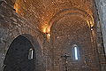
church building in Talteüll, Spain  Façana de llevant amb els dos absis i porta d'entrada | |||||
| Upload media | |||||
| Instance of | |||||
|---|---|---|---|---|---|
| Location | Talteüll, Massoteres, Segarra, Ponent, Lleida Province, Catalonia | ||||
| Street address |
| ||||
| Architectural style | |||||
| Diocese | |||||
| Heritage designation | |||||
| Inception |
| ||||
| Elevation above sea level |
| ||||
 | |||||
Català: Església parroquial de Sant Pere de Talteüll, municipi de Massoteres (Segarra)
This is a category about a building listed in the Catalan heritage register as Bé Cultural d'Interès Local (BCIL) under the reference IPA-19838. |
Media in category "Sant Pere de Talteüll"
The following 24 files are in this category, out of 24 total.
-
 Església de Sant Pere de Talteüll (Massoteres) - 1.jpg 3,841 × 3,072; 5.89 MB
-
 Església de Sant Pere de Talteüll (Massoteres) - 2.jpg 4,608 × 3,072; 10.39 MB
-
 Església de Sant Pere de Talteüll (Massoteres) - 3.jpg 4,608 × 3,072; 8.52 MB
-
 Església de Sant Pere de Talteüll (Massoteres) - 4.jpg 3,177 × 2,827; 5.51 MB
-
 Església de Sant Pere de Talteüll (Massoteres) - 5.jpg 3,815 × 3,072; 5.1 MB
-
 Església de Sant Pere de Talteüll (Massoteres) - 6.jpg 4,067 × 3,072; 6.73 MB
-
 Església de Sant Pere de Talteüll (Massoteres) - 7.jpg 4,608 × 3,072; 9.94 MB
-
 PM 113384 E Talteull.jpg 600 × 400; 268 KB
-
 PM 113386 E Talteull.jpg 600 × 400; 259 KB
-
 PM 113387 E Talteull.jpg 600 × 400; 240 KB
-
 PM 113388 E Talteull.jpg 600 × 400; 229 KB
-
 PM 113391 E Talteull.jpg 336 × 600; 238 KB
-
 PM 113392 E Talteull.jpg 518 × 600; 325 KB
-
 PM 113393 E Talteull.jpg 400 × 600; 294 KB
-
 PM 113395 E Talteull.jpg 600 × 415; 294 KB
-
 SANT PERE DE TALTEÜLL - IB-744.JPG 1,536 × 2,048; 1.49 MB
-
 SANT PERE DE TALTEÜLL - IB-747.JPG 1,536 × 2,048; 1.49 MB
-
 SANT PERE DE TALTEÜLL - IB-748.JPG 2,048 × 1,536; 1.49 MB
-
 SANT PERE DE TALTEÜLL - IB-754.JPG 2,048 × 1,536; 1.46 MB
-
 SANT PERE DE TALTEÜLL - IB-755.JPG 1,536 × 2,048; 1.65 MB
-
 SANT PERE DE TALTEÜLL - IB-758.JPG 1,536 × 2,048; 1.61 MB
-
 SANT PERE DE TALTEÜLL - IB-759.JPG 1,536 × 2,048; 1.55 MB
-
 SANT PERE DE TALTEÜLL - IB-760.JPG 2,048 × 1,536; 1.39 MB
-
 SANT PERE DE TALTEÜLL - IB-765.JPG 1,536 × 2,048; 1.55 MB
_-_1.jpg)
_-_2.jpg)
_-_3.jpg)
_-_4.jpg)
_-_5.jpg)
_-_6.jpg)
_-_7.jpg)


