Category:Sanierungsgebiet Ruhland
Jump to navigation
Jump to search
| Object location | | View all coordinates using: OpenStreetMap |
|---|
Sanierungsgebiet Ruhland
[edit]Diese Kategorie umfasst die Innenstadtsanierung 1993 - 2015 der Stadt Ruhland
Subcategories
This category has the following 9 subcategories, out of 9 total.
D
- Dresdener Straße 35 (Ruhland) (17 F)
F
- Fischerstraße 12 (Ruhland) (6 F)
- Fischerstraße 2 (Ruhland) (4 F)
M
- Markt 1 (Ruhland) (4 F)
- Markt 2, Apotheke (Ruhland) (8 F)
- Markt 3 (Ruhland) (2 F)
- Markt 4 (Ruhland) (1 F)
S
Media in category "Sanierungsgebiet Ruhland"
The following 39 files are in this category, out of 39 total.
-
 Ruhland, Bauplan Ausbau Dresdener Straße, Auszug (Bepflanzung).jpg 635 × 726; 272 KB
-
 Ruhland, Bauplan Ausbau Dresdener Straße, Auszug (Pflanzenliste).jpg 431 × 155; 48 KB
-
 Ruhland, Brauhausplatz, Lieferscheine für Anpflanzungen 1997.pdf 1,239 × 1,752, 3 pages; 433 KB
-
 Ruhland, Dresdener Str. 47, Informationstafel mit QR-Code.jpg 2,272 × 1,704; 318 KB
-
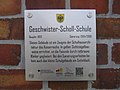
 Ruhland, Dresdener Str. 9, Geschwister Scholl Schule.jpg 3,820 × 2,547; 7.02 MB
-
 Ruhland, Dresdener Str. 9, Informationstafel mit QR-Code.jpg 2,272 × 1,704; 382 KB
-
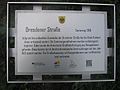 Ruhland, Dresdener Str., Informationstafel mit QR-Code.jpg 2,272 × 1,704; 396 KB
-
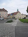
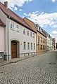
 Ruhland, Dresdener Str., von Ecke Marienstraße nach Nordost.jpg 1,704 × 2,272; 382 KB
-
 Ruhland, Dresdener Str., von Kreuzung Marienstraße nach Nordnordost.jpg 1,704 × 2,272; 382 KB
-
 Ruhland, Fischerstr. 1-2.jpg 2,440 × 3,608; 5.76 MB
-
 Ruhland, Fischerstraße 43, Straßenlampe (Sanierungsgebiet) P1100737.jpg 3,456 × 4,608; 1.76 MB
-
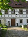
 Ruhland, Gutshof 2, (Fachwerk).jpg 5,472 × 3,648; 17.46 MB
-
-
-
 Ruhland, Gutshof 2, Informationstafel mit QR-Code.jpg 2,272 × 1,704; 293 KB
-
 Ruhland, Kirchplatz 1, 02.jpg 4,296 × 2,864; 5.88 MB
-
 Ruhland, Kirchplatz 1, Informationstafel mit QR-Code.jpg 2,272 × 1,704; 335 KB
-
 Ruhland, Marienstr., Brauhausgraben bei Hausnr. 17, Sommer, 01.jpg 2,272 × 1,704; 260 KB
-
 Ruhland, Marienstr., Brauhausgraben westwärts bei Hausnr. 16, Sommer, 01.jpg 1,704 × 2,272; 667 KB
-
 Ruhland, Marienstr., Brauhausgraben westwärts bei Hausnr. 17, Sommer, 01.jpg 1,704 × 2,272; 620 KB
-
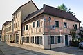
 Ruhland, Markt 11.jpg 2,272 × 1,704; 437 KB
-
 Ruhland, Markt 14, Informationstafel mit QR-Code.jpg 2,272 × 1,704; 414 KB
-
 Ruhland, Markt 14, Nordostansicht, 01.jpg 3,000 × 2,525; 4.65 MB
-
 Ruhland, Markt 14, Ostansicht.jpg 2,416 × 3,624; 5.28 MB
-
 Ruhland, Markt 16+17, Informationstafel mit QR-Code.jpg 2,272 × 1,704; 274 KB
-
 Ruhland, Markt 16-17.jpg 3,463 × 2,308; 3.83 MB
-
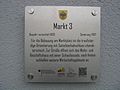 Ruhland, Markt 3, Informationstafel mit QR-Code.jpg 2,272 × 1,704; 346 KB
-
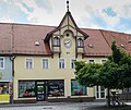
 Ruhland, Markt 7, Hotel "Stern".jpg 3,888 × 2,592; 6.56 MB
-
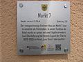 Ruhland, Markt 7, Informationstafel mit QR-Code.jpg 2,272 × 1,704; 380 KB
-
 Ruhland, Markt, Informationstafel mit QR-Code.jpg 2,272 × 1,704; 459 KB
-
 Ruhland, Marktplatz, Blick Richtung Kirchturm.jpg 4,332 × 2,889; 8.06 MB
-
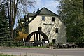 Ruhland, Ortrander Str. 1, Matzmühle, Südansicht.jpg 3,888 × 2,592; 3.79 MB
-
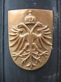
 Ruhland, Sanierungsbebiet, Wappen auf Straßenlampe P1100733.jpg 4,608 × 3,456; 2.19 MB
-
 Ruhland, Sanierungsgebiet, Wappen Straßenlampe P1100743.jpg 3,890 × 3,193; 1.44 MB
-
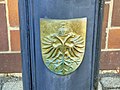
 Ruhland, Stadtwappen an Laternenfuß im Sanierungsgebiet, 01.jpg 1,704 × 2,272; 261 KB
-
 Ruhland, Stadtwappen an Laternenfuß im Sanierungsgebiet, 02.jpg 1,704 × 2,272; 561 KB
-
 Ruhland, Straßenlaterne im Sanierungsgebiet, Brauhausgasse.jpg 1,704 × 2,272; 953 KB
-
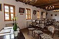
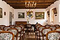 Trauzimmer im Gutshof Ruhland.jpg 5,398 × 3,599; 12.62 MB
-
 Wappensaal & Trauzimmer im Gutshof in Ruhland.jpg 5,398 × 3,599; 10.94 MB
.jpg)


_P1100737.jpg)
.jpg)


.jpg)