Category:Sandfields West
Jump to navigation
Jump to search
community of Neath Port Talbot county borough, Wales  | |||||
| Upload media | |||||
| Pronunciation audio | |||||
|---|---|---|---|---|---|
| Instance of | |||||
| Location | Neath Port Talbot, Wales | ||||
| Population |
| ||||
| Area |
| ||||
 | |||||
Media in category "Sandfields West"
The following 80 files are in this category, out of 80 total.
-
 'Taper' by Andrew Rowe - geograph.org.uk - 5211911.jpg 2,448 × 3,264; 1.45 MB
-
 2010 Wales Neath Port Talbot Community Sandfields West map.svg 512 × 666; 423 KB
-
 2024 Wales Neath Port Talbot Community Sandfields West map.svg 512 × 666; 548 KB
-
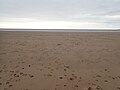
 Aberafan beach - geograph.org.uk - 6179047.jpg 4,000 × 3,000; 2.35 MB
-
 Aberafon Beach - geograph.org.uk - 5390976.jpg 1,600 × 1,200; 156 KB
-
 Aberafon Sands - geograph.org.uk - 5390985.jpg 1,600 × 1,200; 186 KB
-
 Aberavon beach - geograph.org.uk - 4421086.jpg 2,592 × 1,456; 1.48 MB
-
 Aberavon Beach - geograph.org.uk - 5212616.jpg 3,264 × 2,448; 3.13 MB
-
 Aberavon Sands and Baglan Burrows - geograph.org.uk - 2375334.jpg 640 × 457; 150 KB
-
 Aberavon Sands at low tide - geograph.org.uk - 4943104.jpg 4,000 × 3,000; 3.35 MB
-
 Aberavon Sands at low tide - geograph.org.uk - 4943122.jpg 3,935 × 2,951; 3.77 MB
-
 Aberavon seafront - geograph.org.uk - 4421104.jpg 2,592 × 1,456; 1,004 KB
-
 Acacia Close, Port Talbot - geograph.org.uk - 3831357.jpg 800 × 762; 97 KB
-
 Bathers on Aberavon Sands - geograph.org.uk - 4943100.jpg 3,927 × 2,945; 3.69 MB
-
 Cafe Remos, Aberafan seafront - geograph.org.uk - 6179044.jpg 4,000 × 3,000; 2.36 MB
-
 Cars parked on Princess Margaret Way, Aberafan - geograph.org.uk - 6179042.jpg 4,000 × 3,000; 2.47 MB
-
 Coastguard on Aberavon Sands - geograph.org.uk - 4943098.jpg 3,883 × 2,330; 1.76 MB
-
 Dunes on Aberavon Sands - geograph.org.uk - 4943118.jpg 4,000 × 2,400; 1.95 MB
-

-
 First Cymru Bus Depot, Port Talbot (1) - geograph.org.uk - 5284802.jpg 2,592 × 1,944; 1.39 MB
-
 First Cymru Bus Depot, Port Talbot (2) - geograph.org.uk - 5284811.jpg 2,592 × 1,944; 1.37 MB
-
 First Cymru Port Talbot bus depot - geograph.org.uk - 3831384.jpg 800 × 530; 73 KB
-
 Fish and Chip emporium on the seafront - geograph.org.uk - 3470688.jpg 1,984 × 1,488; 676 KB
-
 Fit4Less by Energie, Port Talbot - geograph.org.uk - 3831352.jpg 640 × 371; 46 KB
-
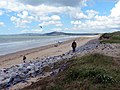
 Following the Wales Coast Path - geograph.org.uk - 6179092.jpg 4,000 × 3,000; 2.21 MB
-
 Footprints in the sand - geograph.org.uk - 6179085.jpg 4,000 × 3,000; 2.62 MB
-
 Franco's Restaurant - geograph.org.uk - 5211905.jpg 3,264 × 2,448; 2.33 MB
-
 Franco's Takeaway and Restaurant, Port Talbot (1) - geograph.org.uk - 6035218.jpg 2,592 × 1,944; 1.38 MB
-
 Franco's, Aberavon seafront - geograph.org.uk - 6179060.jpg 4,000 × 3,000; 2.28 MB
-
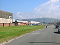 Industrial estate on the edge of Sandfields - geograph.org.uk - 3139265.jpg 2,288 × 1,712; 1.31 MB
-
 Kite Trail sculpture at Aberavon - geograph.org.uk - 940527.jpg 427 × 640; 55 KB
-
 Lifeguard vehicle on Aberafan beach - geograph.org.uk - 6174432.jpg 3,837 × 2,879; 1.64 MB
-
 Ordnance Survey Cut Mark - geograph.org.uk - 6462644.jpg 1,024 × 923; 121 KB
-
 Ordnance Survey Cut Mark - geograph.org.uk - 6462647.jpg 1,024 × 778; 325 KB
-
 Ordnance Survey Cut Mark - geograph.org.uk - 6462650.jpg 1,024 × 773; 105 KB
-
 Ordnance Survey Cut Mark - geograph.org.uk - 6462675.jpg 1,024 × 746; 83 KB
-
 Ordnance Survey Cut Mark - geograph.org.uk - 6462677.jpg 890 × 1,024; 124 KB
-
 Ordnance Survey Cut Mark - geograph.org.uk - 6462681.jpg 906 × 1,024; 107 KB
-
 Ordnance Survey Rivet - geograph.org.uk - 3896181.jpg 480 × 640; 133 KB
-
 Ordnance Survey Rivet - geograph.org.uk - 3896188.jpg 480 × 640; 139 KB
-
 Ordnance Survey Rivet - geograph.org.uk - 3896191.jpg 480 × 640; 143 KB
-
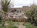
 Paddling pool on the promenade at Aberavon Sands - geograph.org.uk - 3136725.jpg 2,288 × 1,712; 1.3 MB
-
 Picnic area at the crazy golf, Aberafan - geograph.org.uk - 6179054.jpg 4,000 × 3,000; 2.82 MB
-
 Play Area - geograph.org.uk - 5211899.jpg 3,264 × 2,448; 3.02 MB
-
 Port Talbot , Aberavon Sands - geograph.org.uk - 5474852.jpg 5,876 × 3,917; 7.27 MB
-
 Port Talbot , Aberavon Sands - geograph.org.uk - 5474853.jpg 5,977 × 3,985; 6.4 MB
-
 Port Talbot , Aberavon Sands - geograph.org.uk - 5474854.jpg 5,969 × 3,979; 7.12 MB
-
 Port Talbot , Aberavon Sands - geograph.org.uk - 5474856.jpg 5,905 × 3,937; 7.5 MB
-
 Port Talbot , Aberavon Sands - geograph.org.uk - 5474859.jpg 5,909 × 3,939; 6.14 MB
-
 Port Talbot , Aberavon Sands - geograph.org.uk - 5474860.jpg 6,000 × 4,000; 7.09 MB
-
 Port Talbot , Aberavon Sands - geograph.org.uk - 5474861.jpg 6,000 × 4,000; 7.01 MB
-
 Port Talbot , Aberavon Sands - geograph.org.uk - 5474862.jpg 5,897 × 3,932; 6.11 MB
-
 Port Talbot , Aberavon Sands - geograph.org.uk - 5474863.jpg 5,858 × 3,905; 7.81 MB
-
 Port Talbot , Car Park - geograph.org.uk - 5467707.jpg 4,932 × 2,774; 5.07 MB
-
 Port Talbot , Coastal Scenery - geograph.org.uk - 3904089.jpg 4,280 × 2,836; 2.78 MB
-
 Port Talbot , Franco's - geograph.org.uk - 5467708.jpg 5,312 × 2,988; 3.54 MB
-
 Port Talbot , Ramp - geograph.org.uk - 5474851.jpg 5,542 × 3,695; 7.8 MB
-
 Port Talbot , Sculpture - geograph.org.uk - 5467709.jpg 5,312 × 2,988; 2.92 MB
-
 Port Talbot , The Princess Margaret Way - geograph.org.uk - 5474857.jpg 5,426 × 3,617; 4.56 MB
-
 Port Talbot , The Promenade - geograph.org.uk - 5474855.jpg 5,835 × 3,890; 6.58 MB
-
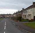
 Purcell Avenue - geograph.org.uk - 2049500.jpg 640 × 480; 48 KB
-
 Restaurant on Aberavon seafront - geograph.org.uk - 3470696.jpg 1,984 × 1,488; 685 KB
-
 Running Track - geograph.org.uk - 5211927.jpg 3,264 × 2,448; 3.87 MB
-
 Sandfields Comprehensive School - geograph.org.uk - 5211923.jpg 3,264 × 2,448; 2.7 MB
-
 Sandfields, Aberafan - geograph.org.uk - 1096091.jpg 640 × 480; 68 KB
-
 Sands and dunes at Aberavon - geograph.org.uk - 2325622.jpg 640 × 480; 123 KB
-
 Scarlet Avenue - geograph.org.uk - 2049488.jpg 640 × 480; 45 KB
-
 Sculpture on Aberavon seafront - geograph.org.uk - 3470715.jpg 1,629 × 1,100; 558 KB
-
 Seaway Parade - geograph.org.uk - 2049502.jpg 640 × 480; 68 KB
-

-
 Sunset across Swansea Bay from Aberavon Beach - geograph.org.uk - 2065207.jpg 2,592 × 1,944; 708 KB
-
 The Naval Social Club, Baglan - geograph.org.uk - 6179081.jpg 4,000 × 3,000; 2.37 MB
-
 Tidal Ripples - geograph.org.uk - 5211916.jpg 3,264 × 2,448; 2.46 MB
-
 Traeth Aberafan - Aberavon Beach - geograph.org.uk - 4058648.jpg 640 × 480; 79 KB
-
 Traeth Aberafan - geograph.org.uk - 3401605.jpg 2,228 × 1,647; 853 KB
-
 Traeth Aberafan Beach - geograph.org.uk - 6179052.jpg 4,000 × 3,000; 2.33 MB
-
 Underpass beneath Afan Way, Port Talbot - geograph.org.uk - 3831417.jpg 800 × 600; 120 KB
-

-
 Western end of the Marine Walk, Aberavon - geograph.org.uk - 6179063.jpg 4,000 × 3,000; 2.32 MB
-


_-_geograph.org.uk_-_5284802.jpg)
_-_geograph.org.uk_-_5284811.jpg)


_-_geograph.org.uk_-_6035218.jpg)


