Category:Sand Point and Middle Hope
Jump to navigation
Jump to search
headland in Somerset, England  | |||||
| Upload media | |||||
| Instance of | |||||
|---|---|---|---|---|---|
| Location | North Somerset, Somerset, South West England, England | ||||
| Located in or next to body of water | |||||
| Owned by | |||||
| Operator | |||||
| Heritage designation |
| ||||
| Area |
| ||||
| official website | |||||
 | |||||
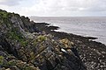
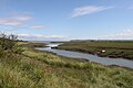
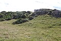
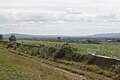
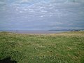
Sand Point in Somerset, England is the peninsula stretching out from Middle Hope, an 84.1 hectare biological and geological Site of Special Scientific Interest. It lies to the north of the village of Kewstoke, and the stretch of coastline called Sand Bay north of the town of Weston-super-Mare. It is owned by the National Trust and is a popular place for walking. On a clear day it commands views over Flat Holm, of the Bristol Channel, South Wales, Clevedon, the Second Severn Crossing and the Severn Bridge.
Subcategories
This category has the following 2 subcategories, out of 2 total.
M
- Middle Hope (8 F)
S
- Sand Point, Somerset (23 F)
Media in category "Sand Point and Middle Hope"
The following 39 files are in this category, out of 39 total.
-
 A sheltered bay on Middle Hope NT - geograph.org.uk - 1539550.jpg 640 × 480; 89 KB
-
 North Somerset , Sand Point - geograph.org.uk - 3162257.jpg 4,288 × 2,848; 6.6 MB
-
 North Somerset , Sand Point - geograph.org.uk - 3162261.jpg 4,282 × 2,838; 7.09 MB
-
 North Somerset , Sand Point Car Park - geograph.org.uk - 3163258.jpg 4,288 × 2,848; 6.18 MB
-
 North Somerset , Sand Point ^ Bay - geograph.org.uk - 3162256.jpg 4,288 × 2,848; 6.87 MB
-
 North Somerset , Sand Point ^ Bristol Channel - geograph.org.uk - 3162263.jpg 4,288 × 2,848; 6.8 MB
-
 North Somerset , Sand Point ^ Coastline - geograph.org.uk - 3162254.jpg 4,288 × 2,848; 6.37 MB
-
 North Somerset , Sand Point ^ Coastline - geograph.org.uk - 3162258.jpg 4,288 × 2,848; 6.88 MB
-
 North Somerset , Sand Point ^ Coastline - geograph.org.uk - 3162268.jpg 4,288 × 2,848; 6.9 MB
-
 Northern shoreline of Middle Hope - geograph.org.uk - 1539587.jpg 640 × 480; 62 KB
-
 Sand Bay from Middle Hope 3 - geograph.org.uk - 1403610.jpg 640 × 480; 196 KB
-
 Sand Point and Middle Hope 01.JPG 3,456 × 2,304; 1.6 MB
-
 Sand Point and Middle Hope 02.JPG 3,456 × 2,304; 1.19 MB
-
 Sand Point and Middle Hope 03.JPG 3,456 × 2,304; 1.46 MB
-
 Sand Point and Middle Hope 04.JPG 3,456 × 2,304; 1.63 MB
-
 Sand Point and Middle Hope 05.JPG 3,456 × 2,304; 2 MB
-
 Sand Point and Middle Hope 06.JPG 3,456 × 2,304; 1.99 MB
-
 Sand Point and Middle Hope 07.JPG 3,456 × 2,304; 2.47 MB
-
 Sand Point and Middle Hope 08.JPG 3,456 × 2,304; 2.86 MB
-
 Sand Point and Middle Hope 09.JPG 3,456 × 2,304; 1.81 MB
-
 Sand Point and Middle Hope 10.JPG 3,456 × 2,304; 2.52 MB
-
 Sand Point and Middle Hope 11.JPG 3,456 × 2,304; 1.45 MB
-
 Sand Point and Middle Hope 12.JPG 3,456 × 2,304; 1.57 MB
-
 Sand Point and Middle Hope 13.JPG 3,456 × 2,304; 1.37 MB
-
 Sand Point and Middle Hope 14.JPG 3,456 × 2,304; 2.24 MB
-
 Sand Point and Middle Hope 15.JPG 3,456 × 2,304; 1.59 MB
-
 Sand Point and Middle Hope 16.JPG 3,456 × 2,304; 1.11 MB
-
 Sand Point and Middle Hope 17.JPG 3,456 × 2,304; 1.61 MB
-
 Sand Point and Middle Hope 18.JPG 3,456 × 2,304; 1.88 MB
-
 Sand Point and Middle Hope 19.JPG 2,304 × 3,456; 1.75 MB
-
 Sand Point and Middle Hope 20.JPG 3,456 × 2,304; 1.21 MB
-
 Sand Point and Middle Hope 21.JPG 3,456 × 2,304; 1.42 MB
-
 The mound (Iron Age fort) on Sand Point - geograph.org.uk - 2935179.jpg 600 × 800; 330 KB
-
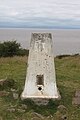
 Trig point at Middle Hope - geograph.org.uk - 1414444.jpg 640 × 480; 68 KB
-
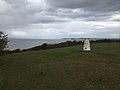 Trig point on Sand Point - geograph.org.uk - 2935154.jpg 800 × 600; 298 KB
-
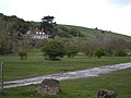 Woodspring House on Middle Hope - geograph.org.uk - 2935192.jpg 800 × 600; 334 KB
-
 A cove at Middle Hope - geograph.org.uk - 936393.jpg 640 × 479; 109 KB
-
 Cove at Middle Hope - geograph.org.uk - 1403528.jpg 640 × 480; 214 KB
-
 Middle Hope - geograph.org.uk - 63208.jpg 640 × 480; 86 KB


_on_Sand_Point_-_geograph.org.uk_-_2935179.jpg)


