Category:Sanborn maps of Manhattan published in 1900
Jump to navigation
Jump to search
Maps from: Insurance Maps of the City of New York. Volume 12. (New York: Sanborn–Perris Map Co., Limited; 1900), including 53 maps (plates) (27 maps of Manhattan and 26 maps of the Bronx), two-page volume key, title page, and street index.
Online at The New York Public Library Digital Collections website, Atlas 128. Vol. 12, 1900.
Subcategories
This category has only the following subcategory.
Media in category "Sanborn maps of Manhattan published in 1900"
The following 31 files are in this category, out of 31 total.
-
 Sanborn V. 12 title page publ. 1900.jpg 4,869 × 7,377; 5.86 MB
-
 Sanborn V. 12 street index publ. 1900.jpg 4,367 × 6,901; 5.26 MB
-
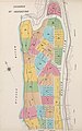
 Sanborn V. 12 lower part of volume index publ. 1900.jpg 4,979 × 7,502; 5.01 MB
-
 Sanborn V. 12 lower part of volume index (small) publ. 1900.jpg 1,568 × 2,512; 822 KB
-
 Sanborn V. 12 Plate 01 publ. 1900.jpg 5,058 × 7,490; 5.28 MB
-
 Sanborn V. 12 Plate 02 publ. 1900.jpg 5,031 × 7,503; 3.76 MB
-
 Sanborn V. 12 Plate 03 publ. 1900.jpg 5,086 × 7,478; 5.01 MB
-
 Sanborn V. 12 Plate 04 publ. 1900.jpg 5,053 × 7,486; 5.43 MB
-
 Sanborn V. 12 Plate 05 publ. 1900.jpg 5,107 × 7,482; 4 MB
-
 Sanborn V. 12 Plate 06 publ. 1900.jpg 5,054 × 7,478; 4.06 MB
-
 Sanborn V. 12 Plate 07 publ. 1900.jpg 5,041 × 7,489; 4.71 MB
-
 Sanborn V. 12 Plate 08 publ. 1900.jpg 5,042 × 7,490; 4.17 MB
-
 Sanborn V. 12 Plate 09 publ. 1900.jpg 5,021 × 7,468; 3.7 MB
-
 Sanborn V. 12 Plate 10 publ. 1900.jpg 5,058 × 7,485; 3.68 MB
-
 Sanborn V. 12 Plate 11 publ. 1900.jpg 5,221 × 7,473; 4.05 MB
-
 Sanborn V. 12 Plate 12 publ. 1900.jpg 5,076 × 7,502; 4.45 MB
-
 Sanborn V. 12 Plate 13 publ. 1900.jpg 5,166 × 7,486; 4.04 MB
-
 Sanborn V. 12 Plate 14 publ. 1900.jpg 5,053 × 7,501; 4.03 MB
-
 Sanborn V. 12 Plate 15 publ. 1900.jpg 5,119 × 7,503; 3.98 MB
-
 Sanborn V. 12 Plate 16 publ. 1900.jpg 5,037 × 7,461; 3.79 MB
-
 Sanborn V. 12 Plate 17 publ. 1900.jpg 5,026 × 7,501; 3.96 MB
-
 Sanborn V. 12 Plate 18 publ. 1900.jpg 5,037 × 7,496; 4.22 MB
-
 Sanborn V. 12 Plate 19 publ. 1900.jpg 5,070 × 7,502; 4.03 MB
-
 Sanborn V. 12 Plate 20 publ. 1900.jpg 5,065 × 7,499; 3.8 MB
-
 Sanborn V. 12 Plate 21 publ. 1900.jpg 5,061 × 7,495; 3.92 MB
-
 Sanborn V. 12 Plate 22 publ. 1900.jpg 5,078 × 7,505; 3.6 MB
-
 Sanborn V. 12 Plate 23 publ. 1900.jpg 5,056 × 7,489; 3.93 MB
-
 Sanborn V. 12 Plate 24 publ. 1900.jpg 5,057 × 7,494; 4.32 MB
-
 Sanborn V. 12 Plate 25 publ. 1900.jpg 5,057 × 7,491; 3.79 MB
-
 Sanborn V. 12 Plate 26 publ. 1900.jpg 5,027 × 7,466; 3.59 MB
-
 Sanborn V. 12 Plate 27 publ. 1900.jpg 5,071 × 7,455; 5.23 MB


_publ._1900.jpg)


