Category:Sanborn maps of Manhattan published in 1894
Jump to navigation
Jump to search
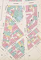
Maps from: Insurance Maps of the City of New York Surveyed and Published by Sanborn–Perris Map Co., Limited. Volume 1. (New York: 1894), comprising 33 maps (double-page plates), numbered 1–24, 24½, 25–30, and West Piers, and South Piers) plus title page, volume key, and street index. Each double-page plate is in two images (left half and right half), except Plate 2, which is shown whole. Plates 14, 19, and 20 are shown whole as well as in halves.
Source: The New York Public Library Digital Collections website, Atlas 107. Vol. 1, 1894.
Subcategories
This category has only the following subcategory.
Media in category "Sanborn maps of Manhattan published in 1894"
The following 75 files are in this category, out of 75 total.
-
 Sanborn Manhattan V. 1 title page publ. 1894.jpg 5,051 × 6,646; 6.09 MB
-
 Sanborn Manhattan V. 1 volume key publ. 1894.jpg 5,044 × 6,623; 5.81 MB
-
 Sanborn Manhattan V. 1 street index publ. 1894.jpg 4,923 × 5,978; 6.42 MB
-
 Sanborn Manhattan V. 1 Plate 01 left half publ. 1894.jpg 5,060 × 6,653; 4.96 MB
-
 Sanborn Manhattan V. 1 Plate 01 right half publ. 1894.jpg 5,071 × 6,592; 5.22 MB
-
 Sanborn Manhattan V. 1 Plate 02 publ. 1894.jpg 6,767 × 4,411; 4.98 MB
-
 Sanborn Manhattan V. 1 Plate 03 left half publ. 1894.jpg 5,059 × 6,660; 5.39 MB
-
 Sanborn Manhattan V. 1 Plate 03 right half publ. 1894 (cropped).jpg 2,195 × 1,882; 1.62 MB
-
 Sanborn Manhattan V. 1 Plate 03 right half publ. 1894.jpg 5,019 × 6,616; 4.4 MB
-
 Sanborn Manhattan V. 1 Plate 04 left half publ. 1894.jpg 5,065 × 6,653; 5.21 MB
-
 Sanborn Manhattan V. 1 Plate 04 right half publ. 1894.jpg 5,033 × 6,597; 4.58 MB
-
 Sanborn Manhattan V. 1 Plate 05 left half publ. 1894.jpg 5,087 × 6,638; 5.39 MB
-
 Sanborn Manhattan V. 1 Plate 05 right half publ. 1894.jpg 5,013 × 6,642; 5.45 MB
-
 Sanborn Manhattan V. 1 Plate 06 left half publ. 1894.jpg 5,064 × 6,614; 5.33 MB
-
 Sanborn Manhattan V. 1 Plate 06 right half publ. 1894.jpg 5,050 × 6,636; 5.59 MB
-
 Sanborn Manhattan V. 1 Plate 07 left half publ. 1894.jpg 5,048 × 6,632; 4.81 MB
-
 Sanborn Manhattan V. 1 Plate 07 right half publ. 1894.jpg 5,069 × 6,620; 5.01 MB
-
 Sanborn Manhattan V. 1 Plate 08 left half publ. 1894.jpg 5,050 × 6,616; 4.27 MB
-
 Sanborn Manhattan V. 1 Plate 08 right half publ. 1894.jpg 5,029 × 6,622; 4.89 MB
-
 Sanborn Manhattan V. 1 Plate 09 left half publ. 1894.jpg 5,070 × 6,623; 4.75 MB
-
 Sanborn Manhattan V. 1 Plate 09 right half publ. 1894 (cropped).jpg 3,411 × 4,474; 2.76 MB
-
 Sanborn Manhattan V. 1 Plate 09 right half publ. 1894.jpg 5,047 × 6,619; 5.37 MB
-
 Sanborn Manhattan V. 1 Plate 10 left half publ. 1894.jpg 3,377 × 4,424; 2.71 MB
-
 Sanborn Manhattan V. 1 Plate 10 right half publ. 1894.jpg 3,382 × 4,425; 2.65 MB
-
 Sanborn Manhattan V. 1 Plate 11 left half publ. 1894.jpg 3,371 × 4,444; 2.57 MB
-
 Sanborn Manhattan V. 1 Plate 11 right half publ. 1894.jpg 3,352 × 4,423; 2.55 MB
-
 Sanborn Manhattan V. 1 Plate 12 left half publ. 1894.jpg 3,175 × 4,434; 2.23 MB
-
 Sanborn Manhattan V. 1 Plate 12 right half publ. 1894.jpg 3,325 × 4,413; 2.35 MB
-
 Sanborn Manhattan V. 1 Plate 13 left half publ. 1894.jpg 3,375 × 4,442; 2.72 MB
-
 Sanborn Manhattan V. 1 Plate 13 right half publ. 1894.jpg 3,370 × 4,341; 2.53 MB
-
 Sanborn Manhattan V. 1 Plate 14 (whole) publ. 1894.jpg 6,772 × 4,446; 5.8 MB
-
 Sanborn Manhattan V. 1 Plate 14 left half publ. 1894 (cropped).jpg 2,304 × 3,371; 1.7 MB
-
 Sanborn Manhattan V. 1 Plate 14 left half publ. 1894.jpg 3,344 × 4,430; 2.77 MB
-
 Sanborn Manhattan V. 1 Plate 14 right half publ. 1894.jpg 3,361 × 4,403; 2.76 MB
-
 Sanborn Manhattan V. 1 Plate 15 left half publ. 1894.jpg 5,058 × 6,592; 4.8 MB
-
 Sanborn Manhattan V. 1 Plate 15 right half publ. 1894.jpg 5,065 × 6,667; 5.15 MB
-
 Sanborn Manhattan V. 1 Plate 16 left half publ. 1894.jpg 5,071 × 6,581; 4.77 MB
-
 Sanborn Manhattan V. 1 Plate 16 right half publ. 1894.jpg 5,113 × 6,624; 4.65 MB
-
 Sanborn Manhattan V. 1 Plate 17 left half publ. 1894.jpg 5,076 × 6,616; 4.63 MB
-
 Sanborn Manhattan V. 1 Plate 17 right half publ. 1894.jpg 4,961 × 6,657; 4.36 MB
-
 Sanborn Manhattan V. 1 Plate 18 left half publ. 1894.jpg 3,391 × 4,417; 2.62 MB
-
 Sanborn Manhattan V. 1 Plate 18 right half publ. 1894.jpg 3,353 × 4,416; 2.51 MB
-
 Sanborn Manhattan V. 1 Plate 19 (whole) publ. 1894.jpg 6,699 × 4,428; 5.36 MB
-
 Sanborn Manhattan V. 1 Plate 19 left half publ. 1894.jpg 3,335 × 4,425; 2.48 MB
-
 Sanborn Manhattan V. 1 Plate 19 right half publ. 1894.jpg 3,324 × 4,387; 2.64 MB
-
 Sanborn Manhattan V. 1 Plate 20 (whole) publ. 1894.jpg 6,631 × 4,440; 5.31 MB
-
 Sanborn Manhattan V. 1 Plate 20 left half publ. 1894.jpg 3,349 × 4,419; 2.54 MB
-
 Sanborn Manhattan V. 1 Plate 20 right half publ. 1894.jpg 3,273 × 4,358; 2.42 MB
-
 Sanborn Manhattan V. 1 Plate 21 left half publ. 1894.jpg 5,027 × 6,651; 4.63 MB
-
 Sanborn Manhattan V. 1 Plate 21 right half publ. 1894.jpg 5,047 × 6,628; 5.57 MB
-
 Sanborn Manhattan V. 1 Plate 22 left half publ. 1894.jpg 5,057 × 6,633; 5.01 MB
-
 Sanborn Manhattan V. 1 Plate 22 right half publ. 1894.jpg 5,042 × 6,607; 5.29 MB
-
 Sanborn Manhattan V. 1 Plate 23 left half publ. 1894.jpg 5,052 × 6,657; 5.2 MB
-
 Sanborn Manhattan V. 1 Plate 23 right half publ. 1894.jpg 5,086 × 6,666; 5.84 MB
-
 Sanborn Manhattan V. 1 Plate 24 left half publ. 1894.jpg 3,364 × 4,420; 2.86 MB
-
 Sanborn Manhattan V. 1 Plate 24 right half publ. 1894 - crop.jpg 2,959 × 2,152; 4.91 MB
-
 Sanborn Manhattan V. 1 Plate 24 right half publ. 1894.jpg 3,369 × 4,414; 2.98 MB
-
 Sanborn Manhattan V. 1 Plate 24½ left half publ. 1894.jpg 3,338 × 4,329; 2.38 MB
-
 Sanborn Manhattan V. 1 Plate 24½ right half publ. 1894.jpg 3,363 × 4,425; 2.59 MB
-
 Sanborn Manhattan V. 1 Plate 25 left half publ. 1894.jpg 3,313 × 4,414; 2.48 MB
-
 Sanborn Manhattan V. 1 Plate 25 right half publ. 1894.jpg 3,334 × 4,387; 2.57 MB
-
 Sanborn Manhattan V. 1 Plate 26 left half publ. 1894.jpg 3,394 × 4,380; 2.77 MB
-
 Sanborn Manhattan V. 1 Plate 26 right half publ. 1894.jpg 3,223 × 4,371; 2.34 MB
-
 Sanborn Manhattan V. 1 Plate 27 left half publ. 1894.jpg 3,303 × 4,430; 2.56 MB
-
 Sanborn Manhattan V. 1 Plate 27 right half publ. 1894.jpg 3,371 × 4,420; 2.29 MB
-
 Sanborn Manhattan V. 1 Plate 28 left half publ. 1894.jpg 3,316 × 4,436; 2.64 MB
-
 Sanborn Manhattan V. 1 Plate 28 right half publ. 1894.jpg 3,309 × 4,382; 2.1 MB
-
 Sanborn Manhattan V. 1 Plate 29 left half publ. 1894.jpg 3,322 × 4,431; 2.66 MB
-
 Sanborn Manhattan V. 1 Plate 29 right half publ. 1894.jpg 3,338 × 4,434; 2.48 MB
-
 Sanborn Manhattan V. 1 Plate 30 left half publ. 1894.jpg 3,341 × 4,434; 2.36 MB
-
 Sanborn Manhattan V. 1 Plate 30 right half publ. 1894.jpg 3,329 × 4,417; 2.33 MB
-
 Sanborn Manhattan V. 1 south piers Market to Rivington publ. 1894.jpg 4,932 × 6,606; 3.57 MB
-
 Sanborn Manhattan V. 1 south piers Whitehall to Market publ. 1894.jpg 4,901 × 6,665; 4.22 MB
-
 Sanborn Manhattan V. 1 west piers Battery to Fulton publ. 1894.jpg 5,018 × 6,622; 4.92 MB
-
 Sanborn Manhattan V. 1 west piers Fulton to Houston publ. 1894.jpg 5,063 × 6,634; 4.6 MB


.jpg)


.jpg)


_publ._1894.jpg)
.jpg)


_publ._1894.jpg)


_publ._1894.jpg)


