Category:Sanborn maps of Brooklyn published in 1918
Jump to navigation
Jump to search
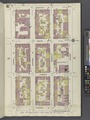
Maps from: Insurance Maps of the Borough of Brooklyn, City of New York. Volume Three. (New York: Sanborn Map Company, 1918), comprising title page, two-page street index, double-page volume key, and 68 plates (maps).
Source: The New York Public Library Digital Collections website, Atlas 71. Vol. 3, 1918.
Media in category "Sanborn maps of Brooklyn published in 1918"
The following 68 files are in this category, out of 68 total.
-
 Brooklyn V. 3, Plate No. 1 (Map bounded by Clinton Ave., Flushing Ave.) NYPL1810127.tiff 5,412 × 7,216, 2 pages; 111.79 MB
-
 Brooklyn V. 3, Plate No. 2 (Map bounded by Clinton Ave., Wallabout Pl.) NYPL1810128.tiff 5,412 × 7,216, 2 pages; 111.79 MB
-
 Brooklyn V. 3, Plate No. 3 (Map bounded by Clinton Ave., Cross, Kent Ave., Washington Ave.) NYPL1810129.tiff 5,412 × 7,216, 2 pages; 111.79 MB
-
 Brooklyn V. 3, Plate No. 4 (Map bounded by Division Ave., Wythe Ave., Taylor, Washington Ave.)eng NYPL1810130.tiff 5,412 × 7,216, 2 pages; 111.79 MB
-
 Brooklyn V. 3, Plate No. 5 (Map bounded by Division Ave., S.9th St., Wythe Ave.) NYPL1810131.tiff 5,412 × 7,216, 2 pages; 111.79 MB
-
 Brooklyn V. 3, Plate No. 6 (Map bounded by S.5th St., Wythe Ave., S.9th St., East River) NYPL1810132.tiff 5,412 × 7,216, 2 pages; 111.79 MB
-
 Brooklyn V. 3, Plate No. 7 (Map bounded by East River, S.2nd St., Wythe Ave., S.5th St.) NYPL1810133.tiff 5,412 × 7,216, 2 pages; 111.79 MB
-
 Brooklyn V. 3, Plate No. 8 (Map bounded by East River, N.1st St., Wythe Ave., S.2nd St.) NYPL1810134.tiff 5,412 × 7,216, 2 pages; 111.79 MB
-
 Brooklyn V. 3, Plate No. 9 (Map bounded by Wythe Ave., S.1st St., Driggs Ave., S.4th St.) NYPL1810135.tiff 5,412 × 7,216, 2 pages; 111.79 MB
-
 Brooklyn V. 3, Plate No. 10 (Map bounded by Driggs Ave., S.1st St., Marcy Ave., S.4th St.) NYPL1810136.tiff 5,412 × 7,216, 2 pages; 111.79 MB
-
 Brooklyn V. 3, Plate No. 11 (Map bounded by S.4th St., Bedford Ave., S.8th St., Wythe Ave.) NYPL1810137.tiff 5,412 × 7,216, 2 pages; 111.79 MB
-
 Brooklyn V. 3, Plate No. 12 (Map bounded by S.8th St., Bedford Ave., Rush, Wythe Ave.) NYPL1810138.tiff 5,412 × 7,216, 2 pages; 111.79 MB
-
 Brooklyn V. 3, Plate No. 13 (Map bounded by S.4th St., Roebling, S.9th St., Bedford Ave.) NYPL1810139.tiff 5,412 × 7,216, 2 pages; 111.79 MB
-
 Brooklyn V. 3, Plate No. 14 (Map bounded by S.4th St., Marcy Ave., Division Ave., Roebling) NYPL1810140.tiff 5,412 × 7,216, 2 pages; 111.79 MB
-
 Brooklyn V. 3, Plate No. 15 (Map bounded by Marcy Ave., S.4th St., Hooper, Division Ave.) NYPL1810141.tiff 5,412 × 7,216, 2 pages; 111.79 MB
-
 Brooklyn V. 3, Plate No. 16 (Map bounded by Marcy Ave., S.1st St., Hooper, S.4th St.) NYPL1810142.tiff 5,412 × 7,216, 2 pages; 111.79 MB
-
 Brooklyn V. 3, Plate No. 17 (Map bounded by Hooper, S.5th St., Union Ave., Johnson Ave., Rutledge, Harrison Ave.) NYPL1810143.tiff 5,412 × 7,216, 2 pages; 111.79 MB
-
 Brooklyn V. 3, Plate No. 18 (Map bounded by S.1st St., Union Ave., S.5th St., Hooper) NYPL1810144.tiff 5,412 × 7,216, 2 pages; 111.79 MB
-
 Brooklyn V. 3, Plate No. 19 (Map bounded by Rush, Division Ave., Bedford Ave., Wilson, Wythe Ave.) NYPL1810145.tiff 5,412 × 7,216, 2 pages; 111.79 MB
-
 Brooklyn V. 3, Plate No. 20 (Map bounded by S.9th St., Roebling, Lee Ave., Ross, Bedford Ave.) NYPL1810146.tiff 5,412 × 7,216, 2 pages; 111.79 MB
-
 Brooklyn V. 3, Plate No. 21 (Map bounded by Roebling, Division Ave., Marcy Ave., Hooper, Lee Ave.) NYPL1810147.tiff 5,412 × 7,216, 2 pages; 111.79 MB
-
 Brooklyn V. 3, Plate No. 22 (Map bounded by Division Ave., Harrison Ave., Penn, Marcy Ave.) NYPL1810148.tiff 5,412 × 7,216, 2 pages; 111.79 MB
-
 Brooklyn V. 3, Plate No. 23 (Map bounded by Wallabout Place, Classon Ave., Flushing Ave.) NYPL1810149.tiff 5,412 × 7,216, 2 pages; 111.79 MB
-
 Brooklyn V. 3, Plate No. 24 (Map bounded by Taylor, Wythe Ave., Hooper, Wallabout Place) NYPL1810150.tiff 5,412 × 7,216, 2 pages; 111.79 MB
-
 Brooklyn V. 3, Plate No. 25 (Map bounded by Wilson, Bedford Ave., Hewes, Wythe Ave.) NYPL1810151.tiff 5,412 × 7,216, 2 pages; 111.79 MB
-
 Brooklyn V. 3, Plate No. 26 (Map bounded by Ross, Lee Ave., Penn, Bedford Ave.) NYPL1810152.tiff 5,412 × 7,216, 2 pages; 111.79 MB
-
 Brooklyn V. 3, Plate No. 27 (Map bounded by Hooper, Marcy Ave., Lynch, Lee Ave.) NYPL1810153.tiff 5,412 × 7,216, 2 pages; 111.79 MB
-
 Brooklyn V. 3, Plate No. 28 (Map bounded by Penn, Harrison Ave., Lorimer, Marcy Ave.) NYPL1810154.tiff 5,412 × 7,216, 2 pages; 111.79 MB
-

-
 Brooklyn V. 3, Plate No. 30 (Map bounded by Hewes, Bedford Ave., Flushing Ave., Franklin Ave., Wythe Ave.) NYPL1810156.tiff 5,412 × 7,216, 2 pages; 111.79 MB
-
 Brooklyn V. 3, Plate No. 31 (Map bounded by Penn, Lee Ave., Bedford Ave.) NYPL1810157.tiff 5,412 × 7,216, 2 pages; 111.79 MB
-
 Brooklyn V. 3, Plate No. 32 (Map bounded by Lynch, Marcy Ave., Hopkins, Nostrand Ave., Lee Ave.) NYPL1810158.tiff 5,412 × 7,216, 2 pages; 111.79 MB
-
 Brooklyn V. 3, Plate No. 33 (Map bounded by Lorimer, Harrison Ave., Delmonico PL., Hopkins, Marcy Ave.) NYPL1810159.tiff 5,412 × 7,216, 2 pages; 111.79 MB
-

-
 Brooklyn V. 3, Plate No. 35 (Map bounded by Leonard, Moore, Wallabout, Harrison Ave., Middleton, Mc.Kibbin) NYPL1810161.tiff 5,412 × 7,216, 2 pages; 111.79 MB
-
 Brooklyn V. 3, Plate No. 36 (Map bounded by Manhattan Ave., Whipple, Flushing Ave., Harrison Ave., Wallabout, Moore) NYPL1810162.tiff 5,412 × 7,216, 2 pages; 111.79 MB
-
 Brooklyn V. 3, Plate No. 37 (Map bounded by Maujer, Lorimer, Montrose Ave., Union Ave.) NYPL1810163.tiff 5,412 × 7,216, 2 pages; 111.79 MB
-
 Brooklyn V. 3, Plate No. 38 (Map bounded by Maujer, Manhattan Ave., Montrose Ave., Lorimer) NYPL1810164.tiff 5,412 × 7,216, 2 pages; 111.79 MB
-
 Brooklyn V. 3, Plate No. 39 (Map bounded by Montrose Ave., Manhattan Ave., Moore, Lorimer) NYPL1810165.tiff 5,412 × 7,216, 2 pages; 111.79 MB
-
 Brooklyn V. 3, Plate No. 40 (Map bounded by Manhattan Ave., Johnson Ave., Bushwick Ave., Seigel) NYPL1810166.tiff 5,412 × 7,216, 2 pages; 111.79 MB
-
 Brooklyn V. 3, Plate No. 41 (Map bounded by Manhattan Ave., Scholes, Bushwick Ave., Johnson Ave.) NYPL1810167.tiff 5,412 × 7,216, 2 pages; 111.79 MB
-
 Brooklyn V. 3, Plate No. 42 (Map bounded by Manhattan Ave., Maujer, Bushwick Ave., Scholes) NYPL1810168.tiff 5,412 × 7,216, 2 pages; 111.79 MB
-
 Brooklyn V. 3, Plate No. 43 (Map bounded by Seigel, Humboldt, Debevoise, Cook, Manhattan Ave.) NYPL1810169.tiff 5,412 × 7,216, 2 pages; 111.79 MB
-
 Brooklyn V. 3, Plate No. 44 (Map bounded by Seigel, Bushwick Ave., Debevoise, Humboldt) NYPL1810170.tiff 5,412 × 7,216, 2 pages; 111.79 MB
-
 Brooklyn V. 3, Plate No. 45 (Map bounded by Delmonico PL., Whipple, Cook, Graham Ave., Hopkins) NYPL1810171.tiff 5,412 × 7,216, 2 pages; 111.79 MB
-
 Brooklyn V. 3, Plate No. 46 (Map bounded by Graham Ave., Debevoise, Morrell, Beaver, Park, Broadway) NYPL1810172.tiff 5,412 × 7,216, 2 pages; 111.79 MB
-
 Brooklyn V. 3, Plate No. 47 (Map bounded by Beaver, Arion PL., Myrtle Ave., Lewis Ave., Park) NYPL1810173.tiff 5,412 × 7,216, 2 pages; 111.79 MB
-
 Brooklyn V. 3, Plate No. 48 (Map bounded by Morrell, Debevoise, Bushwick Ave., Beaver) NYPL1810174.tiff 5,412 × 7,216, 2 pages; 111.79 MB
-
 Brooklyn V. 3, Plate No. 49 (Map bounded by Classon Ave., Willoughby Ave., Skillman, DeKalb Ave.) NYPL1810175.tiff 5,412 × 7,216, 2 pages; 111.79 MB
-
 Brooklyn V. 3, Plate No. 50 (Map bounded by Classon Ave., Myrtle Ave., Skillman, Willoughby Ave.) NYPL1810176.tiff 5,412 × 7,216, 2 pages; 111.79 MB
-
 Brooklyn V. 3, Plate No. 51 (Map bounded by Classon Ave., Park Ave., Skillman, Myrtle Ave.) NYPL1810177.tiff 5,412 × 7,216, 2 pages; 111.79 MB
-
 Brooklyn V. 3, Plate No. 52 (Map bounded by Classon Ave., Flushing Ave., Skillman, Park Ave.) NYPL1810178.tiff 5,412 × 7,216, 2 pages; 111.79 MB
-
 Brooklyn V. 3, Plate No. 53 (Map bounded by Skillman, Willoughby Ave., Nostrand Ave., De Kalb Ave.) NYPL1810179.tiff 5,412 × 7,216, 2 pages; 111.79 MB
-
 Brooklyn V. 3, Plate No. 54 (Map bounded by Skillman, Myrtle Ave., Nostrand Ave., Willoughby Ave.) NYPL1810180.tiff 5,412 × 7,216, 2 pages; 111.79 MB
-
 Brooklyn V. 3, Plate No. 55 (Map bounded by Skillman, Park Ave., Nostrand Ave., Myrtle Ave.) NYPL1810181.tiff 5,412 × 7,216, 2 pages; 111.79 MB
-
 Brooklyn V. 3, Plate No. 56 (Map bounded by Skillman, Flushing Ave., Nostrand Ave., Park Ave.) NYPL1810182.tiff 5,412 × 7,216, 2 pages; 111.79 MB
-
 Brooklyn V. 3, Plate No. 57 (Map bounded by Hokins, Marcy Ave., Myrtle Ave., Nostrand Ave.) NYPL1810183.tiff 5,412 × 7,216, 2 pages; 111.79 MB
-
 Brooklyn V. 3, Plate No. 58 (Map bounded by Hopkins, Tompkins Ave., Myrtle Ave., Marcy Ave.) NYPL1810184.tiff 5,412 × 7,216, 2 pages; 111.79 MB
-
 Brooklyn V. 3, Plate No. 59 (Map bounded by Hopkins, Throop Ave., Myrtle Ave., Tompkins Ave.) NYPL1810185.tiff 5,412 × 7,216, 2 pages; 111.79 MB
-
 Brooklyn V. 3, Plate No. 60 (Map bounded by Hopkins, Sumner Ave., Myrtle Ave., Throop Ave.) NYPL1810186.tiff 5,412 × 7,216, 2 pages; 111.79 MB
-
 Brooklyn V. 3, Plate No. 61 (Map bounded by Hopkins, Broadway, Lewis Ave., Myrtle Ave., Sumner Ave.) NYPL1810187.tiff 5,412 × 7,216, 2 pages; 111.79 MB
-
 Brooklyn V. 3, Plate No. 62 (Map bounded by Myrtle Ave., Marcy Ave., De Kalb Ave., Nostrand Ave.) NYPL1810188.tiff 5,412 × 7,216, 2 pages; 111.79 MB
-
 Brooklyn V. 3, Plate No. 63 (Map bounded by Myrtle Ave., Tompkins Ave., De Kalb Ave., Marcy Ave.) NYPL1810189.tiff 5,412 × 7,216, 2 pages; 111.79 MB
-
 Brooklyn V. 3, Plate No. 64 (Map bounded by Myrtle Ave., Throop Ave., De Kalb Ave., Tompkins Ave.) NYPL1810190.tiff 5,412 × 7,216, 2 pages; 111.79 MB
-
 Brooklyn V. 3, Plate No. 65 (Map bounded by Myrtle Ave., Sumner Ave., De Kalb Ave., Throop Ave.) NYPL1810191.tiff 5,412 × 7,216, 2 pages; 111.79 MB
-
 Brooklyn V. 3, Plate No. 66 (Map bounded by Myrtle Ave., Lewis Ave., De Kalb Ave., Sumner Ave.) NYPL1810192.tiff 5,412 × 7,216, 2 pages; 111.79 MB
-
 Brooklyn V. 3, Plate No. 67 (Map bounded by Myrtle Ave., Broadway, Stuyvesant Ave., De Kalb Ave., Lewis Ave.) NYPL1810193.tiff 5,412 × 7,216, 2 pages; 111.79 MB
-
 Brooklyn V. 3, Plate No. 68 (Map bounded by Vernon Ave., Broadway, Reid Ave., De Kalb Ave., Stuyvesant Ave.) NYPL1810194.tiff 5,412 × 7,216, 2 pages; 111.79 MB