Category:Sanborn Fire Insurance Map from Perry, Noble County, Oklahoma, 1895
Jump to navigation
Jump to search
See parent category for index.
Media in category "Sanborn Fire Insurance Map from Perry, Noble County, Oklahoma, 1895"
The following 15 files are in this category, out of 15 total.
-
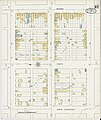
 Sanborn Fire Insurance Map from Perry, Noble County, Oklahoma, 1895, Plate 0001.jpg 6,450 × 7,650; 3.99 MB
-
 Sanborn Fire Insurance Map from Perry, Noble County, Oklahoma, 1895, Plate 0002.jpg 6,450 × 7,650; 2.99 MB
-
 Sanborn Fire Insurance Map from Perry, Noble County, Oklahoma, 1895, Plate 0003.jpg 6,450 × 7,650; 3.12 MB
-
 Sanborn Fire Insurance Map from Perry, Noble County, Oklahoma, 1895, Plate 0004.jpg 6,450 × 7,650; 3.03 MB
-
 Sanborn Fire Insurance Map from Perry, Noble County, Oklahoma, 1895, Plate 0005.jpg 6,450 × 7,650; 3.54 MB
-
 Sanborn Fire Insurance Map from Perry, Noble County, Oklahoma, 1895, Plate 0006.jpg 6,450 × 7,650; 3.64 MB
-
 Sanborn Fire Insurance Map from Perry, Noble County, Oklahoma, 1895, Plate 0007.jpg 6,450 × 7,650; 3.47 MB
-
 Sanborn Fire Insurance Map from Perry, Noble County, Oklahoma, 1895, Plate 0008.jpg 6,450 × 7,650; 2.95 MB
-
 Sanborn Fire Insurance Map from Perry, Noble County, Oklahoma, 1895, Plate 0009.jpg 6,450 × 7,650; 3.08 MB
-
 Sanborn Fire Insurance Map from Perry, Noble County, Oklahoma, 1895, Plate 0010.jpg 6,450 × 7,650; 3.4 MB
-
 Sanborn Fire Insurance Map from Perry, Noble County, Oklahoma, 1895, Plate 0011.jpg 6,450 × 7,650; 3.16 MB
-
 Sanborn Fire Insurance Map from Perry, Noble County, Oklahoma, 1895, Plate 0012.jpg 6,450 × 7,650; 2.9 MB
-
 Sanborn Fire Insurance Map from Perry, Noble County, Oklahoma, 1895, Plate 0013.jpg 6,450 × 7,650; 2.83 MB
-
 Sanborn Fire Insurance Map from Perry, Noble County, Oklahoma, 1895, Plate 0014.jpg 6,450 × 7,650; 2.92 MB
-
 Sanborn Fire Insurance Map from Perry, Noble County, Oklahoma, 1895, Plate 0015.jpg 6,450 × 7,650; 2.8 MB


