Category:Sanborn Fire Insurance Map from Guthrie Center, Guthrie County, Iowa
Jump to navigation
Jump to search
Media in category "Sanborn Fire Insurance Map from Guthrie Center, Guthrie County, Iowa"
The following 20 files are in this category, out of 20 total.
-

-
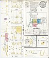
 Sanborn Fire Insurance Map from Guthrie Center, Guthrie County, Iowa. LOC sanborn02676 001-1.tif 6,450 × 7,650; 141.17 MB
-

-
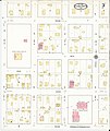
 Sanborn Fire Insurance Map from Guthrie Center, Guthrie County, Iowa. LOC sanborn02676 001-2.tif 6,450 × 7,650; 141.17 MB
-

-
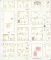
 Sanborn Fire Insurance Map from Guthrie Center, Guthrie County, Iowa. LOC sanborn02676 001-3.tif 6,450 × 7,650; 141.17 MB
-

-
 Sanborn Fire Insurance Map from Guthrie Center, Guthrie County, Iowa. LOC sanborn02676 002-1.tif 6,450 × 7,650; 141.17 MB
-

-
 Sanborn Fire Insurance Map from Guthrie Center, Guthrie County, Iowa. LOC sanborn02676 002-2.tif 6,450 × 7,650; 141.17 MB
-

-
 Sanborn Fire Insurance Map from Guthrie Center, Guthrie County, Iowa. LOC sanborn02676 002-3.tif 6,450 × 7,650; 141.17 MB
-
-
 Sanborn Fire Insurance Map from Guthrie Center, Guthrie County, Iowa. LOC sanborn02676 003-1.tif 6,450 × 7,650; 141.17 MB
-

-
 Sanborn Fire Insurance Map from Guthrie Center, Guthrie County, Iowa. LOC sanborn02676 003-2.tif 6,450 × 7,650; 141.17 MB
-
-
 Sanborn Fire Insurance Map from Guthrie Center, Guthrie County, Iowa. LOC sanborn02676 003-3.tif 6,450 × 7,650; 141.17 MB
-

-
 Sanborn Fire Insurance Map from Guthrie Center, Guthrie County, Iowa. LOC sanborn02676 003-4.tif 6,450 × 7,650; 141.17 MB


