Category:San Rafael Desert
Jump to navigation
Jump to search
plain in Emery and Wayne counties in Utah, United States  | |||||
| Upload media | |||||
| Instance of | |||||
|---|---|---|---|---|---|
| Location |
| ||||
| Elevation above sea level |
| ||||
 | |||||
English: Media related to the San Rafael Desert, a plain in Emery, Garfield, and Wayne counties in Utah, United States.
Subcategories
This category has the following 5 subcategories, out of 5 total.
Media in category "San Rafael Desert"
The following 10 files are in this category, out of 10 total.
-
 2008-0914-CapitolReef-WaterpocketFold1.jpg 3,412 × 1,976; 5.41 MB
-
 2010-Aerial photograph of Green River, Utah.jpg 2,500 × 1,875; 4.87 MB
-
 Capital Reef satellite image.jpg 4,221 × 4,209; 8.29 MB
-
 Capitalreef.jpg 408 × 566; 76 KB
-
 Capitol-Reef-NP-TF.jpg 4,800 × 2,700; 3.87 MB
-
 Cliffs north of Utah State Route 24 in Capitol Reef NP.jpg 1,600 × 1,096; 412 KB
-
 Contrails over San Rafael Reef.jpg 2,682 × 2,062; 4.65 MB
-
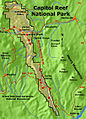
 Map of Capitol Reef National Park.png 2,458 × 4,425; 2.54 MB
-
 Muddy Creek crossing the SR Swell.jpg 2,912 × 3,640; 10.48 MB
-
 The San Rafael Reef.jpg 12,145 × 3,499; 35.73 MB


Categories:
- Plains of Utah
- Landforms of Emery County, Utah
- Landforms of Garfield County, Utah
- Landforms of Wayne County, Utah
- Regions of Utah
- Canyon Lands of Utah
- San Rafael Swell
- Locations along Interstate 70 in Emery County, Utah
- Locations along U.S. Route 6 in Emery County, Utah
- Locations along U.S. Route 50 in Emery County, Utah
- Locations along Utah State Route 4 (1962-1977) in Emery County, Utah
- Locations along Utah State Route 27 (1927-1977) in Emery County, Utah
- Locations along Utah State Route 24 in Emery County, Utah
- Locations along Utah State Route 24 in Wayne County, Utah