Category:San Isabel National Forest
Jump to navigation
Jump to search
National Forest in Colorado, USA administratively combined with the Pike National Forest in 1973   | |||||
| Upload media | |||||
| Instance of | |||||
|---|---|---|---|---|---|
| Location | Colorado | ||||
| IUCN protected areas category | |||||
| Inception |
| ||||
| Highest point | |||||
| Replaces |
| ||||
| official website | |||||
 | |||||
Subcategories
This category has the following 21 subcategories, out of 21 total.
B
- Bishop's Castle (Colorado) (25 F)
- Browns Canyon National Monument (29 F)
- Buffalo Peaks (Colorado) (9 F)
- Buffalo Peaks Wilderness (2 F)
C
- Cordova Pass (Colorado) (3 F)
- Cucharas Pass (3 F)
D
- Dodgeton Trail 1302 (1 F)
I
- Independence Pass Overlook (1 F)
- Indian Trail No. 1300 (2 F)
M
- Mingus Homestead (2 F)
- Mosca Pass (3 F)
O
- Original Monarch Pass (2 F)
S
- Ski Cooper (4 F)
W
Z
- Mount Zwischen (4 F)
Media in category "San Isabel National Forest"
The following 61 files are in this category, out of 61 total.
-

-
-

-
 Agnes Vaille Falls.JPG 2,077 × 4,037; 6.44 MB
-
 Arkansas River water needs assessment (IA arkansasriverwat00smit).pdf 633 × 822, 373 pages; 55.44 MB
-
 Aspen gall.JPG 3,301 × 3,005; 6.1 MB
-
 Bear Lake (Huerfano County, Colorado).JPG 5,933 × 3,567; 18.5 MB
-
 Blanks Trailhead parking area sign.jpg 2,848 × 2,136; 1.96 MB
-
 Buffalo Peaks Wilderness.png 485 × 288; 38 KB
-
 Carbonate Mountain (Alamosa and Huerfano counties, Colorado).JPG 3,786 × 2,318; 5.41 MB
-
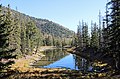
 Chalk Lake - panoramio.jpg 7,850 × 1,929; 10.68 MB
-
 Chalk Lake.JPG 4,994 × 2,252; 7.13 MB
-
 Colorado 2013 (8570015077).jpg 4,320 × 3,240; 3.92 MB
-
 Colorado 2013 (8570018727).jpg 4,320 × 3,240; 3.85 MB
-
 Colorado 2013 (8570019173).jpg 4,320 × 3,240; 3.75 MB
-
 Colorado 2013 (8571105926).jpg 4,320 × 3,240; 4.51 MB
-
 Colorado 2013 (8571107890).jpg 4,320 × 3,240; 4.03 MB
-
 Colorado 2013 (8571109004).jpg 4,216 × 3,162; 4.39 MB
-
 Colorado 2013 (8571111164).jpg 4,320 × 3,240; 3.12 MB
-
 Colorado 2013 (8571111766).jpg 4,320 × 3,240; 3.53 MB
-
 Colorado 2013 (8571112924).jpg 3,785 × 2,838; 3.08 MB
-
 Colorado Trail, Mt Shavano Trail sign.jpg 2,848 × 2,136; 2.1 MB
-
 Cuchara Mountain Park.JPG 5,614 × 3,562; 16.15 MB
-
 Denver, South Park & Pacific grade.JPG 3,264 × 2,448; 5.73 MB
-
 Dike Trail no. 1389.JPG 4,720 × 3,297; 15.72 MB
-
 Engelmann's Spruce, purple young cones, Greenhorn Mountain, Colorado.jpg 2,970 × 1,988; 3.51 MB
-
 Erosion Effect Repeat - Colorado - DPLA - 089206fedbe091f37cddab8118b82103.jpg 4,777 × 3,894; 2.45 MB
-
 Erysimum asperum in Colorado.JPG 1,844 × 2,468; 2.71 MB
-
 Fairley Overlook - tps.jpg 2,944 × 2,208; 1.56 MB
-
 Former Conquistador ski area, Sangre de Cristo Range.jpg 3,872 × 2,592; 3.97 MB
-
 Hancock Pass.JPG 2,643 × 3,406; 9.22 MB
-
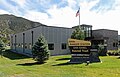
 Headquarters Pike and San Isabel national forests.JPG 5,183 × 3,372; 13.11 MB
-
 Hesperialeonardismont.JPG 1,169 × 1,001; 188 KB
-
 Lower Blue Lake (Huerfano County, Colorado).JPG 5,504 × 3,623; 15.05 MB
-
 Marker for the South Cottonwood trailhead of the Colorado Trail, near Buena Vista.jpg 2,592 × 1,944; 1.93 MB
-
 Mt Elbert Trailhead info signs.jpg 3,264 × 1,836; 870 KB
-
 Mt Massive from Elbert.JPG 3,648 × 2,736; 5.07 MB
-
 North Mount Elbert Trail.JPG 3,648 × 2,736; 6.15 MB
-
 O'Haver Lake.JPG 6,000 × 3,708; 15.51 MB
-
 Pinus aristata cone.jpg 2,043 × 2,322; 2.27 MB
-
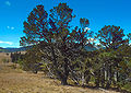
 Pinus aristata tree.jpg 2,048 × 3,072; 4.78 MB
-
 Pinus edulis cones.jpg 2,220 × 1,779; 2.46 MB
-
 Pinus flexilis cones USDA.jpg 2,236 × 1,752; 2.02 MB
-
 Pinus flexilis USDA.jpg 2,772 × 1,972; 3.69 MB
-
 Pinus ponderosa scopulorum cones.jpg 3,072 × 2,048; 3.7 MB
-
 Pinus ponderosa scopulorum pollen cones.jpg 3,072 × 2,048; 2.69 MB
-
 Pseudotsuga glauca closedcones.jpg 3,072 × 2,048; 3.1 MB
-
 Pseudotsuga glauca opencones.jpg 2,430 × 2,048; 2.16 MB
-
 Pseudotsuga glauca treeUSDA.jpg 2,031 × 2,946; 3.56 MB
-
 Reforestation - Colorado - DPLA - 9e347c83df2f8b08b2a56bb2bcb18288.jpg 4,734 × 3,906; 2.4 MB
-
 Reforestation - Colorado - DPLA - b0e43f8576cdad9f822b6a9560726e0c.jpg 4,800 × 3,912; 2.48 MB
-
 Salida Ranger Station.JPG 5,430 × 3,465; 12.02 MB
-
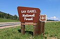 San Isabel National Forest sign.JPG 4,997 × 3,256; 11.67 MB
-
 San Isabel Natl Forest Nima.JPG 3,264 × 2,448; 3.98 MB
-
 Spanish Peaks Wilderness.JPG 3,663 × 3,544; 7.07 MB
-
 Spring Creek Trailhead sign.JPG 2,695 × 3,240; 1.27 MB
-
 Trail along Lake Isabel in San Isabel National Forest in Colorado (31031611447).jpg 4,512 × 3,008; 5.94 MB
-
 Twin Lakes NHD sign.jpg 3,024 × 4,032; 4.73 MB
-
 Vaccinium cespitosum 0806025.jpg 3,072 × 2,048; 3.87 MB
-
 View from Twin Lakes.jpg 4,032 × 3,024; 4.07 MB
-
 West Spanish Peak from Trail 1390.JPG 5,702 × 3,803; 14.75 MB


.JPG)

.JPG)

.jpg)
.jpg)
.jpg)
.jpg)
.jpg)
.jpg)
.jpg)
.jpg)
.jpg)


.JPG)


.jpg)


Categories:
- National Forests of Colorado
- Protected areas of Chaffee County, Colorado
- Protected areas of Custer County, Colorado
- Protected areas of Lake County, Colorado
- Protected areas of Huerfano County, Colorado
- Protected areas of Fremont County, Colorado
- Protected areas of Pueblo County, Colorado
- Protected areas of Saguache County, Colorado
- Protected areas of Las Animas County, Colorado
- Protected areas of Park County, Colorado
- Protected areas of Costilla County, Colorado
- Protected areas of Summit County, Colorado
- National Forests of the United States by name
- Colorado Rockies Forests Ecoregion