Category:Samtaber
Jump to navigation
Jump to search
village in West Bengal, India  | |||||
| Upload media | |||||
| Instance of | |||||
|---|---|---|---|---|---|
| Location | Bagnan II community development block, Uluberia subdivision, Howrah district, Presidency division, West Bengal, India | ||||
 | |||||
English: Samtaher (Bengali: সামতাবেড় Sāmtābeṛ) or Samta (Bengali: সামতা Sāmtā) is a small village and a Gram panchayat in the Howrah district in the Indian state of West Bengal. Samta is located between villages like Ghoraghata, Nabasan, Asaria. It is situated on the banks of the Rupnarayan River. It is located between Howrah and Kharagpur on the South Eastern Railway. This village is located just after the stations of Bagnan and Ghoraghata. It is the second nearest village to Deulti station after Mellock.
Subcategories
This category has the following 2 subcategories, out of 2 total.
S
Media in category "Samtaber"
The following 20 files are in this category, out of 20 total.
-
 Local Road - House of Sarat Chandra Chattopadhyay Area - Samta - Howrah 2014-10-19 9748.JPG 6,016 × 4,000; 17.56 MB
-
 Mud House - Samtaber - Howrah 2014-10-19 9856.JPG 6,016 × 4,000; 14.51 MB
-
 Pond - House of Sarat Chandra Chattopadhyay Area - Samtaber - Howrah 2014-10-19 9750.JPG 6,016 × 4,000; 14.91 MB
-
 Pond - House of Sarat Chandra Chattopadhyay Area - Samtaber - Howrah 2014-10-19 9853-9854.TIF 9,020 × 3,543, 2 pages; 52.66 MB
-
 Pond and House of Sarat Chandra Chattopadhyay with Visitors - Samtaber - Howrah 2014-10-19 9771-9778.tif 24,362 × 4,777, 2 pages; 172.77 MB
-
 Samta - A garden.JPG 640 × 480; 164 KB
-
 Samta - Hibiscus.JPG 640 × 480; 162 KB
-
 Samta - Ishan Roy's samadhi..JPG 640 × 480; 165 KB
-
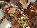
 Samta - Kartika Puja.JPG 640 × 480; 165 KB
-
 Samta - Pond.JPG 640 × 480; 165 KB
-
 Samta - The pond Sarat Chandra mentioned in Palli Samaj.JPG 640 × 480; 165 KB
-
 Samta -Dhakis.JPG 640 × 480; 164 KB
-
 Samta -Flowers and fruits.JPG 640 × 480; 164 KB
-
 Samta -Maa Shinghabahini, on Durga Puja's Nabami.JPG 640 × 480; 164 KB
-
 Samta -Tagar folwers in a house's garden.JPG 2,048 × 1,536; 1.4 MB
-
 Samta -The temple at Samta.JPG 640 × 480; 165 KB
-
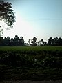
 Samta -The View of the village during sunset.JPG 1,226 × 920; 260 KB
-
 Samta- Shubho Chandi.JPG 480 × 640; 165 KB
-
 শরৎ চন্দ্রের বাড়ির পথচিহ্ন.jpg 1,200 × 1,600; 739 KB
-
 সামতাবেড়, হাওড়া, ভারত।.jpg 1,200 × 1,600; 537 KB


