Category:Salthouse
Jump to navigation
Jump to search
village in the United Kingdom .JPG) | |||||
| Upload media | |||||
| Instance of | |||||
|---|---|---|---|---|---|
| Location | North Norfolk, Norfolk, East of England, England | ||||
| Population |
| ||||
| Area |
| ||||
 | |||||
Subcategories
This category has the following 10 subcategories, out of 10 total.
Media in category "Salthouse"
The following 200 files are in this category, out of 577 total.
(previous page) (next page)-
 'Old Farm', Salthouse - geograph.org.uk - 6193929.jpg 1,024 × 768; 143 KB
-
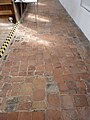 10" brick floor tiles - geograph.org.uk - 6256081.jpg 2,448 × 3,264; 3.73 MB
-
 12" black marble tiles - geograph.org.uk - 6256076.jpg 2,448 × 3,264; 3.73 MB
-
 12th century grave slab - geograph.org.uk - 6259377.jpg 2,448 × 3,264; 2.98 MB
-
 17th century prayer on the wall - geograph.org.uk - 6259344.jpg 2,448 × 3,264; 3.56 MB
-
 A 12 metre hill, a vantage point none the less - geograph.org.uk - 5941444.jpg 4,608 × 3,456; 4.96 MB
-
 A cross-drain in the marshes - geograph.org.uk - 6260113.jpg 2,448 × 3,264; 3.64 MB
-
 A dead-end footpath - geograph.org.uk - 2347583.jpg 640 × 480; 292 KB
-
 A dilapidated stock fence - geograph.org.uk - 1181049.jpg 640 × 480; 133 KB
-
 A fallen spigot mortar emplacement - geograph.org.uk - 6260627.jpg 3,264 × 2,448; 4.75 MB
-
 A glimpse of Salthouse Hall - geograph.org.uk - 6249269.jpg 3,264 × 2,448; 5.11 MB
-
 A view from the edge - geograph.org.uk - 3871913.jpg 640 × 480; 239 KB
-

-
 A wreath of remembrance - geograph.org.uk - 3871996.jpg 640 × 480; 112 KB
-
 A young oak tree - geograph.org.uk - 3872108.jpg 640 × 480; 165 KB
-
 A149 at Salthouse village boundary - geograph.org.uk - 3618255.jpg 640 × 481; 46 KB
-
 A149 by Walsey Hills - geograph.org.uk - 3618253.jpg 640 × 481; 38 KB
-
 A149 Coast Road at Salthouse - geograph.org.uk - 5616998.jpg 800 × 510; 85 KB
-
 A149 coast road towards Salthouse - geograph.org.uk - 6249278.jpg 3,264 × 2,448; 4.74 MB
-
 A149 east of Salthouse - geograph.org.uk - 3618258.jpg 640 × 480; 65 KB
-

-
 A149 Westbound - geograph.org.uk - 6530237.jpg 640 × 480; 48 KB
-
 A149 Westbound - geograph.org.uk - 6530242.jpg 640 × 480; 57 KB
-
 Along Meadow Lane - geograph.org.uk - 6260101.jpg 3,264 × 2,448; 4.83 MB
-
 Along the beach by Salthouse Marshes - geograph.org.uk - 5125440.jpg 1,432 × 1,074; 418 KB
-
 Along the beach by Salthouse Marshes - geograph.org.uk - 5125444.jpg 1,402 × 1,052; 570 KB
-
 Along the cut to Salthouse - geograph.org.uk - 4158812.jpg 1,074 × 1,600; 545 KB
-
 An A road, North Norfolk style - geograph.org.uk - 5351979.jpg 640 × 480; 41 KB
-
 Andrew's Wall - geograph.org.uk - 6260659.jpg 3,264 × 2,448; 5.04 MB
-
 Antitank.JPG 1,280 × 960; 281 KB
-
 Arnold's Marshes (nature reserve) and Shingle Beach - geograph.org.uk - 6328887.jpg 5,184 × 3,888; 830 KB
-
 Arnolds Marsh - geograph.org.uk - 4248932.jpg 640 × 480; 58 KB
-
 Attenborough Walk, Cley - geograph.org.uk - 5930827.jpg 1,600 × 1,200; 459 KB
-
 Attenborough Walk, Cley - geograph.org.uk - 5930829.jpg 1,600 × 1,200; 464 KB
-
 Attenborough Walk, Cley Marshes - geograph.org.uk - 6737935.jpg 1,600 × 1,200; 365 KB
-
 Babcock Hide - geograph.org.uk - 4808519.jpg 1,600 × 1,200; 930 KB
-
 Bard Hill Road on Salthouse Heath - geograph.org.uk - 6265284.jpg 3,264 × 2,448; 5.1 MB
-
 Bard Hill, Salthouse - geograph.org.uk - 3871850.jpg 640 × 480; 197 KB
-
 Barley by the Norfolk Coast - geograph.org.uk - 5102514.jpg 1,600 × 1,200; 609 KB
-
 Barley crop above the Quag, Kelling - geograph.org.uk - 2411089.jpg 640 × 480; 193 KB
-
 Beach at Salthouse - geograph.org.uk - 3900729.jpg 640 × 430; 57 KB
-
 Beach by Gramborough Hill - geograph.org.uk - 6260132.jpg 3,264 × 2,448; 4.72 MB
-
 Beach east of Gramborough Hill - geograph.org.uk - 5125452.jpg 1,469 × 1,102; 638 KB
-
 Beach looking east - geograph.org.uk - 3900716.jpg 640 × 430; 47 KB
-
 Beach near Beach Road - geograph.org.uk - 6233619.jpg 4,946 × 3,297; 1.14 MB
-
 Beach near Salthouse - geograph.org.uk - 4807589.jpg 1,920 × 1,254; 690 KB
-
 Beach Rd, Salthouse - geograph.org.uk - 4016567.jpg 640 × 430; 46 KB
-
 Beach Road - geograph.org.uk - 3152334.jpg 800 × 479; 76 KB
-
 Beach Road at Salthouse - geograph.org.uk - 5606341.jpg 800 × 592; 110 KB
-
 Beach Road, Salthouse - geograph.org.uk - 5336496.jpg 4,000 × 3,000; 1.41 MB
-
 Behind the beach near Gramborough Hill - geograph.org.uk - 4806603.jpg 1,920 × 1,280; 990 KB
-
 Behind the shingle ridge - geograph.org.uk - 3910140.jpg 640 × 430; 69 KB
-
 Behind the shingle ridge - geograph.org.uk - 3910160.jpg 640 × 430; 59 KB
-
 Behind the shingle ridge - geograph.org.uk - 3910175.jpg 640 × 430; 65 KB
-

-
 Beside the footpath - geograph.org.uk - 1011042.jpg 640 × 480; 157 KB
-
 Big sky over harvested fields, Cley - geograph.org.uk - 2555927.jpg 640 × 480; 126 KB
-

-
 Birch trees on Salthouse Heath - geograph.org.uk - 3872120.jpg 640 × 480; 101 KB
-
 Birch, oak and gorse - geograph.org.uk - 3872106.jpg 640 × 480; 184 KB
-
 Birches on Salthouse Heath - geograph.org.uk - 3872099.jpg 480 × 640; 138 KB
-
 Boat by Salthouse Marshes - geograph.org.uk - 4858294.jpg 1,600 × 1,118; 539 KB
-
 Bridge off A149 - geograph.org.uk - 6438533.jpg 1,600 × 1,200; 512 KB
-
 Bridge Road, Kelling - geograph.org.uk - 6758341.jpg 3,920 × 2,204; 2.78 MB
-
 Buried under shingle - geograph.org.uk - 1181060.jpg 640 × 587; 216 KB
-
 Bushes on Gramborough Hill - geograph.org.uk - 6737716.jpg 1,600 × 1,200; 456 KB
-
 Busy turning down to Salthouse - geograph.org.uk - 515798.jpg 640 × 480; 138 KB
-
 By Gramborough Hill - geograph.org.uk - 4806653.jpg 3,066 × 1,880; 1.37 MB
-
 By the A149 - geograph.org.uk - 4030984.jpg 640 × 430; 34 KB
-
 Byway across Salthouse Marshes - geograph.org.uk - 4030986.jpg 640 × 430; 41 KB
-
 Calf in pasture west of Lowes Farm - geograph.org.uk - 2347554.jpg 640 × 480; 280 KB
-
 Car park closed - geograph.org.uk - 4444543.jpg 1,600 × 1,200; 596 KB
-
 Car park on the edge of Salthouse Heath - geograph.org.uk - 3871840.jpg 640 × 480; 164 KB
-
 Catchwater Drain - geograph.org.uk - 3368958.jpg 4,000 × 3,000; 4.7 MB
-
 Catchwater Drain, Salthouse - geograph.org.uk - 1955348.jpg 3,072 × 2,304; 2.64 MB
-
 Catchwater Drain, Salthouse - geograph.org.uk - 5586388.jpg 640 × 480; 83 KB
-
 Cattle in pasture west of Lowes Farm - geograph.org.uk - 2347552.jpg 640 × 480; 292 KB
-
 Cattle near Salthouse - geograph.org.uk - 6737924.jpg 1,600 × 1,200; 375 KB
-
 Cattle on the Salthouse Marshes - geograph.org.uk - 5620284.jpg 800 × 568; 95 KB
-
 Channel and weed - geograph.org.uk - 2084392.jpg 640 × 480; 55 KB
-
 Chillout set up for fairtrade Cocktail party at the Salthouse.jpg 1,680 × 1,260; 1.13 MB
-
 Chippy and fish stall - geograph.org.uk - 544299.jpg 640 × 478; 247 KB
-
 Cley Marshes - geograph.org.uk - 4031009.jpg 640 × 430; 32 KB
-
 Cley Marshes - geograph.org.uk - 4031013.jpg 640 × 430; 23 KB
-
 Close up, Elizabethan postbox, Salthouse - geograph.org.uk - 5579825.jpg 1,488 × 2,254; 729 KB
-
 Coast Path - geograph.org.uk - 3910163.jpg 640 × 430; 59 KB
-
 Coast Road (A149), Salthouse - geograph.org.uk - 5559197.jpg 640 × 480; 49 KB
-
 Coast Road (A149), Salthouse - geograph.org.uk - 5559200.jpg 640 × 480; 40 KB
-
 Coast Road (A149), Salthouse - geograph.org.uk - 5559223.jpg 640 × 480; 44 KB
-
 Coast Road - geograph.org.uk - 6233627.jpg 5,184 × 3,456; 1,007 KB
-
 Coast Road - geograph.org.uk - 6233628.jpg 4,580 × 3,435; 1.1 MB
-
 Coastal grazing, Salthouse - geograph.org.uk - 5559194.jpg 640 × 480; 66 KB
-
 Coastal grazing, Salthouse - geograph.org.uk - 5559205.jpg 640 × 480; 59 KB
-
 Coastal grazing, Salthouse - geograph.org.uk - 5559221.jpg 640 × 480; 57 KB
-
 Coastal marshes near Salthouse - geograph.org.uk - 5102509.jpg 1,600 × 1,200; 863 KB
-
 Coasthopper bus, Salthouse - geograph.org.uk - 5991735.jpg 1,600 × 1,200; 379 KB
-
 Cookie's Crab Shop - geograph.org.uk - 825770.jpg 480 × 640; 163 KB
-
 Cookie's Crab Shop, Salthouse - geograph.org.uk - 1464855.jpg 600 × 450; 98 KB
-
 Cookie's Crab Shop, still going strong - geograph.org.uk - 3454670.jpg 1,600 × 1,156; 516 KB
-
 Cookies Crab Shop - geograph.org.uk - 3658613.jpg 800 × 450; 246 KB
-
 Cookies Crab Shop - geograph.org.uk - 4038384.jpg 640 × 430; 43 KB
-
 Cookies Crab Shop - geograph.org.uk - 5380595.jpg 4,000 × 3,000; 1.34 MB
-
 Cottages beside the green - geograph.org.uk - 825733.jpg 632 × 462; 165 KB
-
 Cottages by the green - geograph.org.uk - 825741.jpg 640 × 468; 190 KB
-
 Cottages, Salthouse - geograph.org.uk - 3658620.jpg 800 × 451; 287 KB
-
 Country Lane leading to Salthouse - geograph.org.uk - 6325200.jpg 5,184 × 3,888; 923 KB
-
 Cows by Beach Road - geograph.org.uk - 6233620.jpg 5,184 × 3,456; 1.57 MB
-
 Cows by Beach Road - geograph.org.uk - 6233621.jpg 4,608 × 3,072; 1,000 KB
-
 Cracks in drying mud - geograph.org.uk - 826763.jpg 480 × 640; 207 KB
-
 Crankham Barn - geograph.org.uk - 6530235.jpg 640 × 480; 52 KB
-
 Crop field east of Salthouse - geograph.org.uk - 5559224.jpg 640 × 480; 62 KB
-
 Cross St - geograph.org.uk - 4038380.jpg 640 × 430; 38 KB
-
 Cross St - geograph.org.uk - 4046204.jpg 640 × 430; 42 KB
-
 Culvert bridging drain - geograph.org.uk - 826779.jpg 480 × 640; 134 KB
-
 Damaged beach - geograph.org.uk - 3909797.jpg 640 × 430; 65 KB
-
 Dead-ended path 1 mile ahead - geograph.org.uk - 2347535.jpg 480 × 640; 302 KB
-
 Debris on the coastal road between Cley and Salthouse - geograph.org.uk - 3771604.jpg 4,320 × 3,240; 5.64 MB
-
 Defaced medieval screen paintings - geograph.org.uk - 6259368.jpg 2,448 × 3,264; 3.59 MB
-
 Ditch across Salthouse Marshes - geograph.org.uk - 4858185.jpg 1,600 × 1,200; 522 KB
-
 Ditch on Salthouse Marshes - geograph.org.uk - 4848591.jpg 1,600 × 1,200; 453 KB
-
 Ditch on Salthouse Marshes - geograph.org.uk - 4858168.jpg 1,600 × 1,200; 451 KB
-
 Drain and track - geograph.org.uk - 1181005.jpg 640 × 480; 126 KB
-

-
 Drainage channel, Salthouse - geograph.org.uk - 4132577.jpg 4,320 × 3,240; 2.98 MB
-
 Drainage ditch - geograph.org.uk - 3910170.jpg 640 × 430; 58 KB
-
 Drainage ditch - geograph.org.uk - 826427.jpg 480 × 640; 161 KB
-
 Drainage ditch by Coast Road - geograph.org.uk - 6233636.jpg 5,184 × 3,456; 1.68 MB
-
 Drainage ditch east of the beach road - geograph.org.uk - 5125459.jpg 1,469 × 1,102; 653 KB
-
 Draining the lagoon - geograph.org.uk - 3909744.jpg 640 × 430; 66 KB
-
 Draining the saltmarshes - geograph.org.uk - 826709.jpg 480 × 640; 186 KB
-
 Ducks at Salthouse - geograph.org.uk - 5351989.jpg 640 × 480; 76 KB
-
 Dun Cow - geograph.org.uk - 4038386.jpg 640 × 430; 44 KB
-
 Dun Cow - geograph.org.uk - 4046212.jpg 640 × 430; 51 KB
-
 Dune by Norfolk Coast Path - geograph.org.uk - 6233622.jpg 5,184 × 3,456; 2.21 MB
-
 Dune by Norfolk Coast Path - geograph.org.uk - 6233623.jpg 5,184 × 3,456; 1.83 MB
-
 East along the beach at Gramborough Hill - geograph.org.uk - 6260134.jpg 3,264 × 2,448; 4.67 MB
-
 Elizabeth II postbox and telephone box, Salthouse - geograph.org.uk - 5579823.jpg 1,623 × 2,403; 733 KB
-
 Emergency Telephone - geograph.org.uk - 4248936.jpg 480 × 640; 140 KB
-
 Entering Salthouse - geograph.org.uk - 5559217.jpg 640 × 473; 42 KB
-
 Entrance to the standby set house - geograph.org.uk - 3872025.jpg 640 × 480; 149 KB
-
 Eroded beach - geograph.org.uk - 3900719.jpg 640 × 430; 54 KB
-
 Erosion at Gramborough Hill - geograph.org.uk - 6737686.jpg 1,600 × 1,200; 334 KB
-
 Exposed posts in the shingle beach - geograph.org.uk - 5152137.jpg 1,600 × 1,200; 891 KB
-
 Fading greens on Salthouse Heath - geograph.org.uk - 5592555.jpg 3,456 × 2,592; 4.03 MB
-
 Farm track - geograph.org.uk - 6249279.jpg 3,264 × 2,448; 4.7 MB
-
 Farm track, Salthouse - geograph.org.uk - 5559198.jpg 640 × 480; 58 KB
-
 Farmland by the A149 - geograph.org.uk - 4016555.jpg 640 × 430; 34 KB
-
 Farmland by the A149 - geograph.org.uk - 4038290.jpg 640 × 430; 34 KB
-
 Farmland by the A149 - geograph.org.uk - 4046201.jpg 640 × 430; 39 KB
-
 Farmland north of the A149 - geograph.org.uk - 4016557.jpg 640 × 430; 51 KB
-
 Farmland Sarbury Hill - geograph.org.uk - 4038418.jpg 640 × 263; 28 KB
-
 Farmland south of the A149 - geograph.org.uk - 4038425.jpg 640 × 348; 32 KB
-
 Farmland south of the A149 - geograph.org.uk - 4038437.jpg 640 × 373; 33 KB
-
 Fence posts in the shingle - geograph.org.uk - 4444552.jpg 1,600 × 1,200; 909 KB
-
 Field by Coast Road - geograph.org.uk - 6233634.jpg 5,184 × 3,456; 998 KB
-
 Fields by Beach Road - geograph.org.uk - 6233638.jpg 5,184 × 3,456; 1.94 MB
-
 Fields by Meadow Lane - geograph.org.uk - 4858181.jpg 1,600 × 1,200; 553 KB
-

-
 Fish and chip shop, Salthouse - geograph.org.uk - 1955345.jpg 3,072 × 2,304; 2.36 MB
-
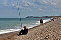
 Fishermen on Salthouse beach - geograph.org.uk - 5125447.jpg 1,469 × 1,102; 677 KB
-
 Floating fence on Arnold's Marsh - geograph.org.uk - 2874529.jpg 640 × 480; 146 KB
-
 Flood damage at Salthouse, Norfolk - geograph.org.uk - 3771534.jpg 4,320 × 3,240; 5.67 MB
-
 Flood warning siren, Salthouse - geograph.org.uk - 3158042.jpg 768 × 1,024; 149 KB
-
 Flooded byway near Salthouse - geograph.org.uk - 4030957.jpg 640 × 390; 46 KB
-
 Flooding, Cley Marshes - geograph.org.uk - 4031014.jpg 640 × 430; 23 KB
-
 Flooding, Cley Marshes - geograph.org.uk - 4031017.jpg 640 × 430; 28 KB
-
 Flooding, Salthouse - geograph.org.uk - 4030978.jpg 640 × 430; 45 KB
-
 Flooding, Salthouse Marshes - geograph.org.uk - 4016561.jpg 640 × 324; 38 KB
-
 Flooding, Salthouse Marshes - geograph.org.uk - 4016562.jpg 640 × 430; 49 KB
-
 Flooding, Salthouse Marshes - geograph.org.uk - 4030998.jpg 640 × 430; 42 KB
-
 Flowering gorse beside the path - geograph.org.uk - 3872072.jpg 640 × 480; 148 KB
-
 Flowering gorse on Bard Hill - geograph.org.uk - 3871875.jpg 640 × 480; 239 KB
-
 Flowering gorse on Salthouse Heath - geograph.org.uk - 3872062.jpg 640 × 480; 124 KB
-
 Flowering gorse on Salthouse Heath - geograph.org.uk - 3872086.jpg 640 × 480; 215 KB
-

-
 Footbridge over the New Cut - geograph.org.uk - 826640.jpg 480 × 640; 165 KB
-
 Footpath from A149 - geograph.org.uk - 5380420.jpg 4,000 × 3,000; 1.73 MB
-

-
 Footpath from Salthouse - geograph.org.uk - 5102512.jpg 1,600 × 1,200; 864 KB
-
 Footpath from Salthouse - geograph.org.uk - 5380571.jpg 3,914 × 2,647; 1.45 MB
-
 Footpath from Salthouse church - geograph.org.uk - 746455.jpg 640 × 480; 114 KB
-
 Footpath on Salthouse Heath - geograph.org.uk - 4592057.jpg 3,456 × 2,592; 3.85 MB
-
 Footpath skirting the saltmarsh - geograph.org.uk - 1011047.jpg 640 × 441; 145 KB
-
 Footpath to Lawn Farm - geograph.org.uk - 2347541.jpg 640 × 480; 300 KB
-
 Footpath to Salthouse Marshes - geograph.org.uk - 5380427.jpg 4,000 × 3,000; 1.48 MB
-
 Footpath to Snipes Marsh - geograph.org.uk - 5102515.jpg 1,600 × 1,200; 688 KB
-
 Former Post Office, Salthouse - geograph.org.uk - 4132694.jpg 4,320 × 3,240; 2.92 MB
-
 Fresh Coffee - geograph.org.uk - 825946.jpg 480 × 640; 162 KB
-
 Fresh scouring on the shingle ridge - geograph.org.uk - 6737909.jpg 1,600 × 1,200; 641 KB
-
 Geese on Walsey Hills - geograph.org.uk - 6249280.jpg 3,264 × 2,448; 4.73 MB
-
 Geese over Salthouse - geograph.org.uk - 4848560.jpg 1,206 × 1,600; 372 KB
-
 Gorse on Salthouse Heath - geograph.org.uk - 3872074.jpg 640 × 480; 105 KB
-
 Gramborough Hill - geograph.org.uk - 2526554.jpg 1,000 × 433; 144 KB
-
 Gramborough Hill - geograph.org.uk - 3910147.jpg 640 × 430; 40 KB
-
 Gramborough Hill - geograph.org.uk - 3910153.jpg 640 × 430; 57 KB
-
 Gramborough Hill - geograph.org.uk - 5152325.jpg 1,600 × 1,200; 721 KB
-
 Gramborough Hill twitcher - geograph.org.uk - 4251351.jpg 4,912 × 2,760; 7.13 MB
-
 Great Eye and Little Eye - geograph.org.uk - 825886.jpg 640 × 462; 175 KB
-

-
 Greylags and a Muntjac - geograph.org.uk - 6263074.jpg 2,448 × 3,264; 3.87 MB


_and_Shingle_Beach_-_geograph.org.uk_-_6328887.jpg)


_towards_Kelling_-_geograph.org.uk_-_5559228.jpg)


,_Salthouse_-_geograph.org.uk_-_5559197.jpg)
,_Salthouse_-_geograph.org.uk_-_5559200.jpg)
,_Salthouse_-_geograph.org.uk_-_5559223.jpg)


