Category:Salle, Norfolk
Jump to navigation
Jump to search
village in the United Kingdom  | |||||
| Upload media | |||||
| Instance of | |||||
|---|---|---|---|---|---|
| Location | Broadland, Norfolk, East of England, England | ||||
| Population |
| ||||
| Area |
| ||||
 | |||||
Subcategories
This category has the following 6 subcategories, out of 6 total.
Media in category "Salle, Norfolk"
The following 103 files are in this category, out of 103 total.
-
 A Copse near Salle - geograph.org.uk - 304271.jpg 427 × 640; 70 KB
-
 A first sign of spring - geograph.org.uk - 1132593.jpg 480 × 640; 171 KB
-
 A garden roller - geograph.org.uk - 1132679.jpg 480 × 640; 145 KB
-
 A tree nursery - geograph.org.uk - 608616.jpg 640 × 480; 89 KB
-
 An ancient oak - geograph.org.uk - 935173.jpg 480 × 640; 167 KB
-
 Another route into Salle Park - geograph.org.uk - 608591.jpg 480 × 640; 144 KB
-

-

-
 Barn at Forest Farm, Wood Dalling - geograph.org.uk - 2299533.jpg 640 × 480; 104 KB
-
 Barn reflecting in farm pond - geograph.org.uk - 1132907.jpg 640 × 480; 92 KB
-
 Barns at Forest Farm, Wood Dalling - geograph.org.uk - 2299538.jpg 640 × 480; 121 KB
-
 Brick barn at Moor Hall Farm - geograph.org.uk - 1132902.jpg 640 × 492; 114 KB
-
 Cabbage for lunch - geograph.org.uk - 1132941.jpg 511 × 640; 116 KB
-
 Cattle sheds - geograph.org.uk - 1132912.jpg 640 × 450; 74 KB
-
 Censing angel, Ss Peter ^ Paul church, Salle - geograph.org.uk - 5006185.jpg 3,696 × 2,448; 2.32 MB
-
 Cherrytree Farm, Salle - geograph.org.uk - 304283.jpg 640 × 427; 93 KB
-
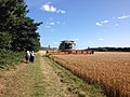 Combine harvester in field looking towards Salle - geograph.org.uk - 4102276.jpg 2,048 × 1,536; 1.51 MB
-
 Cricket ground, Salle - geograph.org.uk - 3015346.jpg 640 × 480; 79 KB
-

-
 Detail of East window, Ss Peter ^ Paul church, Salle - geograph.org.uk - 5007065.jpg 5,204 × 3,516; 5.04 MB
-
 Detail of The Sundial of Ahaz, Ss Peter ^ Paul church, Salle - geograph.org.uk - 5006210.jpg 3,696 × 2,448; 2.31 MB
-
 Early morning sun on Reepham Road - geograph.org.uk - 4294343.jpg 640 × 480; 106 KB
-
 EDP Best Kept Village 1999 Plaque.jpg 5,184 × 3,888; 9.99 MB
-
 Entrance to the ice house - geograph.org.uk - 935190.jpg 640 × 480; 202 KB
-
 Estate cottages at Heydon - geograph.org.uk - 4294366.jpg 640 × 480; 162 KB
-
 Fields east of Forest Farm, Wood Dalling - geograph.org.uk - 2299526.jpg 640 × 480; 165 KB
-
 Footpath to the north of Salle - geograph.org.uk - 4170149.jpg 1,024 × 768; 206 KB
-
 Forest Farm Wood Dalling - geograph.org.uk - 2299611.jpg 640 × 475; 116 KB
-
 Frosty road near Gatehouse Farm - geograph.org.uk - 4294359.jpg 640 × 480; 127 KB
-
 Gatehouse Farm, Salle - geograph.org.uk - 304951.jpg 640 × 427; 105 KB
-
 Gatehouse on the corner of The Street - geograph.org.uk - 935494.jpg 640 × 480; 137 KB
-
 Gates, Salle - geograph.org.uk - 5300812.jpg 640 × 480; 243 KB
-
 Haematomma ochroleucum - Salle, Norfolk, UK.jpg 3,024 × 4,032; 4.61 MB
-
 Haematomma ochroleucum cropped - Salle, Norfolk, UK.jpg 1,783 × 2,357; 2.01 MB
-
 Houses on the B1145 (Cawston Road) - geograph.org.uk - 608602.jpg 640 × 480; 50 KB
-
 Interior, Ss Peter ^ Paul church, Salle - geograph.org.uk - 5006188.jpg 4,784 × 3,156; 5.68 MB
-
 Jacob sheep at Moor Hall Farm - geograph.org.uk - 1132839.jpg 640 × 480; 138 KB
-
-
 Low sun on Heydon Road - geograph.org.uk - 4294354.jpg 640 × 480; 122 KB
-
 Lynton White Institute, Salle - geograph.org.uk - 4170154.jpg 1,024 × 768; 124 KB
-
 Medieval Stained glass detail, Ss Peter ^ Paul church, Salle - geograph.org.uk - 5010176.jpg 4,272 × 2,848; 3.63 MB
-
 Memorial brass, Ss Peter ^ Paul church, Salle - geograph.org.uk - 5007101.jpg 2,650 × 2,210; 4.96 MB
-
 Misericord, Ss Peter ^ Paul church, Salle - geograph.org.uk - 5010147.jpg 4,272 × 2,848; 4.75 MB
-
 New plantation - geograph.org.uk - 756385.jpg 640 × 480; 158 KB
-
 On the path between Reepham and Salle - geograph.org.uk - 102685.jpg 640 × 480; 102 KB
-
 Path along a woodland edge - geograph.org.uk - 1132718.jpg 640 × 480; 93 KB
-
 Path through cereal crop - geograph.org.uk - 1132784.jpg 640 × 455; 85 KB
-
 Path to Moor Hall Farm - geograph.org.uk - 1132775.jpg 640 × 480; 163 KB
-
 Path to Wood Dalling Road - geograph.org.uk - 1132768.jpg 640 × 480; 120 KB
-
 Pheasants are being reared here - geograph.org.uk - 935093.jpg 480 × 640; 146 KB
-
 Physcia caesia - Salle, Norfolk UK.jpg 4,032 × 3,024; 4.4 MB
-
 Physcia caesia Salle, Norfolk UK - crop.jpg 2,552 × 2,186; 2.38 MB
-
 Pond on woodland edge - geograph.org.uk - 1132704.jpg 480 × 640; 127 KB
-
 Postbox beside junction - geograph.org.uk - 756224.jpg 640 × 480; 116 KB
-
 Poultry shed for free range chickens - geograph.org.uk - 1132924.jpg 640 × 480; 113 KB
-
 Private Road, Salle - geograph.org.uk - 304266.jpg 640 × 427; 107 KB
-
 Public footpath leading east - geograph.org.uk - 1132736.jpg 640 × 480; 101 KB
-
 Red Telephone Box Defibrillator.jpg 3,888 × 5,184; 9.69 MB
-
 Road past Estate cottages at Heydon - geograph.org.uk - 4294367.jpg 640 × 480; 147 KB
-
 Royal Mail Priority Postbox Label.jpg 5,184 × 3,888; 8.53 MB
-
 Royal Mail Wall Box.jpg 3,888 × 5,184; 9.71 MB
-
 Rural lane - geograph.org.uk - 756324.jpg 640 × 480; 163 KB
-
 Rural scene at Heydon - geograph.org.uk - 5592584.jpg 3,456 × 2,592; 3.86 MB
-
 Salle cricket green - geograph.org.uk - 4170155.jpg 1,024 × 768; 102 KB
-
 Salle village sign - geograph.org.uk - 4170152.jpg 768 × 1,024; 257 KB
-
 Salle village sign - geograph.org.uk - 4294350.jpg 480 × 640; 182 KB
-
 Salle village sign - geograph.org.uk - 6679888.jpg 1,059 × 1,059; 297 KB
-
 Salle War Memorial for both wars - geograph.org.uk - 4773705.jpg 2,592 × 3,456; 3.05 MB
-
 Salle, Village emblem - geograph.org.uk - 4452041.jpg 2,491 × 1,766; 2.48 MB
-
 Ss Peter ^ Paul church, Salle - geograph.org.uk - 5006048.jpg 3,037 × 2,508; 4.66 MB
-

-
 SS Peter ^ Paul, Salle, churchyard - geograph.org.uk - 5352081.jpg 640 × 480; 104 KB
-
 SS Peter ^ Paul, Salle, noticeboard - geograph.org.uk - 5364829.jpg 640 × 480; 98 KB
-

-

-
 St Peter and St Paul Church, Salle - geograph.org.uk - 6442956.jpg 1,199 × 1,798; 601 KB
-
 St Peter and St Paul, Salle - geograph.org.uk - 5300513.jpg 472 × 640; 151 KB
-
 Stintonhall Farm, Salle - geograph.org.uk - 304277.jpg 640 × 420; 109 KB
-
 Storm damaged tree - geograph.org.uk - 1132878.jpg 640 × 480; 102 KB
-

-

-

-

-

-

-
-
 The former village school - geograph.org.uk - 1132631.jpg 640 × 480; 79 KB
-
 The ice house - view down the pit - geograph.org.uk - 935196.jpg 480 × 640; 129 KB
-
 The orchard - geograph.org.uk - 935206.jpg 640 × 480; 205 KB
-

-
 The pleasure gardens - geograph.org.uk - 935157.jpg 480 × 640; 147 KB
-
 The Street, Salle - geograph.org.uk - 4170153.jpg 1,024 × 768; 163 KB
-

-

-
-
 Unnamed lane - geograph.org.uk - 756301.jpg 480 × 640; 166 KB
-
 View north along a footpath - geograph.org.uk - 1132753.jpg 640 × 480; 99 KB
-
 View north along nameless stream - geograph.org.uk - 756336.jpg 480 × 640; 130 KB
-

-
 View south towards Bluestone Wood - geograph.org.uk - 756352.jpg 480 × 640; 161 KB
-

-
 Waiting for a refill - geograph.org.uk - 1132851.jpg 640 × 480; 122 KB
-
 Water tower, Salle - geograph.org.uk - 5300821.jpg 640 × 479; 153 KB


_-_geograph.org.uk_-_608626.jpg)


_-_geograph.org.uk_-_608602.jpg)


_-_geograph.org.uk_-_5364822.jpg)


_-_geograph.org.uk_-_5364820.jpg)
_-_geograph.org.uk_-_5364827.jpg)


