Category:Salesbury
Jump to navigation
Jump to search
English: Salesbury is a village and civil parish in the Ribble Valley on the outskirts of Blackburn, England. This completely rural parish descends northwards to a secluded and wooded reach where the River Ribble falls over shelving rocks. The Old English name is 'Salebyry', dating from 1246 AD and 'Salewelle' dating from 1296 AD. As well as St Peter’s Church, The Memorial Hall, Salesbury School and Salesbury Cricket Club, Salesbury contains the residence of the Bishop of Blackburn, known locally as the Bishop's House. (→Salesbury)
Polski: Salesbury – wieś w Anglii, w hrabstwie Lancashire, w dystrykcie Ribble Valley. Leży 40 km na północny zachód od miasta Manchester i 300 km na północny zachód od Londynu. (→Salesbury)
village and civil parish in Lancashire, UK  | |||||
| Upload media | |||||
| Instance of | |||||
|---|---|---|---|---|---|
| Location | Ribble Valley, Lancashire, North West England, England | ||||
| Population |
| ||||
 | |||||
Subcategories
This category has the following 2 subcategories, out of 2 total.
C
- Copster Green (4 F)
P
Media in category "Salesbury"
The following 99 files are in this category, out of 99 total.
-
 A field boundary in Ashes Farm - geograph.org.uk - 3878318.jpg 4,592 × 3,056; 7.82 MB
-
 A59 eastbound near Sykes Farm - geograph.org.uk - 4246538.jpg 640 × 481; 84 KB
-
 A59 near Sykes Farm - geograph.org.uk - 3018934.jpg 4,288 × 3,216; 3.79 MB
-
 A59 through Clayton-le-Dale - geograph.org.uk - 3018929.jpg 3,717 × 2,217; 2.12 MB
-
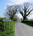 Approaching Dinckley - geograph.org.uk - 3954757.jpg 949 × 1,024; 723 KB
-
 Approaching Sykes Farm from the South East - geograph.org.uk - 5475114.jpg 5,184 × 3,456; 7.15 MB
-
 Barn on the A59 - geograph.org.uk - 3118883.jpg 2,816 × 2,112; 3.25 MB
-
 Bend in the River - geograph.org.uk - 3977625.jpg 1,024 × 768; 461 KB
-
 Blackburn Road, Salesbury Hall - geograph.org.uk - 5134304.jpg 2,848 × 2,136; 1.52 MB
-
 Bolton Hall, Copster Green - geograph.org.uk - 5475040.jpg 5,184 × 3,456; 5.96 MB
-
 Bolton Hall, Copster Green - geograph.org.uk - 97816.jpg 640 × 427; 143 KB
-
 Church View, Salesbury - geograph.org.uk - 413175.jpg 640 × 480; 103 KB
-

-
-
-
 Coppy Scar Wood - geograph.org.uk - 4226207.jpg 640 × 377; 82 KB
-
 Copster Green - geograph.org.uk - 3018933.jpg 4,288 × 3,216; 3.23 MB
-
 Copster Green - geograph.org.uk - 3878268.jpg 4,575 × 3,044; 6.97 MB
-
 Copster Green - geograph.org.uk - 5475046.jpg 5,184 × 3,456; 5.93 MB
-
 Copster Green from Lovely Hall Lane - geograph.org.uk - 97795.jpg 640 × 427; 192 KB
-
 Dewhurst House Farm - geograph.org.uk - 4459932.jpg 4,334 × 2,472; 1.59 MB
-
 Edge of Marles Wood - geograph.org.uk - 1743193.jpg 2,592 × 1,944; 1.59 MB
-
 Elizabeth II postbox on Blackburn Road, Salesbury Hall - geograph.org.uk - 5134299.jpg 1,874 × 1,964; 876 KB
-
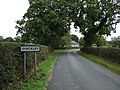 Entering Dinckley - geograph.org.uk - 5132790.jpg 640 × 480; 102 KB
-
 Entrance to car park, Marles Wood - geograph.org.uk - 5132786.jpg 640 × 480; 121 KB
-
 Entrance to the Car Park in Marles Wood - geograph.org.uk - 6093109.jpg 5,184 × 3,456; 6.14 MB
-
 Fallen Tree - geograph.org.uk - 4916524.jpg 1,280 × 960; 1.65 MB
-
 Farm track near the River Ribble - geograph.org.uk - 5132775.jpg 640 × 480; 94 KB
-
 Footbridge on Lovely Hall Lane - geograph.org.uk - 3118878.jpg 2,816 × 2,112; 2.89 MB
-
 Footpath and footbridge - geograph.org.uk - 4226217.jpg 1,280 × 960; 1.57 MB
-
 Footpath by the riverbank - geograph.org.uk - 3954750.jpg 4,000 × 3,000; 5 MB
-
 Footpath in Marles Wood - geograph.org.uk - 2394111.jpg 4,000 × 3,000; 7.81 MB
-
 Footpath in Marles Wood - geograph.org.uk - 3954731.jpg 1,024 × 768; 837 KB
-
 Footpath in Marles Wood - geograph.org.uk - 3954760.jpg 768 × 1,024; 936 KB
-
 Footpath in Marles Wood - geograph.org.uk - 4916516.jpg 1,280 × 960; 1.58 MB
-
 Footpath in Marles Wood - geograph.org.uk - 4916519.jpg 1,280 × 960; 1.79 MB
-
 Footpath near Salesbury Hall - geograph.org.uk - 3954761.jpg 1,024 × 768; 781 KB
-
 Footpath to Copster Green - geograph.org.uk - 5475037.jpg 5,184 × 3,456; 6.73 MB
-
 Grazing, Dinckley - geograph.org.uk - 5132791.jpg 640 × 430; 38 KB
-
 Grazing, Salesbury Hall - geograph.org.uk - 5132782.jpg 640 × 480; 60 KB
-
 Heading east on Ribchester Road - geograph.org.uk - 5132771.jpg 640 × 480; 56 KB
-
 Hey Hurst - geograph.org.uk - 4916558.jpg 1,280 × 960; 1.22 MB
-
 Houses on Ribchester Road, Dinckley - geograph.org.uk - 5132794.jpg 640 × 480; 74 KB
-
 Inverted benchmark on Connerie Bridge - geograph.org.uk - 3551733.jpg 1,600 × 1,200; 1.02 MB
-
 Lovely Hall Lane - geograph.org.uk - 3877340.jpg 4,465 × 2,921; 7.8 MB
-
 Lovely Hall Lane at Copster Green - geograph.org.uk - 3118885.jpg 2,816 × 2,112; 3.18 MB
-
 Lovely Hall, Lovely Hall Lane - geograph.org.uk - 97782.jpg 640 × 480; 149 KB
-
 Manor Court At Salesbury Hall - geograph.org.uk - 3349004.jpg 1,600 × 1,200; 645 KB
-
 Marles Wood in Autumn - geograph.org.uk - 4226203.jpg 4,000 × 3,000; 4.69 MB
-
 Marles Wood on the banks of the Ribble - geograph.org.uk - 2396019.jpg 4,000 × 3,000; 7.08 MB
-
 Natural sculpture - geograph.org.uk - 3954745.jpg 1,024 × 768; 738 KB
-
 New plantation in the Ribble Valley - geograph.org.uk - 1745886.jpg 640 × 480; 99 KB
-
 Oak on the riverbank - geograph.org.uk - 3954743.jpg 1,024 × 768; 667 KB
-

-

-
 On the banks of the Ribble - geograph.org.uk - 3954737.jpg 1,024 × 768; 816 KB
-
 Park Gate, Copster Green - geograph.org.uk - 5475043.jpg 5,184 × 3,456; 5.73 MB
-
 Parked cars on Lovely Hall Lane - geograph.org.uk - 2247205.jpg 3,872 × 2,592; 5.9 MB
-
 Ribchester Road - geograph.org.uk - 5132766.jpg 640 × 480; 93 KB
-
 Ribchester Road outside Marles Wood - geograph.org.uk - 6093107.jpg 5,184 × 3,456; 6.59 MB
-
 River Ribble - geograph.org.uk - 2126937.jpg 3,200 × 960; 464 KB
-
 River Ribble - geograph.org.uk - 3954740.jpg 1,024 × 768; 742 KB
-
 River Ribble - geograph.org.uk - 4459926.jpg 5,118 × 2,850; 1.76 MB
-
 River Ribble - geograph.org.uk - 4916569.jpg 1,280 × 960; 1.2 MB
-
 River Ribble at Marles Wood - geograph.org.uk - 2394096.jpg 4,000 × 3,000; 4.79 MB
-
 River Ribble at Marles Wood - geograph.org.uk - 3954728.jpg 1,024 × 768; 813 KB
-
 River Ribble at Marles Wood - geograph.org.uk - 4226447.jpg 4,000 × 3,000; 6.13 MB
-
 River Ribble near Dinckley - geograph.org.uk - 4226208.jpg 640 × 469; 92 KB
-

-
 Salesbury Common - geograph.org.uk - 97744.jpg 640 × 427; 126 KB
-
 Salesbury Cricket Club - Ground - geograph.org.uk - 3427494.jpg 1,600 × 1,200; 272 KB
-
 Salesbury Cricket Club - Pavilion - geograph.org.uk - 3427500.jpg 1,600 × 1,200; 470 KB
-
 Salesbury Cricket Club - Scoreboard - geograph.org.uk - 3427505.jpg 1,600 × 1,200; 547 KB
-
 Salesbury Hall - geograph.org.uk - 5132779.jpg 640 × 480; 48 KB
-
 Salesbury, UK - panoramio (2).jpg 3,264 × 2,448; 2.25 MB
-
 Salesbury, UK - panoramio (3).jpg 3,264 × 2,448; 2.25 MB
-
 Salisbry - panoramio.jpg 1,280 × 960; 473 KB
-
 St Peter's Church, Salesbury - geograph.org.uk - 3878292.jpg 4,400 × 2,999; 7.02 MB
-
 St Peter's School, Salesbury - geograph.org.uk - 97776.jpg 640 × 427; 115 KB
-
 Sykes Farm - geograph.org.uk - 5475115.jpg 5,184 × 3,456; 7.08 MB
-
 The (new) Salesbury Hall - geograph.org.uk - 171134.jpg 640 × 480; 204 KB
-
 The churchyard of St Peter's, Salesbury - geograph.org.uk - 2247214.jpg 3,872 × 2,592; 6.27 MB
-
 The path through Marles Wood - geograph.org.uk - 3616700.jpg 4,592 × 3,056; 6.74 MB
-
 The River Ribble - geograph.org.uk - 3616621.jpg 4,592 × 3,056; 6.44 MB
-
 The River Ribble - geograph.org.uk - 3616688.jpg 4,373 × 2,978; 7.94 MB
-
 The River Ribble - geograph.org.uk - 3616765.jpg 4,566 × 3,039; 6.63 MB
-
 The River Ribble - geograph.org.uk - 3617550.jpg 4,403 × 2,931; 5.55 MB
-
 The road by New Marles Farm - geograph.org.uk - 3619583.jpg 640 × 341; 65 KB
-
 The view towards Pendle Hill from Barker Brow car park - geograph.org.uk - 2990289.jpg 4,553 × 3,056; 7.9 MB
-
 Track to Palmers Greave - geograph.org.uk - 2247197.jpg 3,872 × 2,592; 6.79 MB
-
 Unused railway cutting south of Hurst Green - geograph.org.uk - 3859038.jpg 4,000 × 3,000; 3.48 MB
-
 Footpath - geograph.org.uk - 413129.jpg 640 × 480; 149 KB
-
 Memorial Hall, Salesbury - geograph.org.uk - 97748.jpg 427 × 640; 90 KB
-

-
 Salesbury - geograph.org.uk - 83573.jpg 640 × 480; 133 KB
-
 Salesbury Memorial Hall - geograph.org.uk - 413163.jpg 640 × 472; 92 KB
-
 Security Gate - geograph.org.uk - 84112.jpg 640 × 480; 129 KB
-
 The Bonny Inn, Salesbury - geograph.org.uk - 413169.jpg 640 × 475; 100 KB
-
 Tree lined road - geograph.org.uk - 186188.jpg 640 × 480; 227 KB


.jpg)
.jpg)


_Salesbury_Hall_-_geograph.org.uk_-_171134.jpg)


