Category:Salamanca, New York
Jump to navigation
Jump to search
- Cities in New York State
- ‒ Capital District
- Albany
- Cohoes
- Glens Falls
- Hudson
- Mechanicville
- Rensselaer
- Saratoga Springs
- Schenectady
- Troy
- Watervliet
- ‒ Central New York
- Auburn
- Cortland
- Fulton
- Ithaca
- Norwich
- Oswego
- Syracuse
- ‒ New York City and Long Island
- Glen Cove
- Long Beach
- New York City
- ‒ Finger Lakes
- Batavia
- Canandaigua
- Geneva
- Rochester
- ‒ Hudson Valley
- Beacon
- Kingston
- Middletown
- Mount Vernon
- New Rochelle
- Peekskill
- Port Jervis
- Poughkeepsie
- Rye
- White Plains
- Yonkers
- ‒ Mohawk Valley
- Amsterdam
- Gloversville
- Johnstown
- Little Falls
- Oneida
- Oneonta
- Rome
- Utica
- ‒ North Country
- Ogdensburg
- Plattsburgh
- Watertown
- ‒ Southern Tier
- Binghamton
- Corning
- Elmira
- Hornell
- ‒ Western New York
- Buffalo
- Dunkirk
- Jamestown
- Lackawanna
- Lockport
- Niagara Falls
- North Tonawanda
- Olean
- Salamanca
- Tonawanda
Main Wikipedia article: Salamanca, New York.

human settlement in Cattaraugus County, New York, United States of America | |||||
| Upload media | |||||
| Instance of | |||||
|---|---|---|---|---|---|
| Location | Cattaraugus County, New York | ||||
| Population |
| ||||
| Area |
| ||||
| Elevation above sea level |
| ||||
 | |||||
Subcategories
This category has the following 3 subcategories, out of 3 total.
Media in category "Salamanca, New York"
The following 76 files are in this category, out of 76 total.
-
 A Forest Creek (235189979).jpeg 2,048 × 1,365; 1.16 MB
-
 Annual report (1909) (14565081598).jpg 3,520 × 2,300; 3.19 MB
-
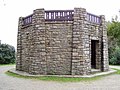 ASP Stone Tower.jpg 1,600 × 1,200; 615 KB
-
 B&P (105635575).jpg 2,032 × 1,515; 950 KB
-

-
 Buffalo, Rochester & Pittsburgh Railway yard in East Salamanca 1908 postcard.webp 1,600 × 1,025; 304 KB
-
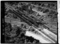
 Erie Berkshire locomotive turntable.jpg 3,331 × 1,669; 2.5 MB
-
 FLT M01 1.1 mi - ASP sign at NY-PA border - panoramio.jpg 1,536 × 2,048; 777 KB
-
 FLT M01 1.1 mi - Register tube and sign at NY-PA boundary - panoramio.jpg 1,536 × 2,048; 718 KB
-
 FLT M01 10.40 mi - Puncheon, 12' long, 3 4x4s on 6x6 sills - panoramio.jpg 1,536 × 2,048; 829 KB
-
 FLT M01 10.60 mi - Sign just E of Access 4 (ASP 3, Quaker Run Rd) - panoramio.jpg 1,536 × 2,048; 731 KB
-
 FLT M01 15.70 mi - ASP sign at ASP 1 (Access 5) - panoramio.jpg 1,536 × 2,048; 553 KB
-
 FLT M01 15.70 mi - FLTC sign at ASP 1 (Access 5) - panoramio.jpg 1,536 × 2,048; 952 KB
-
 FLT M01 19.24 mi - Beck Hollow Lean-to piped spring - panoramio.jpg 2,048 × 1,536; 812 KB
-
 FLT M01 21.1 mi - 25 steps, two 4x4x24s for each - panoramio.jpg 1,200 × 1,600; 799 KB
-
 FLT M01 21.3 mi - Puncheon, 9' long, 2 2x4x12 deck sets, 4 2x4 stringers - panoramio.jpg 1,536 × 2,048; 889 KB
-
 FLT M01 21.31 mi - ASP sign near Bay State Rd - panoramio.jpg 1,536 × 2,048; 929 KB
-
 FLT M01 21.31 mi - Sign near Bay State Rd - panoramio.jpg 1,536 × 2,048; 849 KB
-

-

-
 FLT M01 7.25 mi - Sign behind Willis Creek Lean-to - panoramio.jpg 1,536 × 2,048; 793 KB
-
 FLT M01 7.27 mi - Puncheon, 8' long, 3 4x4s on 6x6 sills - panoramio.jpg 1,536 × 2,048; 779 KB
-
 FLT M01 7.30 mi - Puncheon, 7' long, 3 4x4s on 6x6 sills - panoramio.jpg 1,536 × 2,048; 780 KB
-
 FLT M01 7.40 mi - Puncheon, 8' long, 3 4x4s on 6x6 sills - panoramio.jpg 1,536 × 2,048; 707 KB
-
 FLT M01 7.60 mi - Puncheon, 8' long, 3 4x4s on 6x6 sills - panoramio.jpg 1,536 × 2,048; 818 KB
-
 FLT M01 7.61 mi - Puncheon, 8' long, 3 4x4s on 6x6 sills - panoramio.jpg 1,536 × 2,048; 854 KB
-
 FLT M01 7.90 mi - Puncheon, 12' long, 3 4x4s on 6x6 sills - panoramio.jpg 1,536 × 2,048; 771 KB
-

-
-
 FLT M01 8.40 mi - Puncheon, 12' long, 3 4x4s on 6x6 sills - panoramio.jpg 1,536 × 2,048; 910 KB
-
 FLT M01 8.50 mi - Puncheon, 12' long, 3 4x4s on 6x6 sills - panoramio.jpg 1,536 × 2,048; 878 KB
-
 FLT M01 8.54 mi - Puncheon, 12' long, 3 4x4s on 6x6 sills - panoramio.jpg 1,536 × 2,048; 981 KB
-
 FLT M01 8.60 mi - Puncheon, 12' long, 3 4x4s on 6x6 sills - panoramio.jpg 1,536 × 2,048; 793 KB
-
 FLT M01 8.60 mi - Sign just E of Coon Run Rd - panoramio.jpg 1,536 × 2,048; 640 KB
-

-

-
 FLT M01 8.90 mi - Puncheon, 812' long, 3 4x4s on 6x6 sills - panoramio.jpg 1,536 × 2,048; 751 KB
-
 FLT M01 8.91 mi - Piped spring 70' E of trail - panoramio.jpg 1,536 × 2,048; 692 KB
-
 FLT M01 9.60 mi - Puncheon, 12' long, 3 4x4s on 6x6 sills - panoramio.jpg 1,536 × 2,048; 817 KB
-
 FLT M02 5.8 mile - Bivouac area with fire ring, no nearby water source - panoramio.jpg 1,536 × 2,048; 898 KB
-

-

-
 FLT M02 6.01 mi - Register on Tom Hook's bridge - panoramio.jpg 1,536 × 2,048; 642 KB
-

-
 FLT M03 1.3 mi - Register E of Stone Chimney Rd - panoramio.jpg 1,536 × 2,048; 449 KB
-
-

-

-

-

-

-

-

-

-

-
-

-

-

-

-

-
 Iroquois pow wow001.jpg 578 × 374; 71 KB
-
 La Luz De La Mañana A (235189961).jpeg 2,048 × 3,072; 1.78 MB
-
 La Luz De La Mañana B (235189963).jpeg 2,048 × 1,365; 872 KB
-
 Native American boy in Men's Northern Traditional outfit.jpg 790 × 1,180; 850 KB
-
 NY 353N in Salamanca.jpg 4,608 × 3,456; 7.66 MB
-
 NY 417 at NY 353.jpg 640 × 480; 70 KB
-
 NY Cattaraugus county Salamanca city IMG 1860.JPG 5,184 × 3,456; 10.35 MB
-
 NY Cattaraugus county Salamanca city IMG 1861.JPG 3,456 × 3,122; 6.09 MB
-
 Pow wow in Salamanca NY.jpg 492 × 297; 174 KB
-
 Salamanca City Central School District Overhead.jpg 4,000 × 3,000; 6.72 MB
-
 Salamanca City Central School STEAM Center of Excellence.jpg 6,000 × 4,000; 3.62 MB
-
 SenecaAlleganyCasino.jpg 2,000 × 1,138; 547 KB
-
 Sunrise over Quaker Lake in Salamanca, NY. (8574372489).jpg 1,200 × 900; 220 KB
-
 US Route 219 in Salamanca.jpg 640 × 480; 77 KB
-

.jpeg)
_(14565081598).jpg)

.jpg)


_-_panoramio.jpg)
_-_panoramio.jpg)
_-_panoramio.jpg)


_at_Little_Rock_City_Day_Use_area,_no_water,_camping_permitted_150%27_from_road_and_trail_-_panoramio.jpg)


_-_Erie_Railway,_Salamanca_Turntable,_Atlantic_Street,_Salamanca,_Cattaraugus_County,_NY_HAER_NY,5-SAL,1B-1_(cropped).jpg)

.jpeg)
.jpeg)


.jpg)
