Category:Saint Procopius church in Krzcięcice
Jump to navigation
Jump to search
| Object location | | View all coordinates using: OpenStreetMap |
|---|
 | |||||
| Upload media | |||||
| Instance of |
| ||||
|---|---|---|---|---|---|
| Location | Krzcięcice, Gmina Sędziszów, Jędrzejów County, Świętokrzyskie Voivodeship, Poland | ||||
| Has part(s) | |||||
| Heritage designation |
| ||||
 | |||||
Polski: Krzcięcice - kościół parafialny p.w. św. Prokopa wraz z dzwonnicą
Media in category "Saint Procopius church in Krzcięcice"
The following 4 files are in this category, out of 4 total.
-
 Kościół w Krzcięcicach PC050803.JPG 2,048 × 1,536; 1.23 MB
-
 Krzcięcice dzwonnica.jpg 2,448 × 3,264; 2.19 MB
-
 Krzcięcice kościół.jpg 3,264 × 2,448; 5.54 MB
-
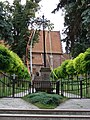 Krzcięcice krzyż.jpg 2,448 × 3,264; 2.76 MB


