Category:Saint Peter Church (Kinver)
Jump to navigation
Jump to search
| Object location | | View all coordinates using: OpenStreetMap |
|---|
church in Kinver, Staffordshire, England, UK  | |||||
| Upload media | |||||
| Instance of | |||||
|---|---|---|---|---|---|
| Dedicated to | |||||
| Location | Kinver, South Staffordshire, Staffordshire, West Midlands, England | ||||
| Diocese | |||||
| Heritage designation |
| ||||
| Inception |
| ||||
| Religion or worldview | |||||
 | |||||
This is a category about listed building number 1230950. |
Media in category "Saint Peter Church (Kinver)"
The following 11 files are in this category, out of 11 total.
-
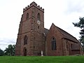
 Church Tower View - geograph.org.uk - 4924954.jpg 600 × 800; 238 KB
-
 Church View - geograph.org.uk - 4924962.jpg 800 × 600; 205 KB
-
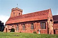 St Peter's Church, Kinver - geograph.org.uk - 70439.jpg 640 × 425; 86 KB
-
 Kinver Church stained glass window - Flickr - TheDazDanks.jpg 930 × 1,600; 783 KB
-
 Kinver St Peter fr NE IanS7053069.jpg 4,201 × 2,904; 1.11 MB
-
 Kinver St Peter fr SE GeoUK7053140.jpg 2,086 × 1,354; 272 KB
-
 Lane beside St Peter's Church, Kinver - geograph.org.uk - 892013.jpg 640 × 480; 276 KB
-
 St Peter's Church - geograph.org.uk - 892012.jpg 640 × 480; 329 KB
-
 St Peter's Church, Kinver - panoramio.jpg 4,608 × 3,456; 2.88 MB
-
 St Peter's Church, Kinver.jpg 5,184 × 2,920; 7.3 MB
-
 St. Peters, Kinver - geograph.org.uk - 1998473.jpg 3,488 × 2,616; 2.24 MB


