Category:Saint Michael church in Księży Las
Jump to navigation
Jump to search
| Object location | | View all coordinates using: OpenStreetMap |
|---|
Polski: kościół filialny pw. św. Michała - Księży Las, ul. Wiejska
 | |||||
| Upload media | |||||
| Instance of | |||||
|---|---|---|---|---|---|
| Named after | |||||
| Location | Księży Las, Gmina Zbrosławice, Tarnowskie Góry county, Silesian Voivodeship, Poland | ||||
| Diocese | |||||
| Heritage designation |
| ||||
 | |||||
Media in category "Saint Michael church in Księży Las"
The following 48 files are in this category, out of 48 total.
-
 Kościół od strony cmentarza.jpg 7,360 × 4,912; 29.46 MB
-
 Ksiezy las 1.jpg 2,048 × 1,536; 1.8 MB
-
 Ksiezy las 2.jpg 2,048 × 1,536; 1.59 MB
-
 Ksiezy las 3.jpg 1,905 × 1,402; 1.18 MB
-
 Księży Las - Kościół.jpg 2,269 × 1,455; 1.22 MB
-
 Księży Las k. rz.k pw. Michała Archanioła 08.07.17pl I.jpg 1,647 × 1,545; 3.43 MB
-
 Księży Las k. rz.k pw. Michała Archanioła 08.07.17pl.jpg 3,020 × 2,112; 6.18 MB
-
 Księży Las Kościół św Michała Archanioła DSC 6082.jpg 2,848 × 2,848; 3.78 MB
-
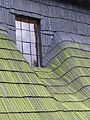
 Księży Las Kościół św. Michała - dach i sygnaturka.JPG 6,000 × 4,000; 13.1 MB
-
 Księży Las Kościół św. Michała - detale fasady.JPG 4,000 × 6,000; 11.34 MB
-
 Księży Las Kościół św. Michała - fasada.jpg 6,000 × 4,000; 12.99 MB
-
 Księży Las Kościół św. Michała - kaplica.JPG 4,000 × 6,000; 10.27 MB
-
 Księży Las Kościół św. Michała - kopuły.jpg 4,000 × 6,000; 9.92 MB
-
 Księży Las Kościół św. Michała - okna strony pd.JPG 4,000 × 6,000; 12.63 MB
-
 Księży Las Kościół św. Michała - okno w dachu od str płn.JPG 4,000 × 6,000; 10.04 MB
-
 Księży Las Kościół św. Michała - sygnaturka.JPG 4,000 × 6,000; 8.97 MB
-
 Księży Las Kościół św. Michała - widok od zach.jpg 6,000 × 4,000; 11.69 MB
-
 Księży Las Kościół św. Michała - widok ogólny.JPG 6,000 × 4,000; 13.13 MB
-
 Księży Las kościół św. Michała 2017-07-08 p.jpg 2,866 × 1,968; 5.72 MB
-
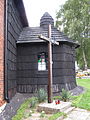
 Księży Las, kościół św. Michała, budynek gospodarczy, widok od pd-zach. 01.JPG 3,000 × 4,000; 5.7 MB
-
 Księży Las, kościół św. Michała, budynek gospodarczy, widok od pd..JPG 3,000 × 4,000; 4.81 MB
-
 Księży Las, kościół św. Michała, budynek gospodarczy, widok od wsch..JPG 4,000 × 3,000; 3.9 MB
-
 Księży Las, kościół św. Michała, fragment dachu (2).JPG 3,000 × 4,000; 3.35 MB
-
 Księży Las, kościół św. Michała, fragment dachu.JPG 3,000 × 4,000; 3.77 MB
-
 Księży Las, kościół św. Michała, fragment elewacji pd..JPG 3,000 × 4,000; 3.46 MB
-
 Księży Las, kościół św. Michała, kaplica, widok od wsch..JPG 3,000 × 4,000; 2.77 MB
-
 Księży Las, kościół św. Michała, kaplica, widok od zach..JPG 3,000 × 4,000; 3.59 MB
-
 Księży Las, kościół św. Michała, klawiatura organowa (1).JPG 4,000 × 3,000; 2.37 MB
-
 Księży Las, kościół św. Michała, klawiatura organowa (2).JPG 3,000 × 4,000; 2.58 MB
-
 Księży Las, kościół św. Michała, krzyż przy wejściu.JPG 3,000 × 4,000; 3.29 MB
-

-
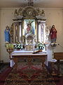 Księży Las, kościół św. Michała, ołtarz główny.JPG 3,000 × 4,000; 2.78 MB
-
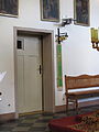 Księży Las, kościół św. Michała, przejście do zakrystii.JPG 3,000 × 4,000; 2.19 MB
-
 Księży Las, kościół św. Michała, wejście, widok od pd..JPG 3,000 × 4,000; 3.5 MB
-
 Księży Las, kościół św. Michała, wejście, widok od pn..JPG 3,000 × 4,000; 3.01 MB
-
 Księży Las, kościół św. Michała, wejście, widok od zach..JPG 4,000 × 3,000; 3.22 MB
-
 Księży Las, kościół św. Michała, widok od pd-wsch..JPG 3,000 × 4,000; 3.5 MB
-
 Księży Las, kościół św. Michała, widok od pd-zach..JPG 3,000 × 4,000; 2.87 MB
-
 Księży Las, kościół św. Michała, widok od zach. (2).JPG 3,000 × 4,000; 3.1 MB
-
 Księży Las, kościół św. Michała, widok od zach..JPG 3,000 × 4,000; 2.9 MB
-
 Księży Las, kościół św. Michała, wnętrze kaplicy bocznej.JPG 4,000 × 3,000; 2.56 MB
-
 Księży Las, kościół św. Michała, wnętrze, widok w stronę organów.JPG 4,000 × 3,000; 2.31 MB
-
 Księży Las, kościół św. Michała, wnętrze, widok w stronę ołtarza.JPG 4,000 × 3,000; 2.72 MB
-
 Księży Las, kościół św. Michała, wnętrze, widok z lewej strony chóru.JPG 4,000 × 3,000; 2.54 MB
-
 SM Księży Las Kościół Michała Archanioła 2018 (0).jpg 4,330 × 2,887; 12.45 MB
-
 Szałsza Kościół Narodzenia NMP - widok od płn.JPG 6,000 × 4,000; 10.35 MB
-
 Widok od strony cmentarza z pięknym dużym dachem.jpg 7,001 × 4,672; 25.92 MB
-
 Widok po remoncie od strony wejścia na plac kościelny.jpg 10,417 × 6,529; 52.93 MB


.JPG)


.JPG)
.JPG)


.JPG)


.jpg)


