Category:Saint Mary Church (Lydney)
Jump to navigation
Jump to search
| Object location | | View all coordinates using: OpenStreetMap |
|---|
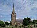
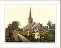
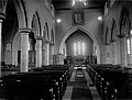
church in Lydney, Forest of Dean, Gloucestershire, England, UK  | |||||
| Upload media | |||||
| Instance of | |||||
|---|---|---|---|---|---|
| Location | Lydney, Forest of Dean, Gloucestershire, South West England, England | ||||
| Diocese | |||||
| Heritage designation |
| ||||
| Inception |
| ||||
| Religion or worldview | |||||
 | |||||
Media in category "Saint Mary Church (Lydney)"
The following 21 files are in this category, out of 21 total.
-
 Churchyard of St. Mary's, Lydney - geograph.org.uk - 582403.jpg 640 × 480; 155 KB
-
 KoscioliokoliceLydney.jpg 622 × 464; 203 KB
-
 Lydney Church (4641735).jpg 1,200 × 1,591; 209 KB
-
 Lydney Church - geograph.org.uk - 1563141.jpg 480 × 640; 71 KB
-
 Lydney church.jpg 640 × 480; 48 KB
-
 Lydney. St. Mary's - geograph.org.uk - 110936.jpg 640 × 480; 98 KB
-
 Parish church of St Mary's, Lydney - geograph.org.uk - 1944206.jpg 550 × 640; 55 KB
-
 St Mary's Church - geograph.org.uk - 4517911.jpg 480 × 640; 90 KB
-
 St Mary's Church - geograph.org.uk - 4517954.jpg 480 × 640; 62 KB
-
 St Mary's Church - geograph.org.uk - 4517956.jpg 480 × 640; 118 KB
-
 St Mary's church and graveyard - geograph.org.uk - 4517906.jpg 640 × 480; 68 KB
-
 St Mary's Church, Lydney - geograph.org.uk - 4962249.jpg 768 × 1,024; 153 KB
-
 St Mary's Parish Church in Lydney - geograph.org.uk - 5198707.jpg 3,840 × 2,880; 1.22 MB
-
 St Mary, Lydney, Gloucestershire (2667427018).jpg 1,744 × 1,308; 299 KB
-

-
 The Church from Bathurst Park, Lydney (4641740).jpg 1,200 × 911; 135 KB
-
 The church Lydney England.jpg 1,075 × 840; 135 KB
-
 The Church, Lydney (4641742).jpg 1,200 × 911; 110 KB
-
 The church, Lydney, England-LCCN2002697002.jpg 3,700 × 2,758; 2.52 MB
-
 The church, Lydney, England-LCCN2002697002.tif 3,700 × 2,758; 29.2 MB
-
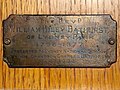 William Hiley Bathurst plaque.jpg 3,180 × 2,387; 2.45 MB


.jpg)


.jpg)

.jpg)

.jpg)

