Category:Saint John the Baptist Church (Seyfrieds)
Jump to navigation
Jump to search
| Object location | | View all coordinates using: OpenStreetMap |
|---|
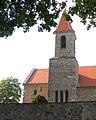
parish church and cemetery in Heidenreichstein, Austria  | |||||
| Upload media | |||||
| Instance of | |||||
|---|---|---|---|---|---|
| Location | Heidenreichstein, Gmünd District, Lower Austria, Austria | ||||
| Heritage designation | |||||
 | |||||
Media in category "Saint John the Baptist Church (Seyfrieds)"
The following 5 files are in this category, out of 5 total.
-
 Kath. Pfarrkirche hl. Johannes der Täufer und Friedhof in Seyfrieds.jpg 5,184 × 3,456; 6.12 MB
-
 Kirche Seyfrieds.jpg 1,794 × 2,234; 999 KB
-
 Pfarrkirche Seyfrieds - Wandmalerei.jpg 5,472 × 3,648; 14.44 MB
-
 Pfarrkirche Seyfrieds Innen.jpg 5,472 × 3,648; 11.71 MB
-
 Pfarrkirche Seyfrieds Südansicht 2020-06.jpg 4,912 × 3,070; 10.46 MB


