Category:Saint Anne church in Ząb
Jump to navigation
Jump to search
| Object location | | View all coordinates using: OpenStreetMap |
|---|
 | |||||
| Upload media | |||||
| Instance of | |||||
|---|---|---|---|---|---|
| Named after | |||||
| Location | Ząb, Lesser Poland Voivodeship, Gmina Poronin, Tatra County, Lesser Poland Voivodeship, Poland | ||||
| Religion or worldview | |||||
 | |||||
Media in category "Saint Anne church in Ząb"
The following 5 files are in this category, out of 5 total.
-
 Kościół na Bachledówce PG3 (3).jpg 2,189 × 1,642; 892 KB
-
 Zab kosciol 01.jpg 957 × 675; 521 KB
-
 Zab kosciol 02.jpg 813 × 675; 676 KB
-
 Zab kosciol 03.jpg 1,024 × 500; 231 KB
-
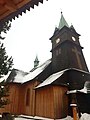 Ząb - Saint Anne church, 2017.jpg 3,024 × 4,032; 3.75 MB
.jpg)


