<nowiki>Saint-Christophe-la-Couperie; Saint-Christophe-la-Couperie; Saint-Christophe-la-Couperie; Saint-Christophe-la-Couperie; Saint-Christophe-la-Couperie; Сен-КгӀистоф-ла-КупегӀи; Saint-Christophe-la-Couperie; 圣克里斯托夫-拉库普里; Saint-Christophe-la-Couperie; سینٹ-کروسٹوفے-لا-کوپیرے; Saint-Christophe-la-Couperie; Saint-Christophe-la-Couperie; Saint-Christophe-la-Couperie; 圣克里斯托夫-拉库普里; Saint-Christophe-la-Couperie; Saint-Christophe-la-Couperie; Saint-Christophe-la-Couperie; Saint-Christophe-la-Couperie; Saint-Christophe-la-Couperie; Saint-Christophe-la-Couperie; Saint-Christophe-la-Couperie; Saint-Christophe-la-Couperie; Saint-Christophe-la-Couperie; Saint-Christophe-la-Couperie; Saint-Christophe-la-Couperie; Saint-Christophe-la-Couperie; Saint-Christophe-la-Couperie; Saint-Christophe-la-Couperie; Saint-Christophe-la-Couperie; Saint-Christophe-la-Couperie; Сен-Кристоф-ла-Купери; Сен-Кристоф-ла-Купері; Saint-Christophe-la-Couperie; chemun de la Franzia; ancienne commune française du département de Maine-et-Loire; sveitarfélag í Frakklandi; коммуна во Франции; französische Gemeinde; comuna francesa; komunë në Francë; antic municipi francès; 法国曼恩-卢瓦尔省旧市镇; 法国旧市镇; Fransa'da eski commune; település Franciaországban; bývalá obec v departementu Maine-et-Loire ve Francii; kumun Bro-C'hall; comuna francesa; voormalige gemeente in Maine-et-Loire, Frankrijk; колишній муніципалітет у департаменті Мен і Луара, Франція; komune di Peurancih; 法國舊市鎮; 法国曼恩-卢瓦尔省旧市镇; una comuna francesa; comune francese; former commune in Maine-et-Loire, France; بلدية في فرنسا; comun fransexo; sat în Ordée-d'Anjou în Pays de la Loire, Franța; Saint-Christophe-la-Couperie (lungsod)</nowiki>


 Map commune FR insee code 49270.png 756 × 605; 36 KB
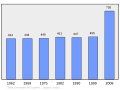 Population - Municipality code 49270.svg 475 × 355; 13 KB