Category:Sabden
Jump to navigation
Jump to search
English: Sabden is a village and civil parish in Ribble Valley, and the Forest of Pendle, Lancashire. (→Sabden)
Nederlands: Sabden is een plaats en civil parish in het bestuurlijke gebied Ribble Valley, in het Engelse graafschap Lancashire met 1.371 inwoners. (→Sabden)
Polski: Sabden – wieś w Anglii, w hrabstwie Lancashire, w dystrykcie Ribble Valley. Leży 42 km na północ od miasta Manchester i 299 km na północny zachód od Londynu. W 2001 miejscowość liczyła 1371 mieszkańców. (→Sabden)

village and civil parish in the Ribble Valley, Lancashire  | |||||
| Upload media | |||||
| Instance of | |||||
|---|---|---|---|---|---|
| Location | Ribble Valley, Lancashire, North West England, England | ||||
| Population |
| ||||
 | |||||
Subcategories
This category has the following 2 subcategories, out of 2 total.
H
S
- Sabden War Memorial (1 F)
Media in category "Sabden"
The following 200 files are in this category, out of 317 total.
(previous page) (next page)-
 "Farm Gate" - geograph.org.uk - 59148.jpg 640 × 427; 183 KB
-

-

-

-
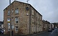
 "Union Mill", Sabden - geograph.org.uk - 486435.jpg 640 × 480; 172 KB
-
 "Victoria Mill", Sabden - geograph.org.uk - 486432.jpg 480 × 640; 150 KB
-
 A cairn with Ogden Clough beyond - geograph.org.uk - 4037728.jpg 4,592 × 3,056; 7.65 MB
-
 A flat valley bottom - geograph.org.uk - 1640444.jpg 640 × 482; 60 KB
-
 A gap in the trees - geograph.org.uk - 6090674.jpg 6,032 × 4,014; 5.89 MB
-
 A lone runner - geograph.org.uk - 4038511.jpg 4,538 × 2,386; 4.05 MB
-
 A quiet corner of Sabden - geograph.org.uk - 1920341.jpg 2,592 × 1,944; 1.27 MB
-
 A stile and footpath opposite Laneside Farm - geograph.org.uk - 4860785.jpg 4,592 × 2,924; 6.94 MB
-
 A tight fit - geograph.org.uk - 4870161.jpg 4,592 × 3,056; 7.01 MB
-
 A tree and a couple of stumps on the moor - geograph.org.uk - 4860840.jpg 4,592 × 3,056; 7.39 MB
-
 A View from Padiham Heights - geograph.org.uk - 3820984.jpg 4,320 × 3,240; 5.14 MB
-
 Abattoir, Wiswell Moor - geograph.org.uk - 61505.jpg 640 × 480; 108 KB
-
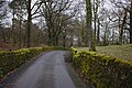
 Access Lane leading away from Ratten Clough - geograph.org.uk - 3807574.jpg 4,320 × 3,240; 3.24 MB
-
 Across the fields towards Sabden - geograph.org.uk - 1233013.jpg 640 × 480; 58 KB
-
 An amazing lane - geograph.org.uk - 6123265.jpg 6,032 × 4,014; 6.46 MB
-
 Another lease on life - geograph.org.uk - 6087823.jpg 5,741 × 3,689; 3.95 MB
-
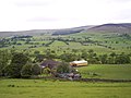
 Approaching Dean Farm - geograph.org.uk - 1140917.jpg 640 × 466; 141 KB
-
 Approaching the Woods above Churn Clough Reservoir - geograph.org.uk - 3807570.jpg 4,320 × 3,240; 3.12 MB
-
 Apronfull Hill - geograph.org.uk - 1216978.jpg 640 × 480; 67 KB
-
 Apronfull Hill - geograph.org.uk - 4254977.jpg 3,648 × 2,736; 4.01 MB
-
 Back Lane in Well Wood - geograph.org.uk - 2154729.jpg 3,872 × 2,592; 7.22 MB
-
 Back Lane, Padiham Heights - geograph.org.uk - 136132.jpg 640 × 426; 116 KB
-
 Bank Hill - geograph.org.uk - 3732057.jpg 3,648 × 2,736; 4.59 MB
-
 Beech Wood - geograph.org.uk - 6088142.jpg 6,032 × 4,014; 6.86 MB
-
 Beside Badger Well Water - geograph.org.uk - 3734789.jpg 3,648 × 2,736; 4.31 MB
-
 Between the walls on the White Hill - geograph.org.uk - 6087904.jpg 6,032 × 4,014; 7.63 MB
-
 Black Hill - geograph.org.uk - 3395739.jpg 3,072 × 2,304; 3.2 MB
-
 Black Hill - geograph.org.uk - 3822187.jpg 4,320 × 3,240; 4.86 MB
-
 Black Hill - geograph.org.uk - 4067901.jpg 3,888 × 2,592; 1.88 MB
-
 Boggy moorland above Ogden Clough - geograph.org.uk - 3811866.jpg 3,872 × 2,592; 4.78 MB
-
 Bridge over Sabden Brook - geograph.org.uk - 1350308.jpg 640 × 480; 125 KB
-
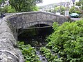 Bridge over Sabden Brook - geograph.org.uk - 1350314.jpg 640 × 480; 125 KB
-
 Bridleway at Heyhouses - geograph.org.uk - 4014574.jpg 1,024 × 768; 737 KB
-
 Brogden Farm off Simonstone Road - geograph.org.uk - 3882474.jpg 1,024 × 768; 176 KB
-
 C C Sabden Bridge - geograph.org.uk - 1350323.jpg 640 × 480; 118 KB
-
 Cairn below Mearley Moor - geograph.org.uk - 3811850.jpg 3,872 × 2,592; 4.75 MB
-
 Calf and Bank Hills - geograph.org.uk - 4255029.jpg 3,648 × 2,736; 4.85 MB
-
 Calf Hill - geograph.org.uk - 3734782.jpg 3,648 × 2,736; 4.86 MB
-
 Car park - geograph.org.uk - 6088138.jpg 6,032 × 4,014; 4.82 MB
-
 Car repairs in Sabden - geograph.org.uk - 6087907.jpg 6,032 × 4,014; 4.92 MB
-
 Cattle Grid - geograph.org.uk - 6090354.jpg 6,032 × 4,014; 3.83 MB
-
 Cattle Grid on Clitheroe Road - geograph.org.uk - 4470287.jpg 640 × 480; 325 KB
-
 Cattle Grid, Clitheroe Road - geograph.org.uk - 1350339.jpg 640 × 381; 47 KB
-
 Charters well - geograph.org.uk - 768638.jpg 640 × 480; 123 KB
-

-
 Churn Clough - geograph.org.uk - 2275947.jpg 3,872 × 2,592; 7.5 MB
-
 Churn Clough Reservoir - geograph.org.uk - 2461874.jpg 1,600 × 1,198; 326 KB
-
 Churn Clough Reservoir - geograph.org.uk - 3734802.jpg 3,648 × 2,736; 4.76 MB
-
 Churn Clough Reservoir - geograph.org.uk - 4299008.jpg 3,648 × 2,736; 3.93 MB
-
 Churn Clough Reservoir - geograph.org.uk - 4754517.jpg 3,952 × 2,956; 4.84 MB
-
 Clitheroe Road - geograph.org.uk - 1350335.jpg 640 × 480; 75 KB
-
 Clitheroe Road at the Nick of Pendle - geograph.org.uk - 3735897.jpg 3,648 × 2,736; 3.71 MB
-
 Clitheroe Road Baptist Sabden - geograph.org.uk - 2793702.jpg 2,560 × 1,920; 1.01 MB
-
 Clitheroe Road by the Nick of Pendle - geograph.org.uk - 3734851.jpg 3,648 × 2,736; 4.81 MB
-
 Clitheroe Road passes through the Nick of Pendle - geograph.org.uk - 2461838.jpg 1,600 × 1,198; 391 KB
-
 Clitheroe Road, above Sabden - geograph.org.uk - 4470289.jpg 640 × 481; 308 KB
-
 Clitheroe road, above Sabden - geograph.org.uk - 6090358.jpg 6,032 × 4,014; 6 MB
-
 Clitheroe Road, Nick of Pendle - geograph.org.uk - 4470240.jpg 640 × 480; 283 KB
-
 Clitheroe Road, Sabden - geograph.org.uk - 4255046.jpg 3,648 × 2,736; 4.66 MB
-
 Clitheroe Road, Sabden - geograph.org.uk - 5600046.jpg 640 × 480; 429 KB
-
 Cottages on Whalley Road, Sabden - geograph.org.uk - 3820941.jpg 4,320 × 3,240; 4.5 MB
-
 Dean Farm - geograph.org.uk - 340579.jpg 640 × 480; 132 KB
-
 Dean Height - geograph.org.uk - 4068976.jpg 3,171 × 2,592; 1.7 MB
-
 Defibrillator at the pub - geograph.org.uk - 6085496.jpg 6,032 × 4,014; 4.64 MB
-
 Disused quarry - geograph.org.uk - 5400966.jpg 1,280 × 958; 1.06 MB
-
 Down toward Sabden - geograph.org.uk - 6085484.jpg 9,136 × 3,739; 7.4 MB
-
 Dry Stone Wall - geograph.org.uk - 6088144.jpg 6,032 × 4,014; 5.64 MB
-
 Dry stone walling below The Height - geograph.org.uk - 3882342.jpg 1,024 × 768; 187 KB
-
 Entering Sabden - geograph.org.uk - 4069137.jpg 4,197 × 2,949; 4.5 MB
-
 Entering Sabden - geograph.org.uk - 4069293.jpg 3,955 × 3,330; 4.59 MB
-
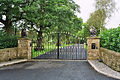
 Entrance and road to Lower Clerk Hill - geograph.org.uk - 407407.jpg 640 × 480; 189 KB
-
 Farm Outbuildings at Ratten Clough - geograph.org.uk - 3807582.jpg 4,320 × 3,240; 3.4 MB
-
 Farmstead at Dry Corner - geograph.org.uk - 2460057.jpg 1,600 × 1,198; 337 KB
-
 Field Boundary below Wiswell Moor - geograph.org.uk - 1832269.jpg 2,816 × 2,112; 2.13 MB
-

-

-
 Flagged fencing above Sabden - geograph.org.uk - 3732111.jpg 3,648 × 2,736; 4.71 MB
-
 Footpath crossing Badger Well Water - geograph.org.uk - 2461863.jpg 1,600 × 1,198; 330 KB
-
 Footpath nearing Sabden - geograph.org.uk - 2275861.jpg 3,872 × 2,592; 4.51 MB
-
 Footpath on Spence Moor - geograph.org.uk - 3867235.jpg 4,320 × 3,240; 3.26 MB
-
 Footpath to Pendleside Close - geograph.org.uk - 1760242.jpg 480 × 640; 80 KB
-
 Footpath to Whittaker's Farm - geograph.org.uk - 1760243.jpg 480 × 640; 105 KB
-
 Former Mill in Sabden - geograph.org.uk - 6087821.jpg 5,765 × 3,572; 3.53 MB
-
 From Four Lane Ends - geograph.org.uk - 3732126.jpg 2,736 × 3,648; 5.02 MB
-
 From Heyhouses to New York - geograph.org.uk - 3732033.jpg 3,648 × 2,736; 5.3 MB
-
 From St Mary's churchyard in Sabden - geograph.org.uk - 4014602.jpg 4,000 × 3,000; 5.08 MB
-
 From the viewpoint at Black Hill - geograph.org.uk - 4870075.jpg 4,592 × 3,056; 7.04 MB
-

-
 Gardeners Row - geograph.org.uk - 4299012.jpg 3,648 × 2,736; 4.65 MB
-
 Gardeners Row and the green - geograph.org.uk - 4299017.jpg 3,648 × 2,736; 4.75 MB
-
 Gardeners Row, Sabden - geograph.org.uk - 2030882.jpg 1,630 × 1,017; 387 KB
-
 Gate on Moorland Track - geograph.org.uk - 340593.jpg 640 × 480; 118 KB
-
 Gates at Bramley Farm - geograph.org.uk - 2459953.jpg 1,600 × 1,198; 390 KB
-
 Gorse flowers - geograph.org.uk - 6087901.jpg 6,032 × 4,014; 1.47 MB
-
 Graffiti on the water treatment works - geograph.org.uk - 2275954.jpg 3,872 × 2,592; 4.11 MB
-
 Grassland above Sabden - geograph.org.uk - 4014577.jpg 1,024 × 768; 558 KB
-
 Grassland above Sabden - geograph.org.uk - 4014584.jpg 4,000 × 3,000; 5.93 MB
-
 Grassland above Sabden - geograph.org.uk - 4016011.jpg 4,000 × 3,000; 4.99 MB
-
 Grassland below Bank Hill - geograph.org.uk - 4014591.jpg 3,000 × 4,000; 4.43 MB
-
 Grazing land in Sabden Fold - geograph.org.uk - 2266950.jpg 3,872 × 2,592; 5.26 MB
-
 Hey Barn Farm - geograph.org.uk - 2461892.jpg 1,600 × 1,198; 274 KB
-
 Hey Houses - geograph.org.uk - 2275938.jpg 3,872 × 2,592; 4.98 MB
-
 Hillside Farm - geograph.org.uk - 4067928.jpg 2,562 × 1,581; 1.74 MB
-
 Hollins Farm - geograph.org.uk - 2268630.jpg 3,872 × 2,592; 3.06 MB
-
 Houses in Sabden - geograph.org.uk - 5497815.jpg 3,840 × 2,160; 2.43 MB
-
 In Sabden Fold - geograph.org.uk - 2268588.jpg 3,872 × 2,592; 4.53 MB
-
 In the Woods above Churn Clough Reservoir - geograph.org.uk - 3807571.jpg 4,320 × 3,240; 4.27 MB
-
 Junction of footpaths near Wiswell Moor Houses - geograph.org.uk - 2266920.jpg 3,872 × 2,592; 3.8 MB
-
 Longridge and Sykes Fells - geograph.org.uk - 4254972.jpg 3,648 × 2,736; 3.9 MB
-
 Looking across to Deerstones (crag) on the top right - geograph.org.uk - 4377810.jpg 2,592 × 1,456; 827 KB
-

-
 Looking down on Sabden - geograph.org.uk - 1640534.jpg 640 × 482; 43 KB
-

-

-
 Lower Barn Farm - geograph.org.uk - 2268596.jpg 3,872 × 2,592; 3.74 MB
-
 Lower Clerk Hill - geograph.org.uk - 4865010.jpg 4,592 × 3,056; 6.9 MB
-
 Meeting of footpaths below Wiswell Moor - geograph.org.uk - 2268607.jpg 3,872 × 2,592; 5.43 MB
-
 Memorial at Nick of Pendle - geograph.org.uk - 4470275.jpg 640 × 480; 328 KB
-

-
 Moorland above Ogden Clough - geograph.org.uk - 3811843.jpg 3,872 × 2,592; 5.44 MB
-
 Moss covered capping stones - geograph.org.uk - 6088225.jpg 6,032 × 4,014; 6.06 MB
-
 Muddy gateway on Wiswell Moor - geograph.org.uk - 2266957.jpg 3,872 × 2,592; 5.25 MB
-
 Nearing the bottom of Clitheroe Road - geograph.org.uk - 3735933.jpg 3,648 × 2,736; 4.77 MB
-
 New York near Sabden - geograph.org.uk - 3882451.jpg 1,024 × 768; 205 KB
-
 Nick of Pendle - geograph.org.uk - 1137543.jpg 640 × 480; 92 KB
-
 Nick of Pendle - geograph.org.uk - 3735911.jpg 3,648 × 2,736; 4.55 MB
-
 Nick of Pendle - geograph.org.uk - 4067930.jpg 3,888 × 2,334; 1.82 MB
-
 Nick of Pendle - geograph.org.uk - 4069129.jpg 4,608 × 3,336; 5.76 MB
-
 Nick of Pendle - geograph.org.uk - 6395773.jpg 8,570 × 2,400; 7.36 MB
-
 Nick of Pendle - geograph.org.uk - 810331.jpg 640 × 480; 45 KB
-
 Nick of Pendle and Sabden - geograph.org.uk - 1297579.jpg 640 × 480; 81 KB
-
 Nick of Pendle Quarries - geograph.org.uk - 3735914.jpg 3,648 × 2,736; 4.71 MB
-
 Nick of Pendle quarry side - geograph.org.uk - 3734878.jpg 3,648 × 2,736; 4.7 MB
-
 Ogden Clough - geograph.org.uk - 144082.jpg 640 × 480; 90 KB
-
 Ogden Clough - geograph.org.uk - 3811861.jpg 3,872 × 2,592; 3.58 MB
-
 Ogden Clough - geograph.org.uk - 772443.jpg 640 × 480; 113 KB
-

-
 Old quarry in Well Wood off Back Lane - geograph.org.uk - 3882470.jpg 1,024 × 768; 404 KB
-
 On Black Hill - geograph.org.uk - 1216981.jpg 640 × 480; 56 KB
-
 On Sabden Recreation Ground - geograph.org.uk - 3735946.jpg 3,648 × 2,736; 4.63 MB
-
 On the Footpath between Wiswell and Sabden (1) - geograph.org.uk - 3820814.jpg 4,320 × 3,240; 5.54 MB
-
 On the Footpath between Wiswell and Sabden (2) - geograph.org.uk - 3820830.jpg 4,320 × 3,240; 4.87 MB
-
 On the Footpath between Wiswell and Sabden (3) - geograph.org.uk - 3820841.jpg 4,320 × 3,240; 5.22 MB
-
 On the Track between Dean Farm and Sabden - geograph.org.uk - 3820968.jpg 4,320 × 3,240; 5.12 MB
-
 Outbuilding at Higher Whins - geograph.org.uk - 3820935.jpg 4,320 × 3,240; 3.62 MB
-
 Padiham Heights - from the viewpoint at Black Hill - geograph.org.uk - 4870967.jpg 4,592 × 3,056; 7.32 MB
-
 Padiham Heights - geograph.org.uk - 2275854.jpg 3,872 × 2,592; 4.23 MB
-
 Padiham Road - geograph.org.uk - 1350332.jpg 640 × 369; 51 KB
-
 Padiham Road at Sabden - geograph.org.uk - 3882462.jpg 1,024 × 768; 155 KB
-
 Padiham Road at Sabden Bridge - geograph.org.uk - 4339694.jpg 640 × 480; 86 KB
-
 Padiham Road, Sabden - geograph.org.uk - 1140779.jpg 640 × 432; 93 KB
-
 Padiham Road, Sabden - geograph.org.uk - 2275911.jpg 3,872 × 2,592; 3.4 MB
-
 Padiham Road, Sabden - geograph.org.uk - 3820920.jpg 4,320 × 3,240; 2.72 MB
-
 Padiham Road-Back Lane junction - geograph.org.uk - 4339699.jpg 640 × 427; 38 KB
-
 Parish church of St. Nicholas at Sabden - geograph.org.uk - 3882456.jpg 1,024 × 768; 193 KB
-
 Parsley Barn - geograph.org.uk - 6373480.jpg 4,320 × 3,240; 5.22 MB
-
 Parsley Barn, Nick of Pendle - geograph.org.uk - 1137520.jpg 640 × 480; 99 KB
-
 Pasture beside Sabden Brook - geograph.org.uk - 1832286.jpg 2,816 × 2,112; 2.19 MB
-
 Path across Mearley Moor - geograph.org.uk - 3811838.jpg 3,872 × 2,592; 1.51 MB
-
 Path across the fields to Lane Side - geograph.org.uk - 2267106.jpg 3,872 × 2,592; 4.34 MB
-
 Path near Cobden Farm - geograph.org.uk - 2698542.jpg 1,600 × 1,198; 322 KB
-
 Path on Black Hill - geograph.org.uk - 2367834.jpg 640 × 480; 84 KB
-
 Pendle Hill - geograph.org.uk - 71650.jpg 640 × 480; 123 KB
-
 Pendle Hill - geograph.org.uk - 899996.jpg 640 × 480; 50 KB
-
 Pendle Hill Memorial to WWII Airmen - geograph.org.uk - 4470278.jpg 640 × 480; 311 KB
-
 Pendle Street, Sabden, Lancashire - geograph.org.uk - 2030875.jpg 1,632 × 1,224; 1,014 KB
-
 Pendleton Moor - geograph.org.uk - 1218824.jpg 640 × 480; 47 KB
-
 Picnic Area Padiham Heights - geograph.org.uk - 1919405.jpg 3,648 × 2,736; 2.12 MB
-
 Ratten Cleugh - geograph.org.uk - 4068928.jpg 3,660 × 2,440; 1.73 MB
-
 Ratten Clough - geograph.org.uk - 3807578.jpg 4,320 × 3,240; 3.36 MB
-
 Rattenclough near Sabden - geograph.org.uk - 3882448.jpg 1,024 × 768; 197 KB
-
 Read-Pendleton Boundary on Bridge - geograph.org.uk - 1350310.jpg 640 × 480; 99 KB
-
 Ready for the World Cup - geograph.org.uk - 1920344.jpg 2,592 × 1,944; 1.27 MB
-
 Road junction - geograph.org.uk - 774052.jpg 640 × 480; 231 KB
-
 Road junction on Padiham Heights - geograph.org.uk - 2460067.jpg 1,600 × 1,198; 309 KB
-
 Sabden - geograph.org.uk - 4067910.jpg 3,888 × 2,592; 1.77 MB
-
 Sabden - geograph.org.uk - 4067913.jpg 3,616 × 2,334; 1.66 MB
-
 Sabden - geograph.org.uk - 4068958.jpg 2,592 × 3,888; 1.65 MB
-
 Sabden - geograph.org.uk - 5239022.jpg 1,280 × 853; 694 KB
-
 Sabden - geograph.org.uk - 6087911.jpg 5,794 × 3,623; 3.52 MB
-
 Sabden Baptist Chapel - geograph.org.uk - 407554.jpg 640 × 480; 238 KB
-
 Sabden Bridge - geograph.org.uk - 4014565.jpg 1,024 × 598; 441 KB
-
 Sabden Bridge is closed - geograph.org.uk - 2275872.jpg 3,872 × 2,592; 4.57 MB
-
 Sabden Brook - geograph.org.uk - 1760236.jpg 640 × 480; 194 KB
-
 Sabden Brook - geograph.org.uk - 1832282.jpg 2,816 × 2,112; 2.06 MB
-
 Sabden Brook downstream - geograph.org.uk - 4860864.jpg 4,548 × 3,027; 7.71 MB
-
 Sabden Brook footbridge - geograph.org.uk - 2460104.jpg 1,600 × 1,198; 593 KB
-
 Sabden Brook from Watt Street - geograph.org.uk - 1760237.jpg 640 × 480; 216 KB
-
 Sabden House, Lancashire 01.jpg 4,000 × 3,000; 5.04 MB
-
 Sabden House, Lancashire 02.jpg 4,000 × 3,000; 4.96 MB
-
 Sabden Methodist Church - geograph.org.uk - 407546.jpg 640 × 480; 237 KB
-
 Sabden Valley - geograph.org.uk - 3732079.jpg 3,648 × 2,736; 4.56 MB
-
 Sabden Village near Clitheroe - geograph.org.uk - 1544494.jpg 640 × 480; 78 KB
-
 Sabden War Memorial - geograph.org.uk - 5600051.jpg 480 × 640; 414 KB
-
 Sheep - geograph.org.uk - 486401.jpg 640 × 480; 199 KB
-
 Sheep and Daffodils - geograph.org.uk - 6088228.jpg 6,032 × 4,014; 3.72 MB


_on_the_top_right_-_geograph.org.uk_-_4377810.jpg)


_-_geograph.org.uk_-_3820814.jpg)
_-_geograph.org.uk_-_3820830.jpg)
_-_geograph.org.uk_-_3820841.jpg)


