Category:Saba Bank Atoll
Jump to navigation
Jump to search
caribbean atoll, Dutch national park | |||||
| Upload media | |||||
| Instance of | |||||
|---|---|---|---|---|---|
| Named after | |||||
| Location |
| ||||
| Located in or next to body of water | |||||
| Heritage designation |
| ||||
| IUCN protected areas category | |||||
| Inception |
| ||||
 | |||||
Subcategories
This category has only the following subcategory.
Media in category "Saba Bank Atoll"
The following 7 files are in this category, out of 7 total.
-
Bathymetric map of Saba Bank with fish stations marked - pone.0010676.g001.png 1,992 × 1,488; 2.52 MB
-
Saba Bank fish survey clustering of stations - pone.0010676.g202.png 1,980 × 1,514; 203 KB
-
Saba Bank NP Map.jpg 697 × 514; 21 KB
-
Saba Bank underwater atoll composite image (cropped).png 278 × 197; 135 KB
-
Saba Bank underwater atoll composite image.png 500 × 500; 699 KB
-
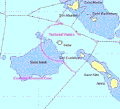
Sababank.gif 415 × 377; 49 KB
-
Species-accrual curve for dives on Saba Bank - pone.0010676.g201.png 1,897 × 1,882; 116 KB


