Category:SVG topographic maps of Kenya
Jump to navigation
Jump to search
Media in category "SVG topographic maps of Kenya"
The following 24 files are in this category, out of 24 total.
-
 Great Rift Valley in Kenya (shaded map).svg 1,000 × 1,100; 2.09 MB
-
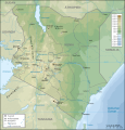
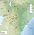
 Kenya topographic map-be.svg 1,181 × 1,231; 3.24 MB
-
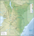
 Kenya topographic map-bg.svg 1,181 × 1,231; 3.23 MB
-
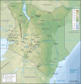
 Kenya topographic map-de.svg 1,181 × 1,231; 3.24 MB
-
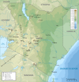
 Kenya topographic map-fr.svg 1,181 × 1,231; 3.26 MB
-
 Kenya topographic map-hu.svg 1,181 × 1,231; 3.28 MB
-
 Kenya topographic map-mk.svg 1,181 × 1,231; 3.22 MB
-
 Kenya topographic map-sr.svg 1,181 × 1,231; 3.26 MB
-
 Kenya topographic map-sw.svg 1,181 × 1,231; 3.18 MB
-
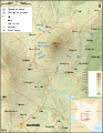
 Mount Kenya Population map-en.svg 1,802 × 2,793; 1.18 MB
-
 Mount Kenya Population map-fr.svg 1,802 × 2,793; 1.18 MB
-
 Mount Kenya Population map-mk.svg 1,802 × 2,793; 1.39 MB
-
 Mount Kenya Region map-de.svg 1,782 × 2,300; 1.46 MB
-
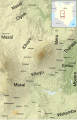
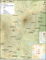
 Mount Kenya Region map-en.svg 1,782 × 2,300; 1.34 MB
-
 Mount Kenya Region map-fr.svg 1,782 × 2,300; 1.46 MB
-
 Mount Kenya Region map-he.svg 1,782 × 2,300; 1.49 MB
-
 Mount Kenya Region map-hu.svg 1,782 × 2,300; 1.47 MB
-
 Mount Kenya Region map-mk.svg 1,782 × 2,300; 1.34 MB
-
 Mount Kilimanjaro and Mount Meru map-es.svg 2,242 × 1,888; 1.68 MB
-
 Mount Kilimanjaro and Mount Meru map-fr.jpg 3,362 × 2,830; 2.11 MB
-
 Mount Kilimanjaro and Mount Meru map-fr.svg 2,242 × 1,888; 1.68 MB
-
 Mount Kilimanjaro and Mount Meru map-nl.svg 2,242 × 1,888; 1.69 MB
-
 Mount Kilimanjaro Ethnic Groups map-fr.svg 2,050 × 1,907; 794 KB
-
 Карта Кеніі.svg 1,181 × 1,231; 3.24 MB
.svg)


