Category:SVG topographic maps of Chile
Jump to navigation
Jump to search
Media in category "SVG topographic maps of Chile"
The following 23 files are in this category, out of 23 total.
-
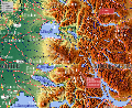
 Arica-y-parinacota.svg 1,002 × 1,099; 2.96 MB
-
 Chile.cuencas.hidrograficas.region.del.biobio.svg 800 × 715; 1.34 MB
-
 Chile.puyehue.svg 749 × 610; 1.27 MB
-
 Dakar Rally 2010 map-blank.svg 1,513 × 1,584; 3.52 MB
-
 Dakar Rally 2010 map-ca.svg 1,513 × 1,584; 3.53 MB
-
 Dakar Rally 2010 map-cs.svg 1,513 × 1,584; 3.53 MB
-
 Dakar Rally 2010 map-de.svg 1,513 × 1,584; 3.53 MB
-
 Dakar Rally 2010 map-en.svg 1,513 × 1,584; 3.53 MB
-
 Dakar Rally 2010 map-es.svg 1,513 × 1,584; 3.58 MB
-
 Dakar Rally 2010 map-fr.svg 1,513 × 1,584; 3.53 MB
-
 Dakar Rally 2010 map-hu.svg 1,513 × 1,584; 3.53 MB
-
 Dakar Rally 2010 map-mk.svg 1,513 × 1,584; 3.53 MB
-
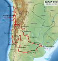
 Dakar Rally 2011 map-cs.svg 1,513 × 1,584; 3.42 MB
-
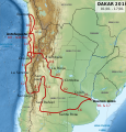
 Dakar Rally 2011 map-en.svg 1,513 × 1,584; 3.42 MB
-
 Dakar Rally 2011 map-es.svg 1,513 × 1,584; 3.42 MB
-
 Dakar Rally 2011 map-fr.svg 1,513 × 1,584; 3.42 MB
-
 Dakar Rally 2011 map-mk.svg 1,513 × 1,584; 3.43 MB
-
 Easter Island map-en.svg 1,750 × 1,245; 878 KB
-
 Golfo de Arauco-es.svg 512 × 512; 25.23 MB
-
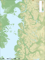 Map Palena-es.svg 2,519 × 3,371; 7.16 MB
-
 Relief Map of Chile.svg 1,183 × 2,658; 2.1 MB
-
 Rios-antofagasta-region.svg 1,698 × 1,233; 5.05 MB
-
 Río-loa-(origen).svg 890 × 592; 1.04 MB


.svg)