Category:SVG topographic maps of Algeria
Jump to navigation
Jump to search
Media in category "SVG topographic maps of Algeria"
The following 9 files are in this category, out of 9 total.
-
Algeria relief location map.svg 1,287 × 1,279; 723 KB
-
Chad River Basin relief.svg 531 × 511; 130 KB
-
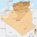
French Algeria evolution map 1830-1962 ar.svg 1,287 × 1,278; 1.86 MB
-
Kabylie topographic map-fr-2.svg 847 × 423; 4.98 MB
-
Kabylie topographic map-fr.svg 848 × 425; 4.98 MB
-
Kabylie topographic map-ru.svg 848 × 425; 4.97 MB
-
MontañasSaharianas.svg 1,083 × 675; 28.93 MB
-
MontañasSaharianas2.svg 1,083 × 675; 29.05 MB
-
Sitta ledanti distribution map-fr.svg 1,274 × 980; 1.68 MB


