Category:SVG maps of the history of departments of France
Jump to navigation
Jump to search
Media in category "SVG maps of the history of departments of France"
The following 48 files are in this category, out of 48 total.
-
Apennins departement (1812).svg 2,250 × 1,750; 696 KB
-
Carte des prêtres assermentés en France en 1791.svg 507 × 507; 154 KB
-
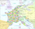
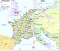
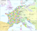
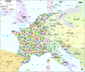
Departements of French Empire 1811-fr.svg 1,120 × 840; 844 KB
-
Départements et provinces de France.svg 588 × 550; 351 KB
-
Départments napoléoniens - sans noms des états.svg 2,250 × 1,750; 2.75 MB
-
France L-1 (1812)-de.svg 2,250 × 1,750; 1.77 MB
-
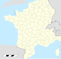
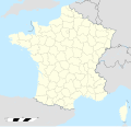
France location map-Departements 1790.svg 2,000 × 1,922; 581 KB
-
France location map-Departements 1791.svg 2,000 × 1,922; 568 KB
-
France location map-Departements 1793.svg 2,000 × 1,922; 565 KB
-
France location map-Departements 1795.svg 2,000 × 1,922; 640 KB
-
France location map-Departements 1797.svg 2,000 × 1,922; 603 KB
-
France location map-Departements 1798.svg 2,000 × 1,922; 890 KB
-
France location map-Departements 1800.svg 2,000 × 1,922; 886 KB
-
France location map-Departements 1801.svg 2,000 × 1,922; 883 KB
-
France location map-Departements 1802.svg 2,000 × 1,922; 869 KB
-
France location map-Departements 1805.svg 2,000 × 1,922; 869 KB
-
France location map-Departements 1808.svg 2,000 × 1,922; 868 KB
-
France location map-Departements 1810.svg 2,000 × 1,922; 890 KB
-
France location map-Departements 1811.svg 2,000 × 1,922; 913 KB
-
France location map-Departements 1812.svg 2,000 × 1,922; 890 KB
-
France location map-Departements 1813.svg 2,000 × 1,922; 885 KB
-
France location map-Departements 1814.svg 2,000 × 1,922; 808 KB
-
France location map-Departements 1815.svg 2,000 × 1,922; 588 KB
-
France location map-Departements 1848.svg 2,000 × 1,922; 587 KB
-
France location map-Departements 1852.svg 2,000 × 1,922; 580 KB
-
France location map-Departements 1860.svg 2,000 × 1,922; 567 KB
-
France location map-Departements 1871-1914.svg 2,000 × 1,922; 599 KB
-
France location map-Departements 1919.svg 2,000 × 1,922; 575 KB
-
France location map-Departements 1947.svg 2,000 × 1,922; 573 KB
-
France location map-Departements 1964.svg 2,000 × 1,922; 577 KB
-
France location map-Departements 1967.svg 2,000 × 1,922; 598 KB
-
France location map-Departements 1970.svg 2,000 × 1,922; 578 KB
-
France location map-Departements 1971-1972.svg 2,000 × 1,922; 620 KB
-
France location map-Departements 1973-1974.svg 2,000 × 1,922; 673 KB
-
France location map-Departements 1975-1996.svg 2,000 × 1,922; 675 KB
-
France location map-Departements 1997-2014.svg 2,000 × 1,922; 783 KB
-
France location map-Provinces 1789.svg 2,000 × 1,922; 557 KB
-
Map administrative divisions of the First French Empire 1812 hu.svg 2,052 × 1,728; 3.73 MB
-
Map administrative divisions of the First French Empire 1812-br.svg 2,052 × 1,728; 2.82 MB
-
Map administrative divisions of the First French Empire 1812-de-big.svg 2,052 × 1,728; 2.81 MB
-
Map administrative divisions of the First French Empire 1812-de.svg 1,646 × 1,325; 6.3 MB
-
Map administrative divisions of the First French Empire 1812-el.svg 2,189 × 1,843; 5.39 MB
-
Map administrative divisions of the First French Empire 1812-en.svg 2,052 × 1,728; 4.14 MB
-
Map administrative divisions of the First French Empire 1812-es.svg 2,250 × 1,750; 1.71 MB
-
Map administrative divisions of the First French Empire 1812-fr.svg 2,052 × 1,728; 2.84 MB
-
Map administrative divisions of the First French Empire 1812-zh.svg 2,052 × 1,728; 2.83 MB
-
Tarn-et-Garonne department evolution map-fr.svg 500 × 500; 241 KB
-
État de Franche-Comté map-fr.svg 800 × 900; 167 KB


