Category:SVG maps of the history of Estonia
Jump to navigation
Jump to search
Media in category "SVG maps of the history of Estonia"
The following 22 files are in this category, out of 22 total.
-
Teutonic Order 1466-es.svg 1,210 × 1,053; 1.79 MB
-
Ancient Estonian counties.svg 1,281 × 878; 221 KB
-
Baltic states territorial changes 1939-45 en.svg 1,198 × 1,302; 411 KB
-
Baltic states territorial changes 1939-45 es.svg 1,198 × 1,302; 411 KB
-
Baltijas valstu teritoriālās izmaiņas no 1939. līdz 1945. gadam.svg 1,278 × 1,389; 411 KB
-
Confederation of Livonia 1260-fr.svg 955 × 1,034; 1.36 MB
-
Confederazione Livone.svg 955 × 1,034; 621 KB
-
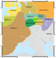
Finno-ugrian-map-de.svg 963 × 987; 927 KB
-
Finno-ugrian-map-es.svg 963 × 987; 1.01 MB
-
Finno-ugrian-map-pt.svg 963 × 987; 992 KB
-
Finno-ugrian-map-ukr.svg 963 × 987; 927 KB
-
Finno-ugrian-map.svg 963 × 987; 927 KB
-
Finnugroj en 1000 (eo).svg 963 × 987; 927 KB
-
Inflanty 1260.svg 895 × 969; 984 KB
-
Kievan-rus-1015-1113-(hu).svg 2,166 × 2,659; 608 KB
-
Księstwo Kurlandii i Semigalii w 1740 roku 1740.svg 1,074 × 945; 482 KB
-
Livland 1260.svg 955 × 1,034; 790 KB
-
Medieval Livonia 1260 hu.svg 1,273 × 1,379; 1.07 MB
-
Medieval Livonia 1260.svg 955 × 1,034; 734 KB
-
Moonsund 1917 map.svg 2,980 × 4,213; 1.52 MB
-
PBW June 1920-es.svg 2,014 × 1,567; 1.36 MB
-
Reichskommissariat Ostland (1942).svg 450 × 456; 506 KB


